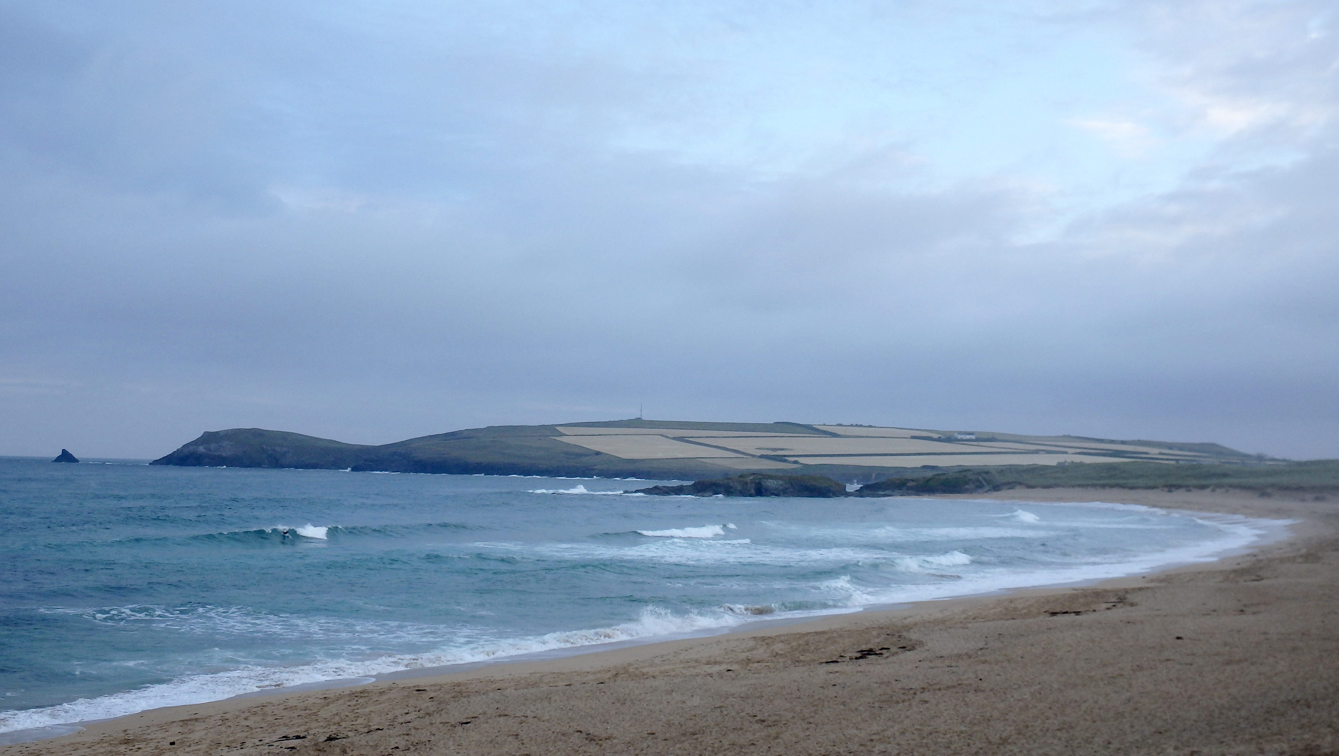
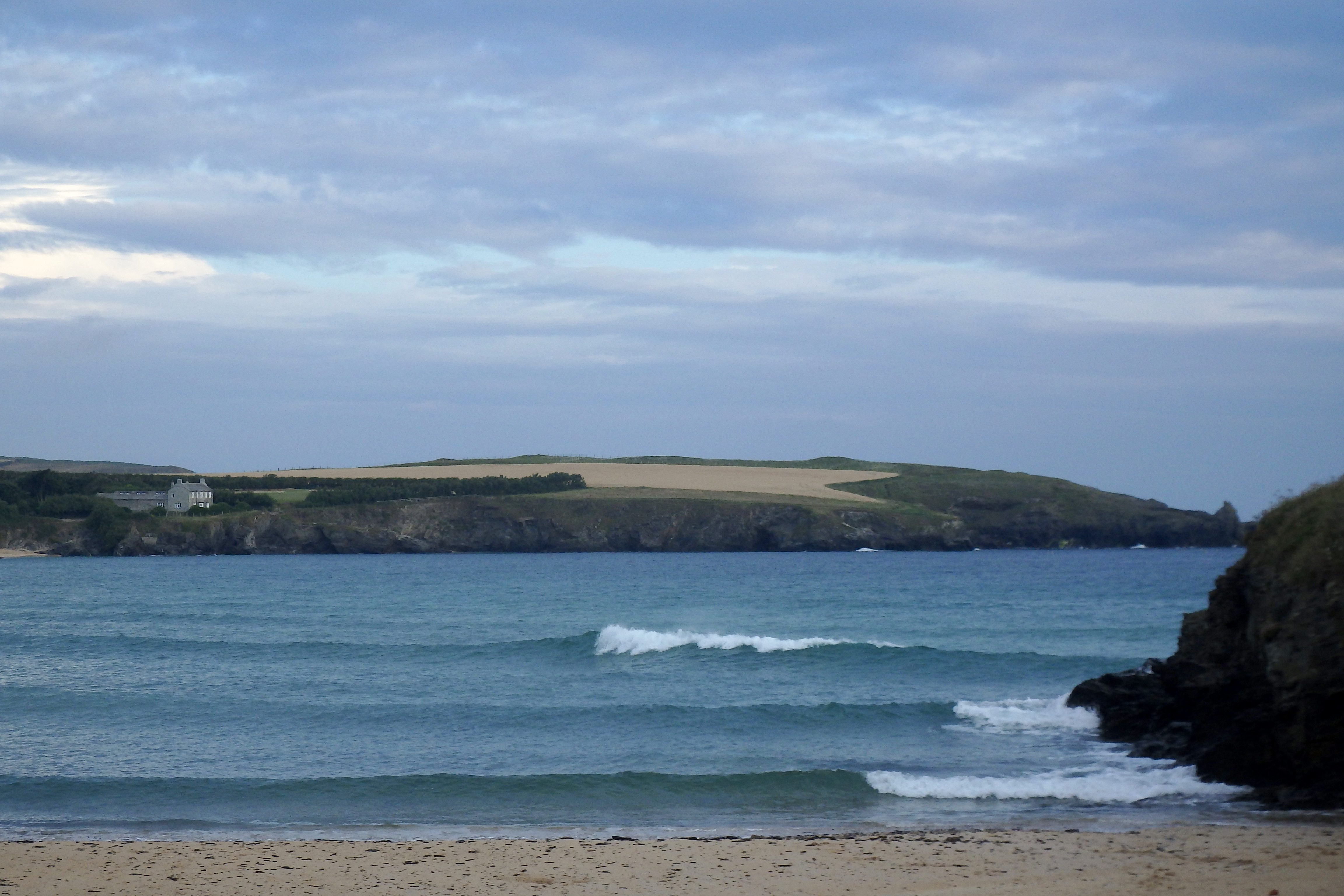
At 6.20 a.m:
Constantine (3*): 2 to 3 feet
A bright enough and pleasant enough morning is greeting us this morning, the pale blue sky only lightly patched by some white bright strips of cloud.
A southerly breeze is lightly drifting across the bay putting a light ruffle on the backwash effected surf.
The tide is just a little too high for the two to three feet of darkly peaking surf and so there’s a bit of a bumpy lump to it all. But there is a lined up little swell pushing in, quite close together but fun looking and with the occasional bigger set to play on.
The breeze is forecast to stay light and might just slip offshore as the tide starts to drop out before the onshore sea breeze effect kicks in during lunchtime.
Yep, it’s looking okay for a fun little surf on a pleasant enough summer’s day!
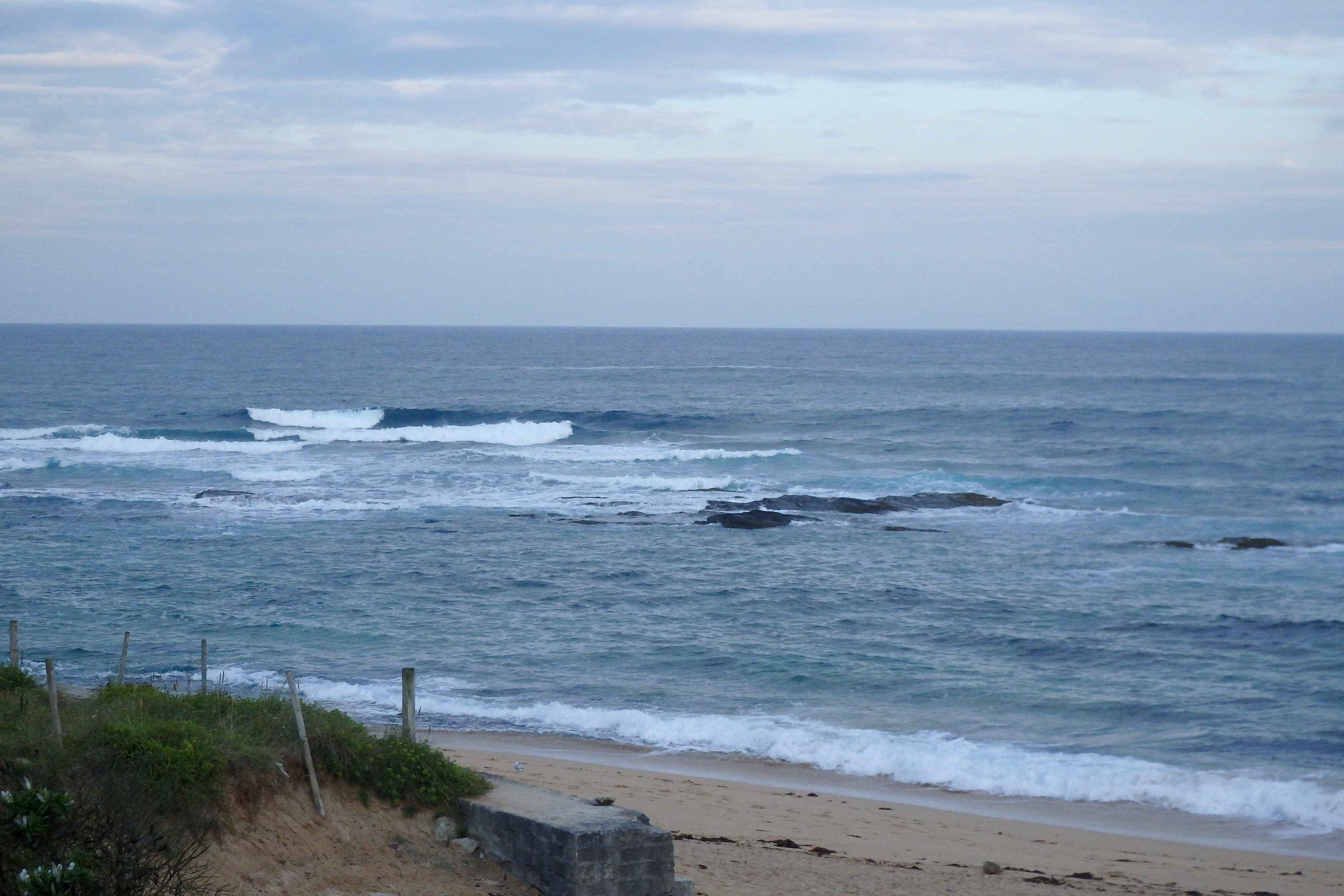
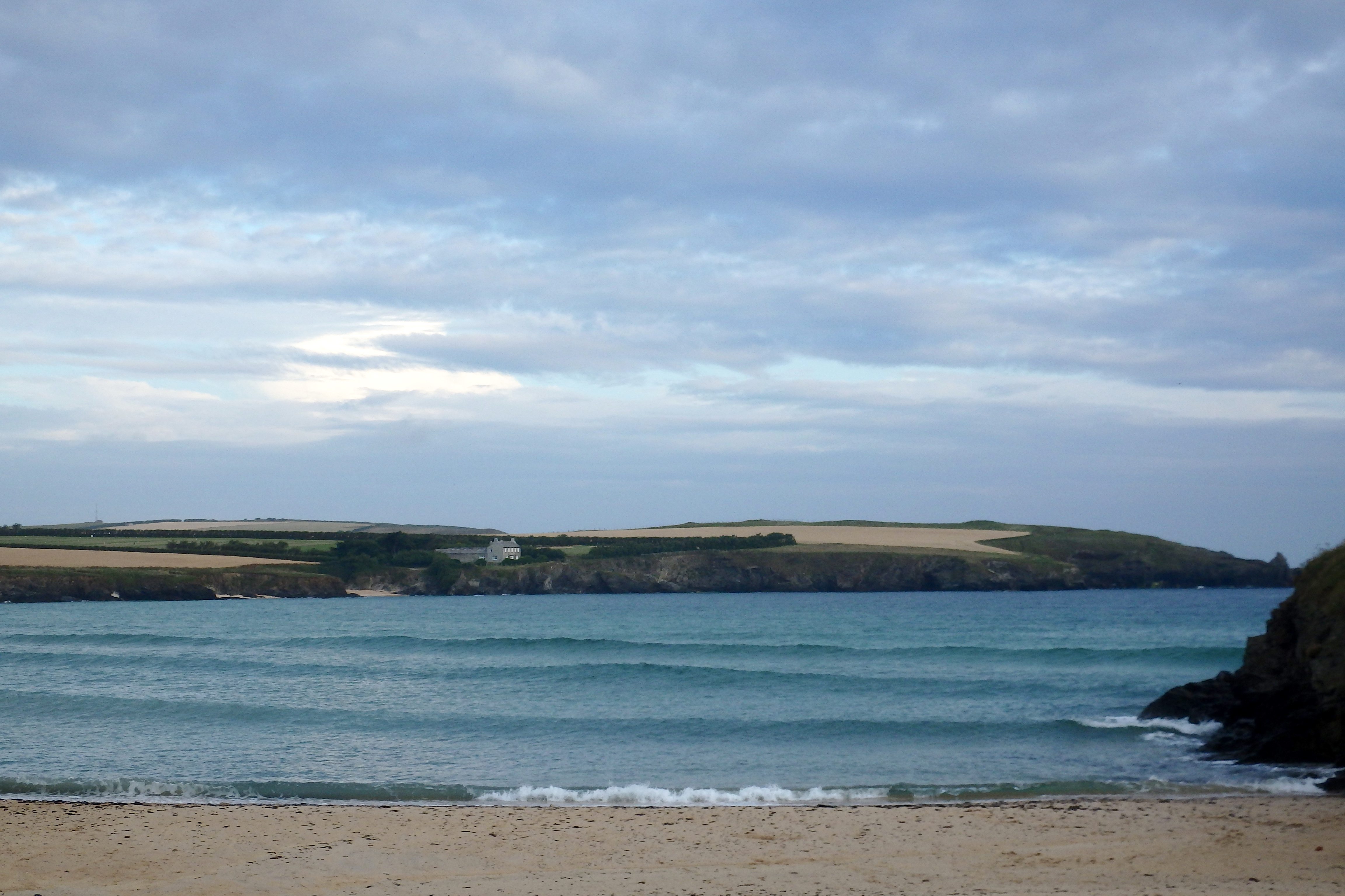
Harlyn (1*): 0 to 1 foot
A foot or so of smooth and lined up little swell is gliding ashore just ahead of high water.
Those tiny little waves aren’t breaking because of the high spring tide but give it an hour or two and there should be some shin high and snappy little ones crisply crashing in.
The sun is shining and reflecting silver turquoise off the smooth surface of the sea, so it is, as always, a fabulous place to just be this morning but the surf is all over on the other side of the headland again today!
Today’s Tide Times:
Low Tide: 14:10 (1.0m) High Tide: 20:06 (7.4m)

Surf Forecast for Saturday 23rd July 2016
Light, light breezes are set for another pleasant and sunny summer’s day.
We can expect a couple of feet of fun and playful surf to be breaking throughout most of the day, the spring high tides early and late in the day.
With the last of the schools closing for summer we can expect an invasion of the groms and visitors but there should be enough fun little waves to keep all the surf breaks lively and spread that action around!
Surf Conditions for the Weekend
That brief spell of scorching weather looks to be well behind us now as the winds return to onshore and those little weather fronts bounce along our coastline.
The breeze has now settled back to the west, onshore but only lightly onshore. And that breeze should at least support the little swells that should head our way and keep them rolling our way through the weekend.
That wind will stay onshore through the end of the week and all the way into the weekend, twitching from south west to north westerly and back again.
So, we can only hope to enjoy a couple to three feet of gently onshore blown surf through the end of the week and into the weekend.
Have a great week, wherever you are and whatever you’re doing!
SJ’s Surf Forecast for the SW
Forecast last updated at 08:00 Friday 22nd July 2016
Hi everyone – these updates are currently made at any time of the day as and when I get the time/chance to update – however from September the intention would be for it to be updated every weekday morning by 10am.
[Don’t forget to look at this forecast the day before you go beach for the latest, as things can often change!]
The Rest Of The Week:
‘Fantastic start to the week – make the most of this classic Summer spell before conditions deteriorate!’
Sunrise and sunset – 05:35 and 21:20
Twilight starts and ends – 04:55 and 22:00
Midday – 13:25
Length of day – 15:45
Offshore Sea Temp approx – 16.5C / 62F
outputmodelrun-220716-0800
Monday 18th:
‘Stunning day. Surf will be going off. Get on it!’
Swell – (i) OK W going Weak W-WNW
Wind – Light-Medium ESE-SE
Weather – Hot summery blue sky day.
North Coast – 3ft (Waisthigh) going 2-3ft (Knee-Waisthigh)
South Coast – 1ft
Tides – 11:13 Low, 17:09 High
Tuesday 19th:
‘Smaller than Monday, but with offshores and sunny weather – it’ll still be a great day. Wind strength will decrease throughout the day with light/variable conditions and a potential glass off around sunset. Will build slighlty during the day, especially on the tidal push this afternoon.’
Swell – (i) Weak going OK W-WNW
Wind – Medium SE going Light Variable around sunset
Weather – Hot Summery blue sky day. Clouding over in the evening.
North Coast – 1-2ft (Kneehigh) going 2-3ft (Knee-Waisthigh)
South Coast – 1-2ft (Kneehigh) going 1ft
Tides – 05:29 High, 11:51 Low, 17:48 High
Wednesday 20th:
‘A return to onshore conditions for the North with WNW winds and cloudier skies. There will be waves, but onshore/messy.’
Swell – (i) OK W-WNW
Wind – Medium going Light-Medium WWNW
Weather – Chance of thunder/rain first thing, then a mixture of cloud and sunshine.
North Coast – 1-3ft (Knee-Waisthigh) going 3ft (Waisthigh)
South Coast – 1ft
Tides – 06:08 High, 12:29 Low, 18:27 High
Thursday 21st:
‘There’ll be waves aplenty on the North,but they’ll lack any real qulity with the SW winds.’
Swell – (i) OK W-WNW going Weak W
Wind – Light-Medium WSW-SW going SW
Weather – Cloudy and dry, with the odd sunny spell. Feeling cooler/fresher, but still warm.
North Coast – 3ft (Waisthigh)
South Coast – 1-2ft (Kneehigh)
Tides – 06:47 High, 13:07 Low, 19:07 High
Friday 22nd:
‘A clean wave on the North first thing around the high/dropping tide at main/semi sheltered spots. Winds will turn onshore NW later on though.’
Swell – (i) Weak W-WSW
Wind – Light+ S going Light-Medium NW
Weather – Mixture of cloud and sunshine, with a chance of a shower.
North Coast – 3ft (Waisthigh)
South Coast – 1ft
Tides – 07:28 High, 13:49 Low, 19:48 High
Weekend Summary:
‘Poor quality waves with a weak swell and onshore conditions, but at least it won’t be flat.’
Saturday 23rd:
‘Despite the onshore winds, they should remain light enough, especially early morning, to allow for a good wave. However, from mid-morning onwards the winds will pick up causing onshore sloppy surf.’
Swell – (i) Weak W
Wind – Light+ W-NW going Light-Medium W-SW
Weather – Mixture of cloud and sunshine, turning overcast later on with a chance of light rain.
North Coast – 3ft (Waisthigh) going 2-3ft (Knee-Waisthigh)
South Coast – 1ft
Tides – 08:09 High, 14:31 Low, 20:31 High
Sunday 24th:
‘SW winds and a weak swell will mean not much quality to the surf, but at least it won’t be flat.’
Swell – (i) Weak W
Wind – Light-Medium SW going W
Weather – Cloudy with a chance of rain.
North Coast – 2-3ft (Knee-Waisthigh) going 3ft (Waisthigh)
South Coast – 1-2ft (Kneehigh)
Tides – 08:52 High, 15:14 Low, 21:15 High
Early Next Week:
‘A bit of a meh wishy washy week. A small weak swell and W-NW winds will see next week be filled with small mushburgers and sloppy surf.’
The scale for measuring conditions:
0-1ft – Unridable/Flat
1-2ft – Kneehigh
3ft – Waisthigh
4-5ft – Chest/Shoulderhigh
6ft – Headhigh
6-8ft = 1-1.5x Overhead
8-10ft = 1.5x Overhead
10-12ft = 2x Overhead
Please Note!
Wave height predictions are based on the larger breaks on both coasts such as Fistral and Croyde for the North, and Praa Sands and Bantham for the South.
Wave height is measured from the front of the wave, and 6ft would usually mean a ‘head-high’ wave.
Try and use some ‘local’ knowledge about what the wave sizes will be elsewhere. For example the Newquay Bay area is generally 1/3 to 3/4 the size of Fistral, increasing the further up the bay you go from Towan to Lusty Glaze, and that it will be clean on a W wind at ‘harbour left’ at Towan at mid-tide’ for example.
Tide times are based on Newquay.
Stay Stoked!
SJ