At 6.50 a.m:
Constantine (3*): 3 to 4 feet.
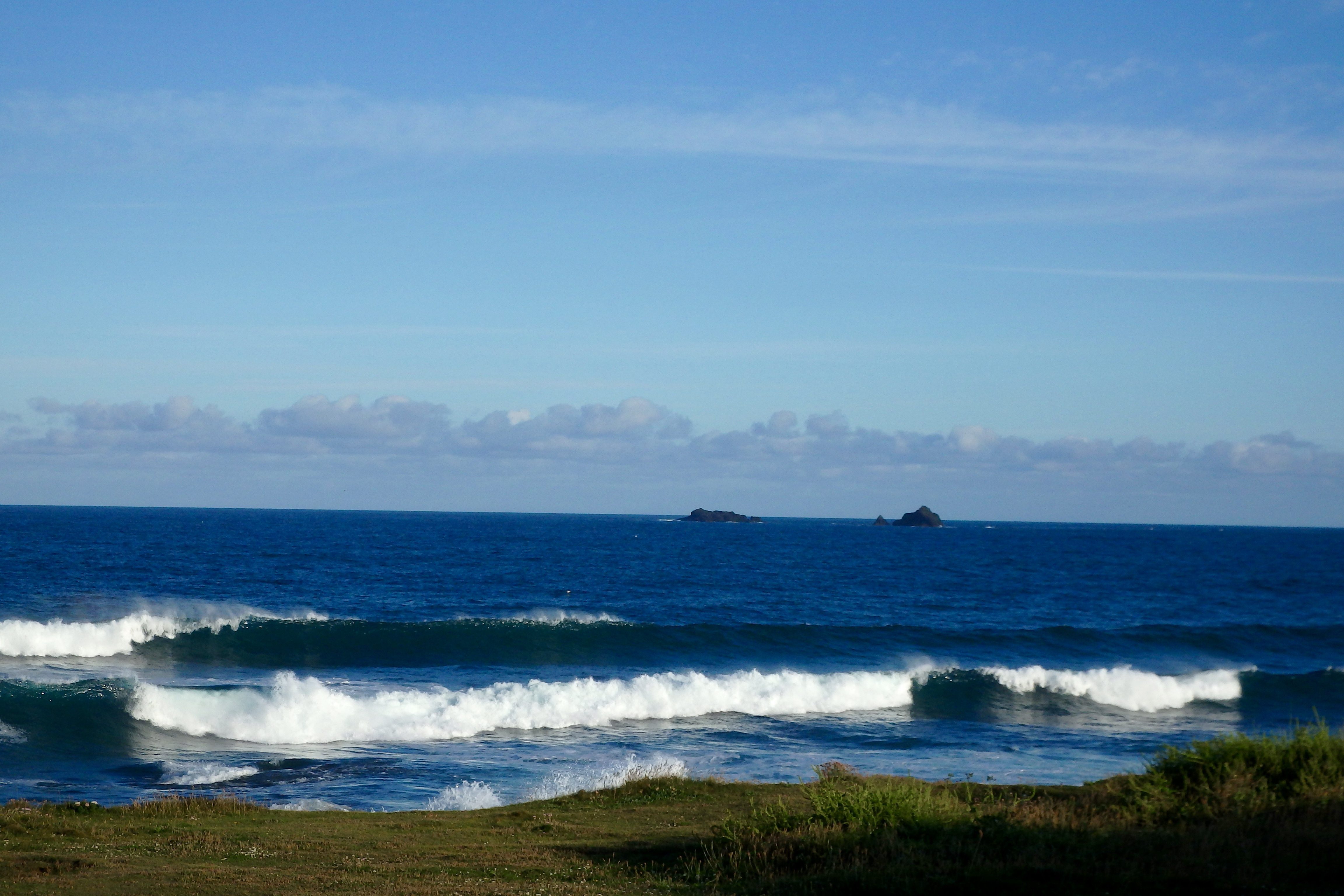
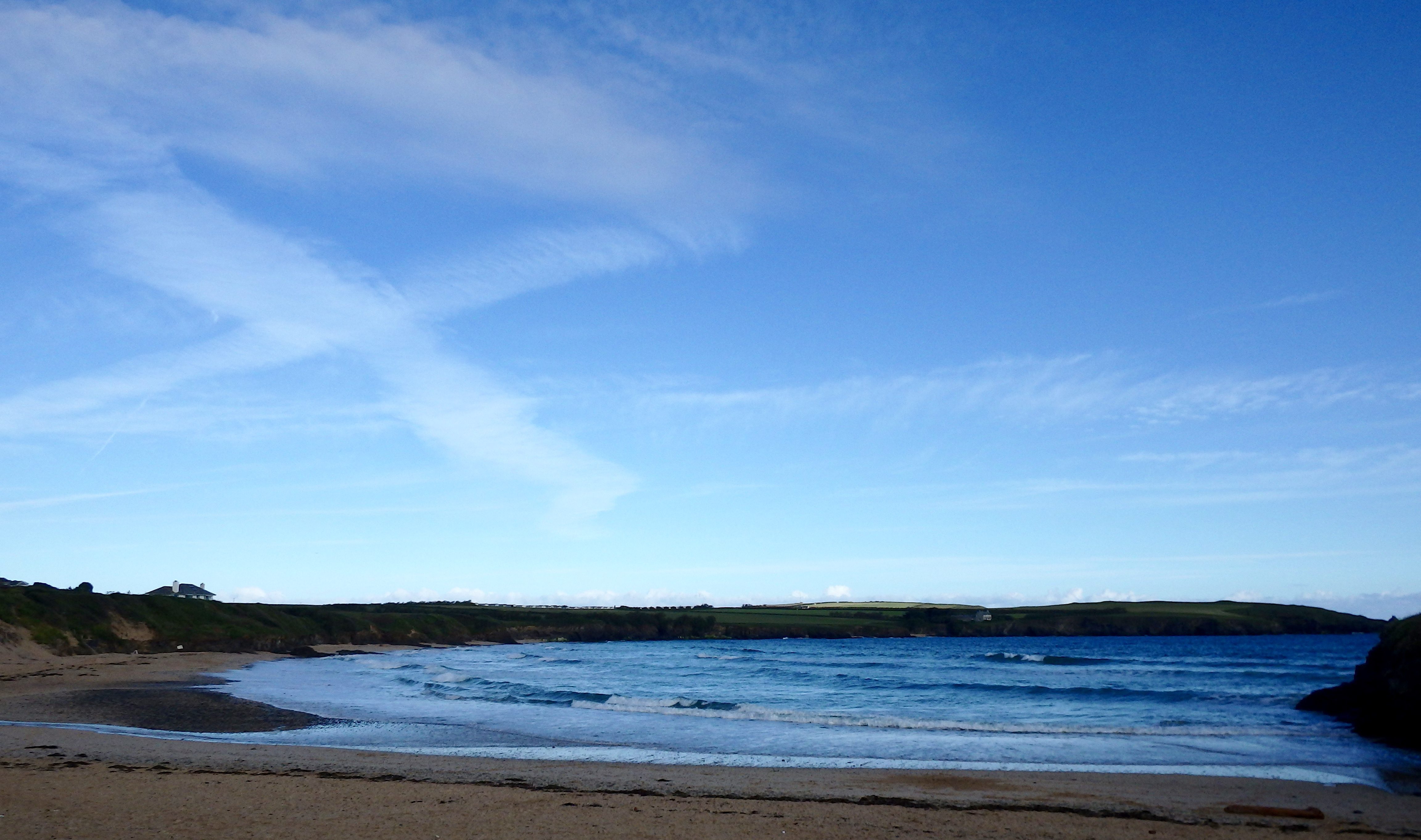
A bright and cheery morning has dawned over us at last, the breeze light, the sun bright and the surf pounding ashore.
Three to occasionally bigger than three feet of surf is rolling in, the north westerly breeze adding a ruffle to the otherwise deep, deep blue waves as they crash across the Reef.
It’s nowhere near perfect surf but there are some pleasantly looking and chunky peaks to get stuck into if you’re keen.
And the Keybuild Dawnsurf Squad do seem to be keen with the whole crew on parade this morning!
The breeze is set light with no more than a breeze expected all day and we should enjoy some bright sunshine for most of the time while the waves power on in!
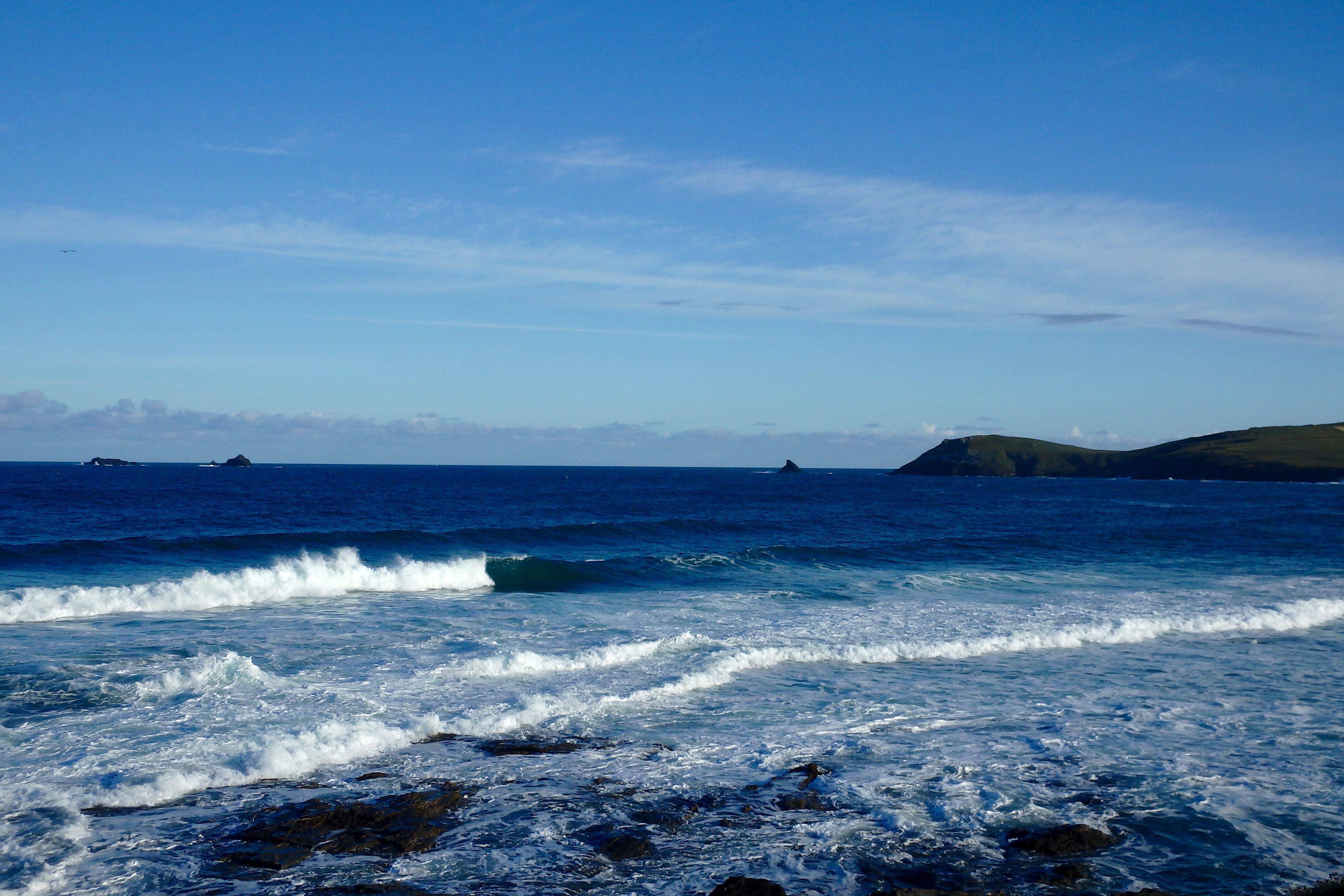
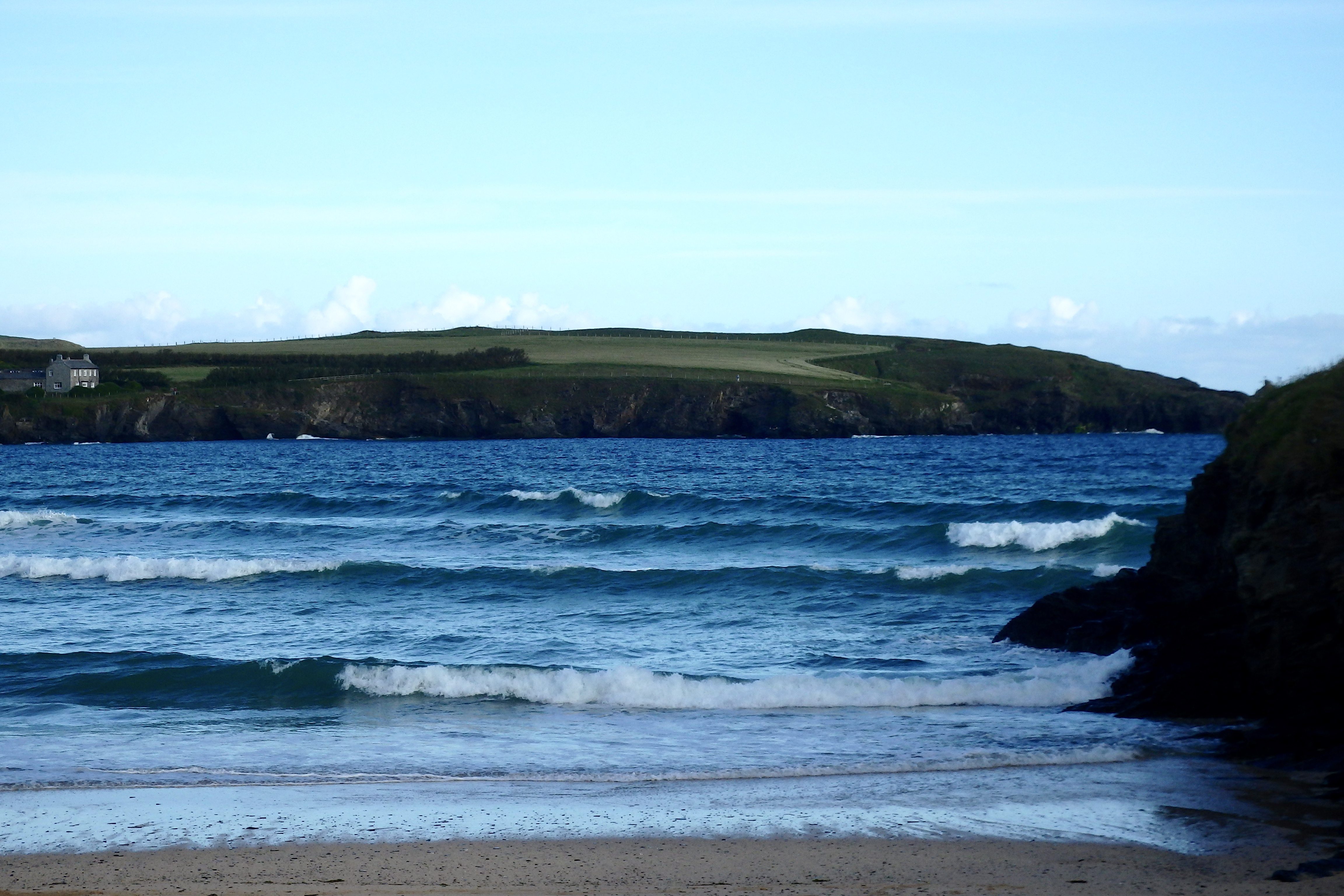
Harlyn (2*): 1 to 2 feet.
A foot or two of onshore breeze blown surf is drifting into Harlyn this morning producing a fairly weak looking lineup of lightly slopped little waves.
The breeze is likely to slip on around more to the west and eventually the west south west and so those little waves should clean up by this evening. In the meantime the other side is where the wave riding action is today, there area some pleasant little crunchers smashing in over there this morning!
Today’s Tide Times:
Low Tide: 14:24 (1.3m) High Tide: 08:00 (6.9m)

Surf Forecast for Friday 24th June 2016
A west south westerly breeze is likely to continue to lightly blow our way today, a fairly close-fetch three feet of bumpy surf rolling our way in some broken sunshine.
It looks to be an okay day, nothing too stunning but with enough surf to keep us happy, especially early on!
Surf Conditions for the Weekend
Light winds continue to drift in onshore as this week winds down, the swell keeping up its steady three foot rhythm as it continues to pour our way well into the weekend.
The weather continues to be mixed but should settle more as the breeze eases to the west, veering from south west to north west and back again.
So it looks like a weekend of fun waves and okay weather awaits, those big tides having an effect as the tide is pushed over seven metres up the beach and then pulled back down again. With a bit of timing and just some local knowledge you should be able to enjoy a good session or two each day, especially if you’re keen on an early start!
Have a great weekend, wherever you are and whatever you’re doing!
SJ’s Surf Forecast for the SW
Forecast last updated at 09:00 Thursday 23rd June 2016
Hi everyone – these updates are currently made at any time of the day as and when I get the time/chance to update – however from September the intention would be for it to be updated every weekday morning by 10am.
[Don’t forget to look at this forecast the day before you go beach for the latest, as things can often change!]
The Rest Of The Week:
‘The weather will improve as the week goes on, but unless you catch your timing just right with the winds, the rest of the week looks poor for surf.’
Sunrise and sunset – 05:10 and 21:35
Twilight starts and ends – 04:25 and 22:20
Midday – 13:20
Length of day – 16:25
Offshore Sea Temp approx – 14.5C / 58F
outputmodelrun-230616-0900
Monday 20th:
‘Dark, grey, missly day.’
Swell – (i) Medium W
Wind – Medium W
Weather – Overcast and raining
North Coast – 5-6ft (Shoulder-Headhigh) going 4-6ft (Chest-Headhigh)
South Coast – 1-3ft (Knee-Waisthigh)
Tides – 06:00 High, 12:00 Low, 18:00 High
Tuesday 21st:
‘Semi-sheltered spots on the North should have a small but clean wave.’
Swell – (i) Medium W going W-WSW
Wind – Overcast or cloudy, but dry.
Weather – Light-Medium W-SW going S
North Coast – 4-6ft (Chest-Headhigh) going 4ft (Chesthigh)
South Coast – 1-2ft (Kneehigh)
Tides – 06:26 High, 12:46 Low, 18:44 High
Wednesday 22nd:
‘Surf on! There’ll be a window of light/no winds later on, so mid-late afternoon on the tidal push should see the waves clean up nicely!’
Swell – (i) Medium W
Wind – Light SW going Variable going N-NW
Weather – Cloudy with some rain showers, turning slightly brighter later on
North Coast – 3-4ft (Waist-Chesthigh)
South Coast – 0-1ft (Flat-Kneehigh)
Tides – 07:03 High, 13:24 Low, 19:22 High
Thursday 23rd:
‘Small wave with onshore winds – not great, but there’s a wave there if you want to get wet behind your ears.’
Swell – (i) Medium W
Wind – Light N-NW going Light-Medium W
Weather – Cloudy and dry, with plenty of sunny spells
North Coast – 4-5ft (Chest-Shoulderhigh)
South Coast – 0ft (Flat)
Tides – 07:42 High, 14:03 Low, 20:02 High
Friday 24th:
‘Blown out onshore messy slop on the North and messy dribble on the south.’
Swell – (i) Medium going Weak W
Wind – Medium W-SW going W
Weather – Cloudy with plenty of sunny spells, but also the chance of a heavy shower
North Coast – 3-4ft (Waist-Chesthigh)
South Coast – 1ft (Flat-Kneehigh)
Tides – 08:22 High, 14:44 Low, 20:45 High
Weekend Summary:
‘No good surf this weekend! We should have a return to good weather, however with no quality to the weak swell and onshore winds, there’ll be a bit of messy slop for beginners, but nothing in the way of real waves.’
Saturday 25th:
‘Small onshore messy slop for the North, flat for the south. Leave it to beginners – there’s no quality to the waves as it’s a weak wave period anyway.’
Swell – (i) Weak W-WNW going WNW
Wind – Medium NW
Weather – Cloudy with plenty of sunny spells
North Coast – 3-4ft (Waist-Chesthigh) going 3ft (Waisthigh)
South Coast – 0ft (Flat)
Tides – 09:06 High, 15:29 Low, 21:31 High
Sunday 26th:
‘Same as yesterday – leave it to beginners!’
Swell – (i) Weak WNW going VeryWeak W-NW
Wind – Light-Medium W-NW going Medium W-SW
Weather – Cloudy but dry
North Coast – 2-3ft (Knee-Waisthigh)
South Coast – 0ft (Flat)
Tides – 09:55 High, 16:17 Low
Early Next Week:
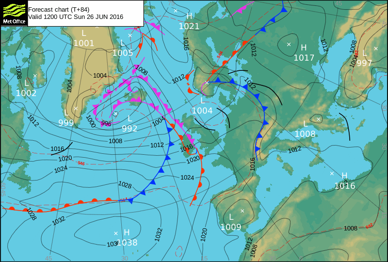
‘There’s a battle on between a blocking high in the Western approaches, and a low over Iceland. At the moment the charts show a general trend for the low to push down/win bringing onshore predominantly Westerly winds. Unfortunately this will mean poor onshore surf for the North coast which is the only place where the swell will get to. So mostly waist-shoulderhigh onshore choppy conditions for the week.’
The scale for measuring conditions:
0-1ft – Unridable/Flat
1-2ft – Kneehigh
3ft – Waisthigh
4-5ft – Chest/Shoulderhigh
6ft – Headhigh
6-8ft = 1-1.5x Overhead
8-10ft = 1.5x Overhead
10-12ft = 2x Overhead
Please Note!
Wave height predictions are based on the larger breaks on both coasts such as Fistral and Croyde for the North, and Praa Sands and Bantham for the South.
Wave height is measured from the front of the wave, and 6ft would usually mean a ‘head-high’ wave.
Try and use some ‘local’ knowledge about what the wave sizes will be elsewhere. For example the Newquay Bay area is generally 1/3 to 3/4 the size of Fistral, increasing the further up the bay you go from Towan to Lusty Glaze, and that it will be clean on a W wind at ‘harbour left’ at Towan at mid-tide’ for example.
Tide times are based on Newquay.
Stay Stoked!
SJ