At 6.20 a.m:
Constantine (1*): 2 feet.
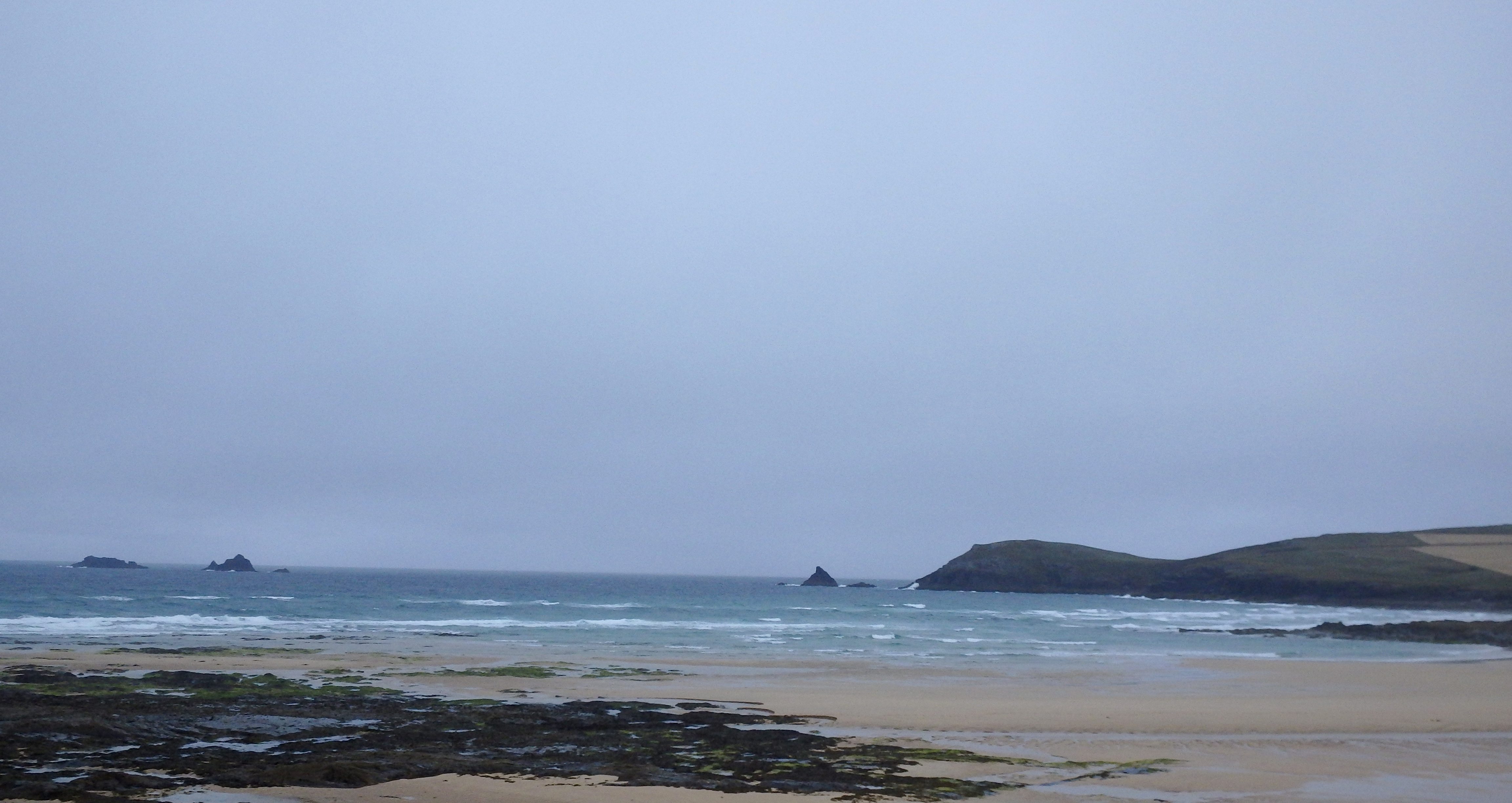
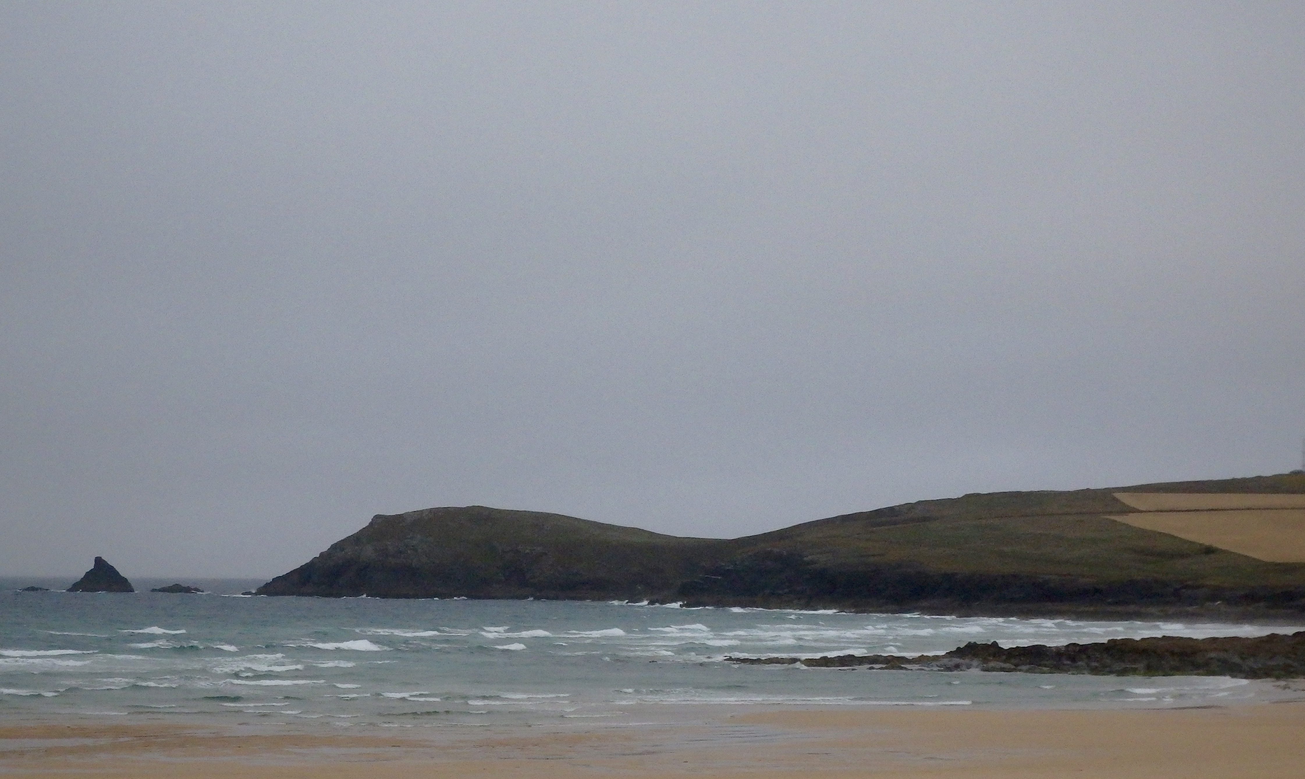
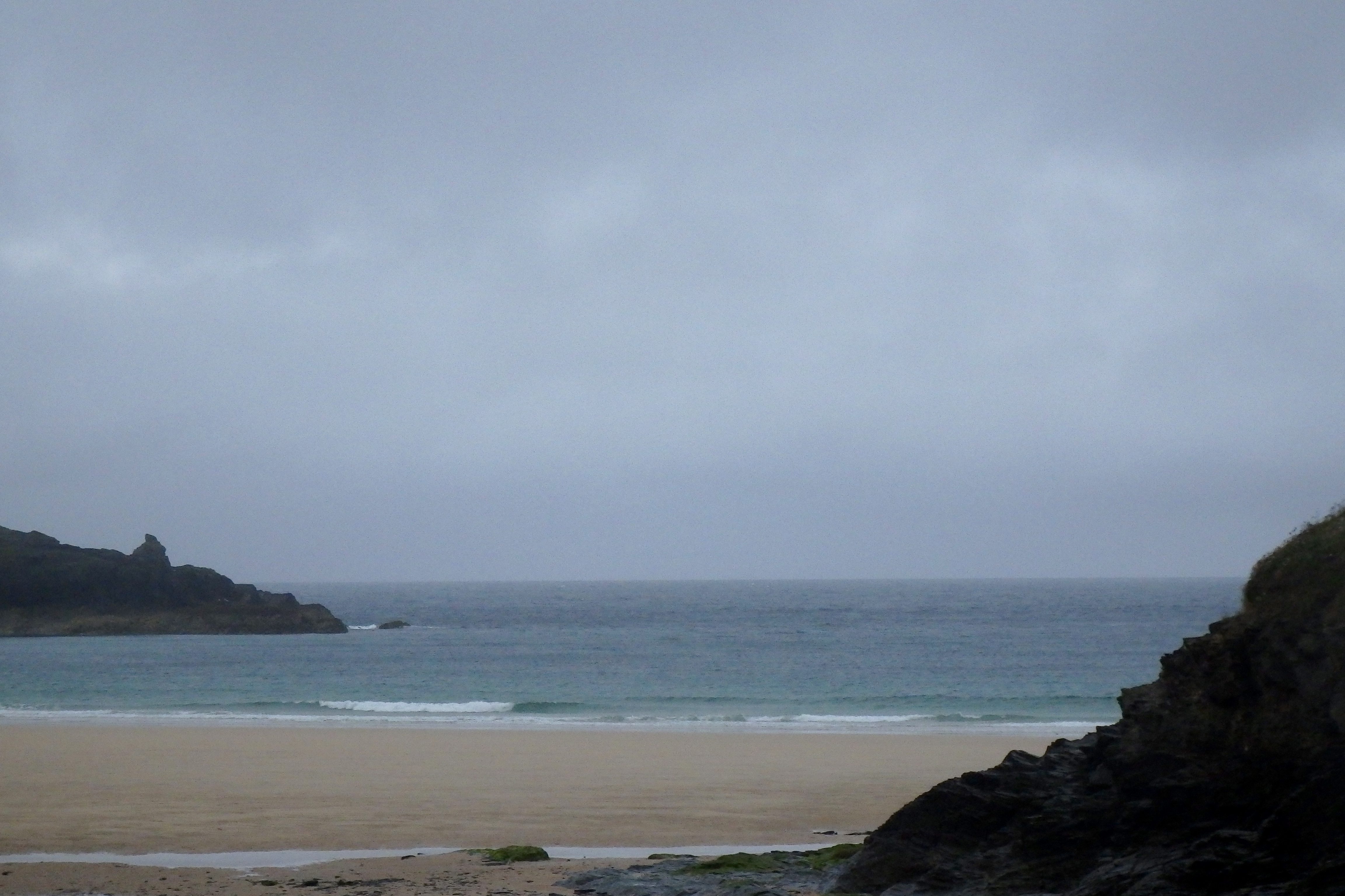
A gloomy and dreary old, mizzle soaked morning is gently reminding us that summer is galloping along with autumn eagerly waiting!
The rain soaked wind is fresh enough to shake the hedgerows and so the weak and powerless, swell less surf is being trashed.
A couple of feet or so of mixed up and wind junked little waves are wandering aimlessly into the bay but there’s nothing too inspirational to tempt a surfer. Especially not on this cold and wet and windy, more autumnal morning!
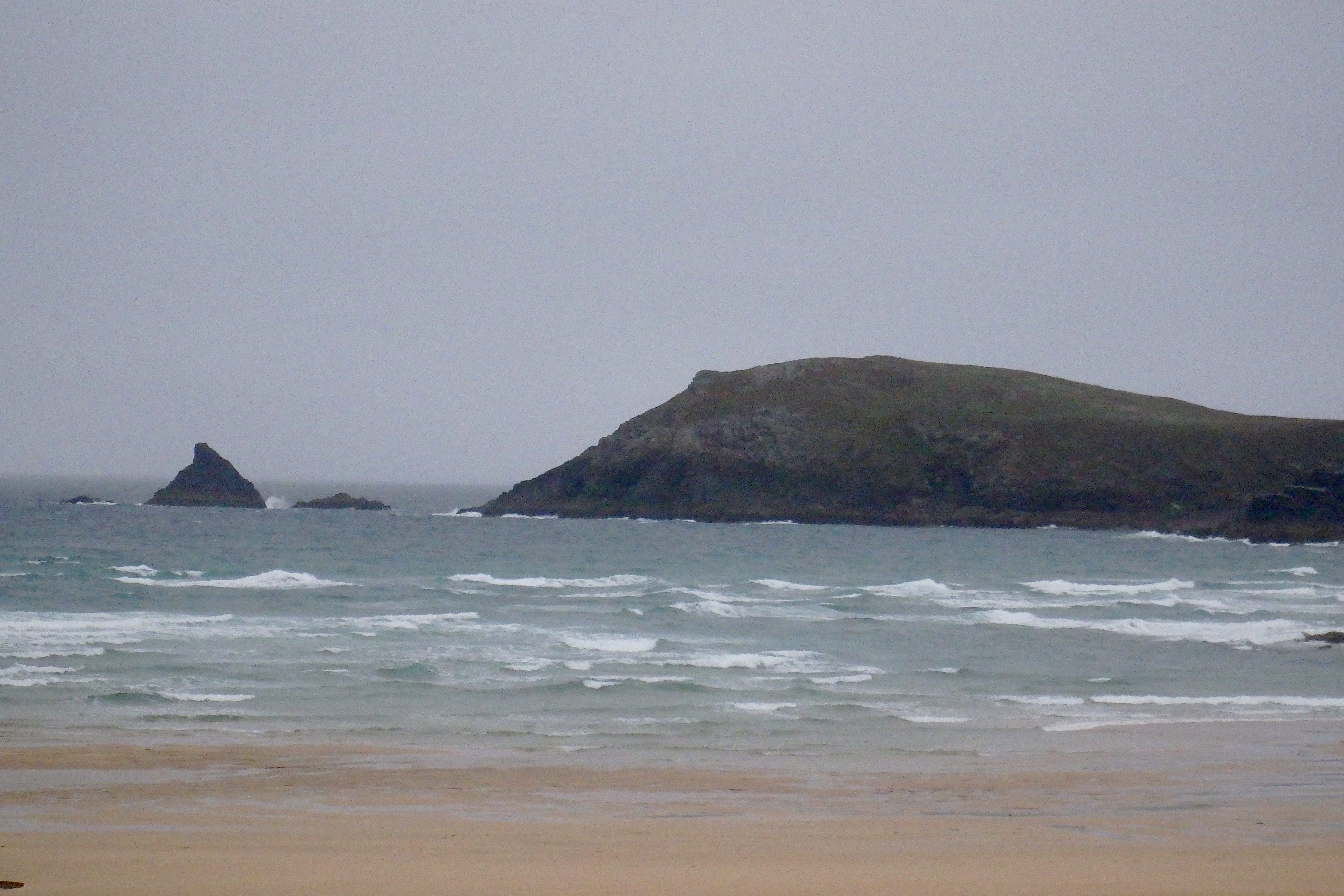
Although, sometimes you do get those little inside sections that wrap across the sand on days like this. And with only a 6.3m almost midday high, HTC might just be worth a little look back later!?
Harlyn (0*): 0 to 1 foot
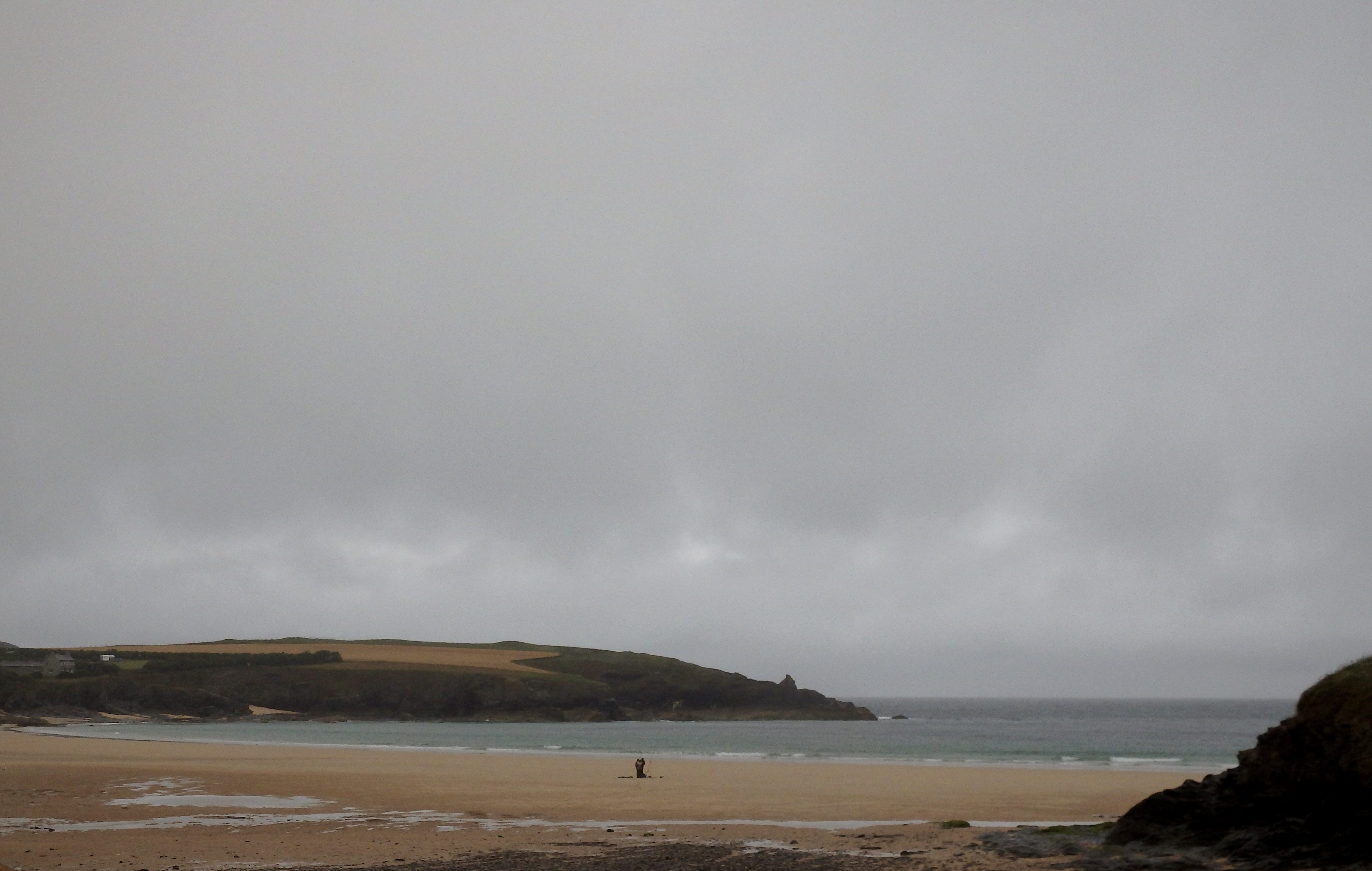
It is almost flat here this morning with only six inches to a foot of wind slopped and weak looking little wave lines slopping onto the beach.
The north westerly wind is onshore and the swell is weak, so it’s not the place to aim for to surf today!
And have you seen the proposed development plans for here (docs.planning.cornwall.gov.uk/rpp/index.asp?caseref=PA16%2F01850%2FPREAPP)?
Today’s Tide Times:
Low Tide: 17:59 (2.0m) High Tide: 11:36 (6.3m)

Surf Forecast for Thursday 28th July 2016
It’s not looking pretty and it’s not looking very surfy either with that same brisk, onshore, west nor’ westerly wind blowing in and a gutless windswell weakly stumbling our way. And don’t even mention the weather!
Still, it could just turn out to be a tiny bit better than you might expect, especially just before high tide.
Surf Conditions for the Rest of the Week
Steady onshores are going to breeze our way through this week, that same rolling three foot swell being delivered into our bays and coves in a tired and confused lump of surf.
Our main surf breaks on the more western facing beaches are likely to be showing three feet of sloppy and bumpy surf for most of the time and that’s where the action will be for most of this week, the surf being too weak to get into our more sheltered spots.
A week of mixed weather conditions awaits too but it should be mostly pleasant enough to enjoy some fun times at the beach but don’t forget to take your waterproofs as well!
Have a great week, wherever you are and whatever you’re doing!
SJ’s Surf Forecast for the SW
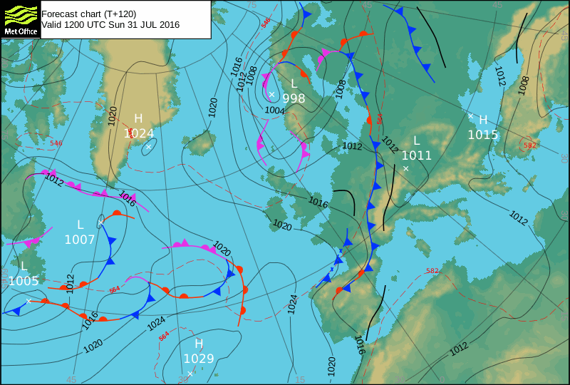
Forecast last updated at 09:00 Wednesday 27th July 2016
Hi everyone – these updates are currently made at any time of the day as and when I get the time/chance to update – however from September the intention would be for it to be updated every weekday morning by 10am.
[Don’t forget to look at this forecast the day before you go beach for the latest, as things can often change!]
The Rest Of The Week:
‘A fairly consistent / groundhog weak with similar conditions most days with a small swell and onshore winds. Not great in terms of quality, but hey it’s Summer – at least it’s not flat. Enough to get wet behind the ears along with a bit of paddling practise, and have a laugh in the sloppy conditions,’
Sunrise and sunset – 05:45 and 21:10
Twilight starts and ends – 05:05 and 21:50
Midday – 13:25
Length of day – 15:25
Offshore Sea Temp approx – 16.5C / 62F
outputmodelrun-270716-0900
Monday 25th:
‘Small onshore mushburgers.’
Swell – (i) Weak W-WNW
Wind – Light-Medium W-WSW going WNW
Weather – Bright and sunny day.
North Coast – 3ft (Waisthigh)
South Coast – 1ft
Tides – 09:38 High, 16:00 Low
Tuesday 26th:
‘Small onshore mushburgers.’
Swell – (i) Weak W-WNW
Wind – Light-Medium WSW
Weather – Overcast and cloudy, with a chance towards evening.
North Coast – 3ft (Waisthigh)
South Coast – 1ft
Tides – 10:28 High, 16:52 Low
Wednesday 27th:
‘Small onshore slop/mushburgers with an increase in wind strength.’
Swell – (i) Weak W
Wind – Medium going Light-Medium WNW
Weather – Overcast and rainy start, drying out later on in the day
North Coast – 3ft (Waisthigh)
South Coast – 1ft
Tides – 05:25 Low, 11:27 High, 17:52 Low
Thursday 28th:
‘Be careful out there on Thursday – an increase in wind could cause the slop to get a bit bigger throughout the day.’
Swell – (i) Weak W
Wind – Medium SW going W
Weather – Overcast and rainy start, drying out later on in the day
North Coast – 3ft (Waisthigh) going 4-5ft (Chest-Shoulderhigh)
South Coast – 1ft going 1-2ft (Kneehigh)
Tides – 06:34 Low, 12:36 High, 19:13 Low
Friday 29th:
‘The opposite of Thursday with ‘surf’ size decreasing during the day. Still onshore sloppy much though.’
Swell – (i) Weak W-WNW
Wind – Light-Medium W-WSW going NW
Weather – Cloudy with some rain and some sunny spells.
North Coast – 5-6ft (Shoulder-Headhigh) going 4-5ft (Chest-Shoulderhigh)
South Coast – 1-2ft (Kneehigh) going 1ft
Tides – 07:52 Low, 13:52 High, 20:32 Low
Weekend Summary:
‘Enough swell for surf schools and learners with small onshore conditions.’
Saturday 30th:
‘Changble winds – keep an eye on the latest forecast updates for Saturday – could be good if the winds go light, or could be onshore mush if they’re onshore.’
Swell – (i) Weak W-WNW
Wind – Changable (Possibly Light W-NW going Light-Medium NW)
Weather – Bright and sunny!
North Coast – 3-4ft (Waist-Chesthigh) going 2-3ft (Knee-Waisthigh)
South Coast – 1ft
Tides – 09:05 Low, 15:04 High, 21:43 Low
Sunday 31st:
‘Getting smaller. Still a small onshore sloppy wave – get the stand up paddleboards or longboards out!’
Swell – (i) Weak W-WNW
Wind – Light-Medium NW
Weather – Bright and sunny!
North Coast – 2-3ft (Knee-Waisthigh)
South Coast – 1ft
Tides – 10:09 Low, 16:08 High (Neap tides)
Early Next Week:
‘Too early to tell yet.’
The scale for measuring conditions:
0-1ft – Unridable/Flat
1-2ft – Kneehigh
3ft – Waisthigh
4-5ft – Chest/Shoulderhigh
6ft – Headhigh
6-8ft = 1-1.5x Overhead
8-10ft = 1.5x Overhead
10-12ft = 2x Overhead
Please Note!
Wave height predictions are based on the larger breaks on both coasts such as Fistral and Croyde for the North, and Praa Sands and Bantham for the South.
Wave height is measured from the front of the wave, and 6ft would usually mean a ‘head-high’ wave.
Try and use some ‘local’ knowledge about what the wave sizes will be elsewhere. For example the Newquay Bay area is generally 1/3 to 3/4 the size of Fistral, increasing the further up the bay you go from Towan to Lusty Glaze, and that it will be clean on a W wind at ‘harbour left’ at Towan at mid-tide’ for example.
Tide times are based on Newquay.
Stay Stoked!
SJ