At 6.40 a.m:
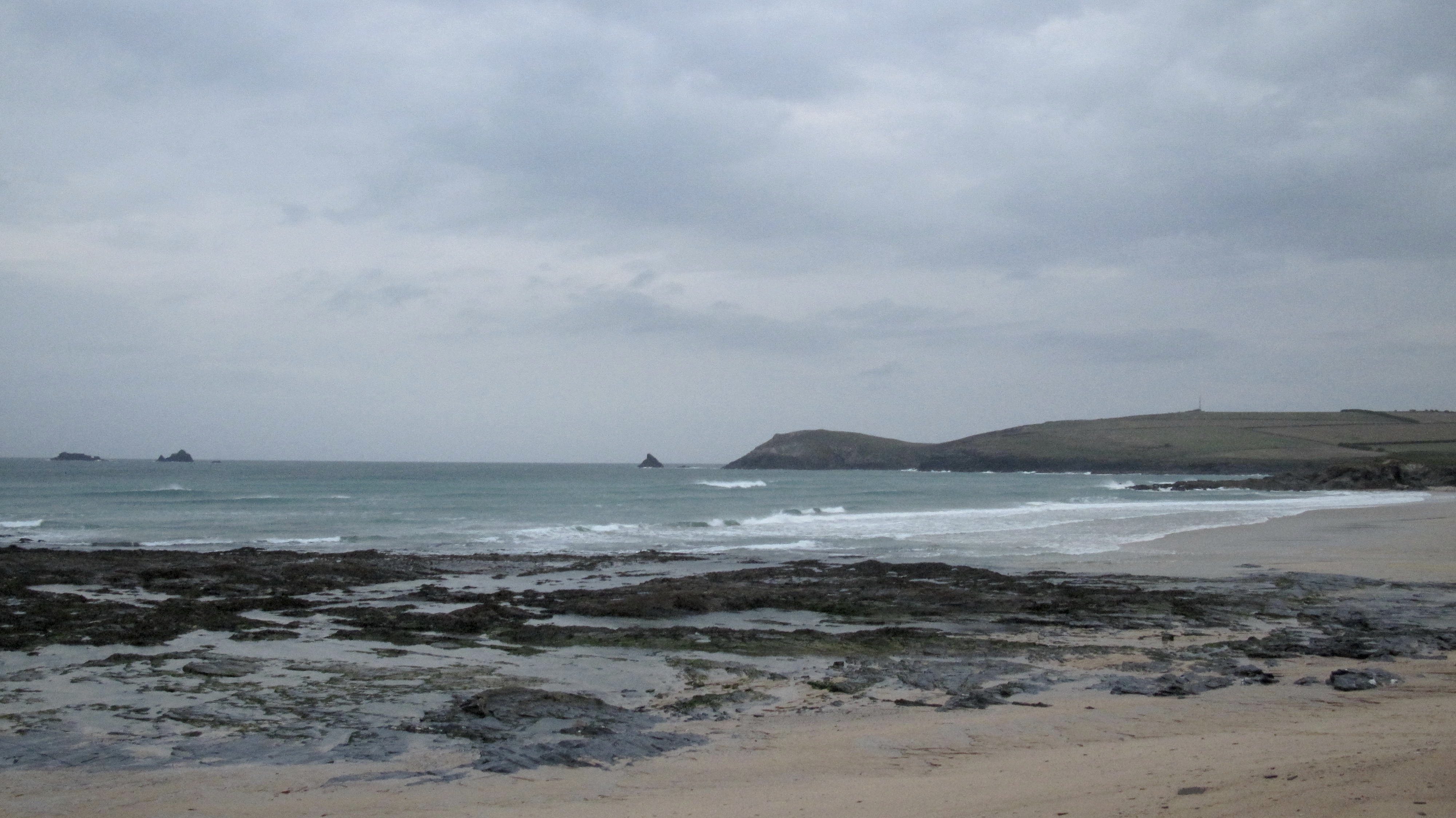
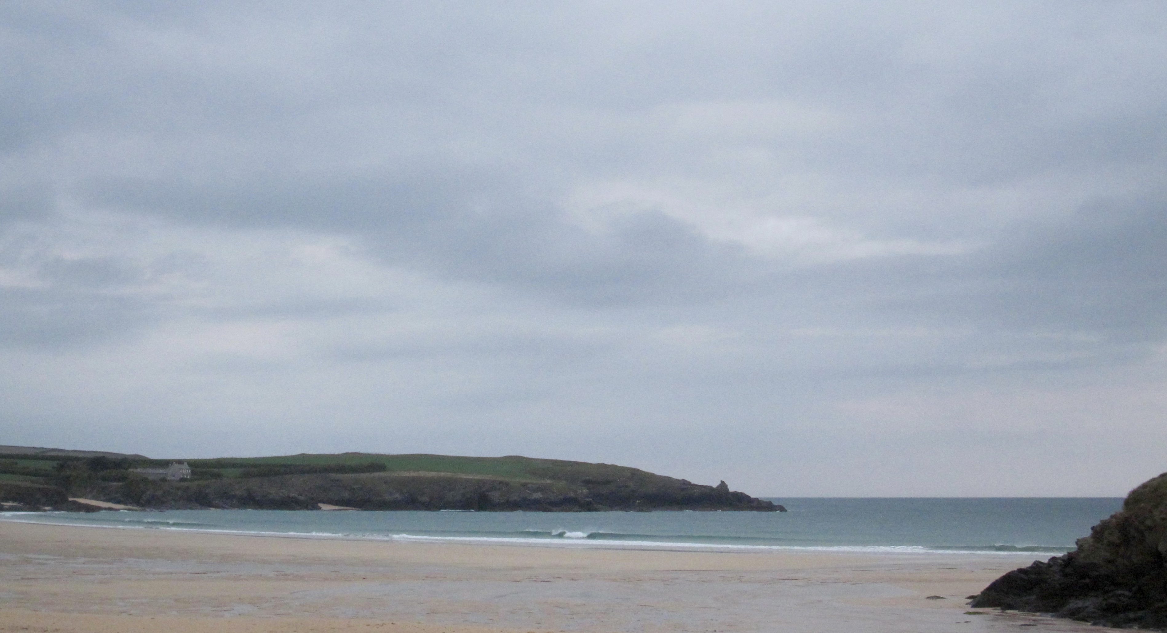
Constantine (3*): 3 feet.
‘Hard the wind blows….’
And indeed it does this morning, well, for a south easterly it does anyway.
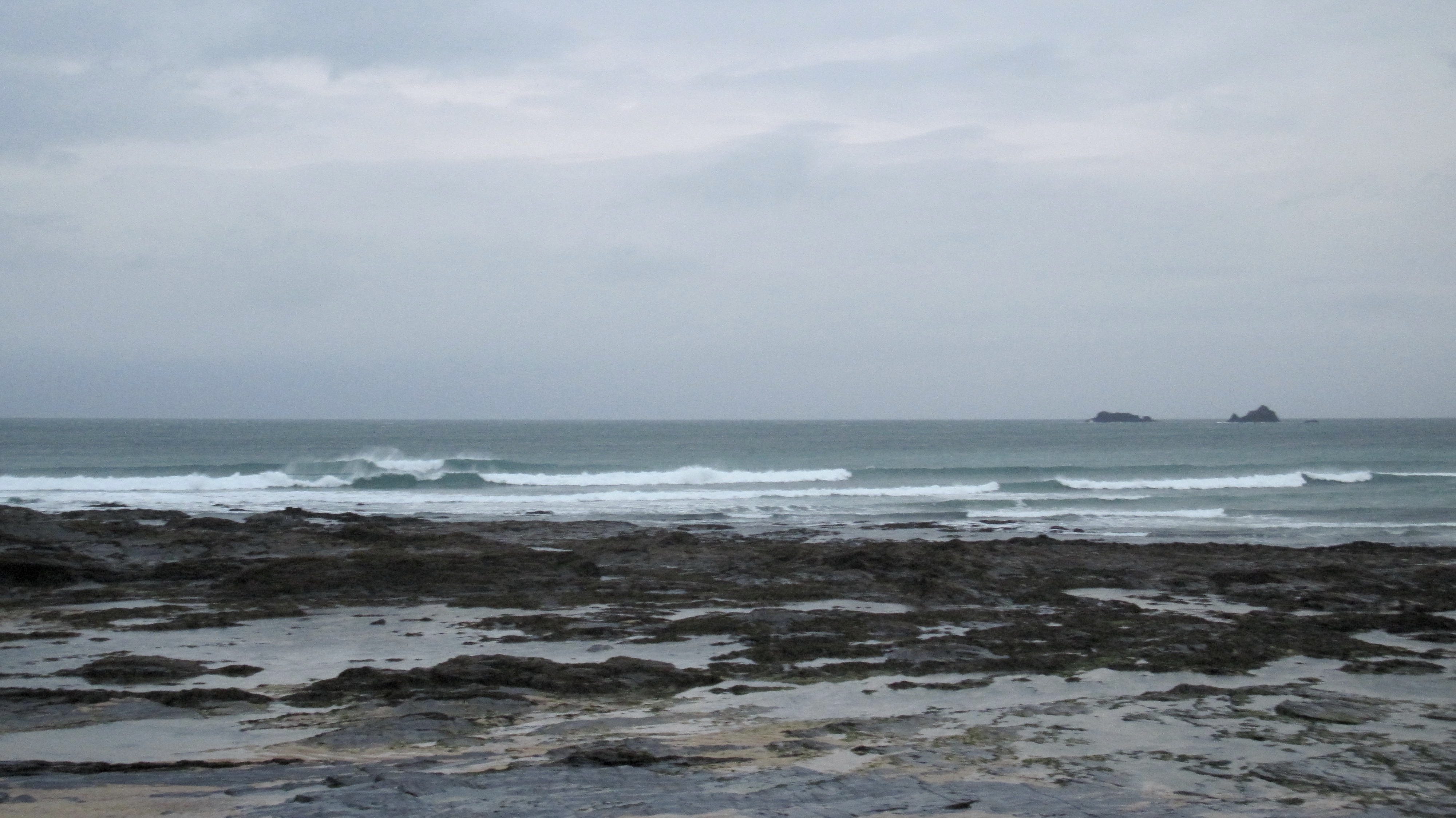
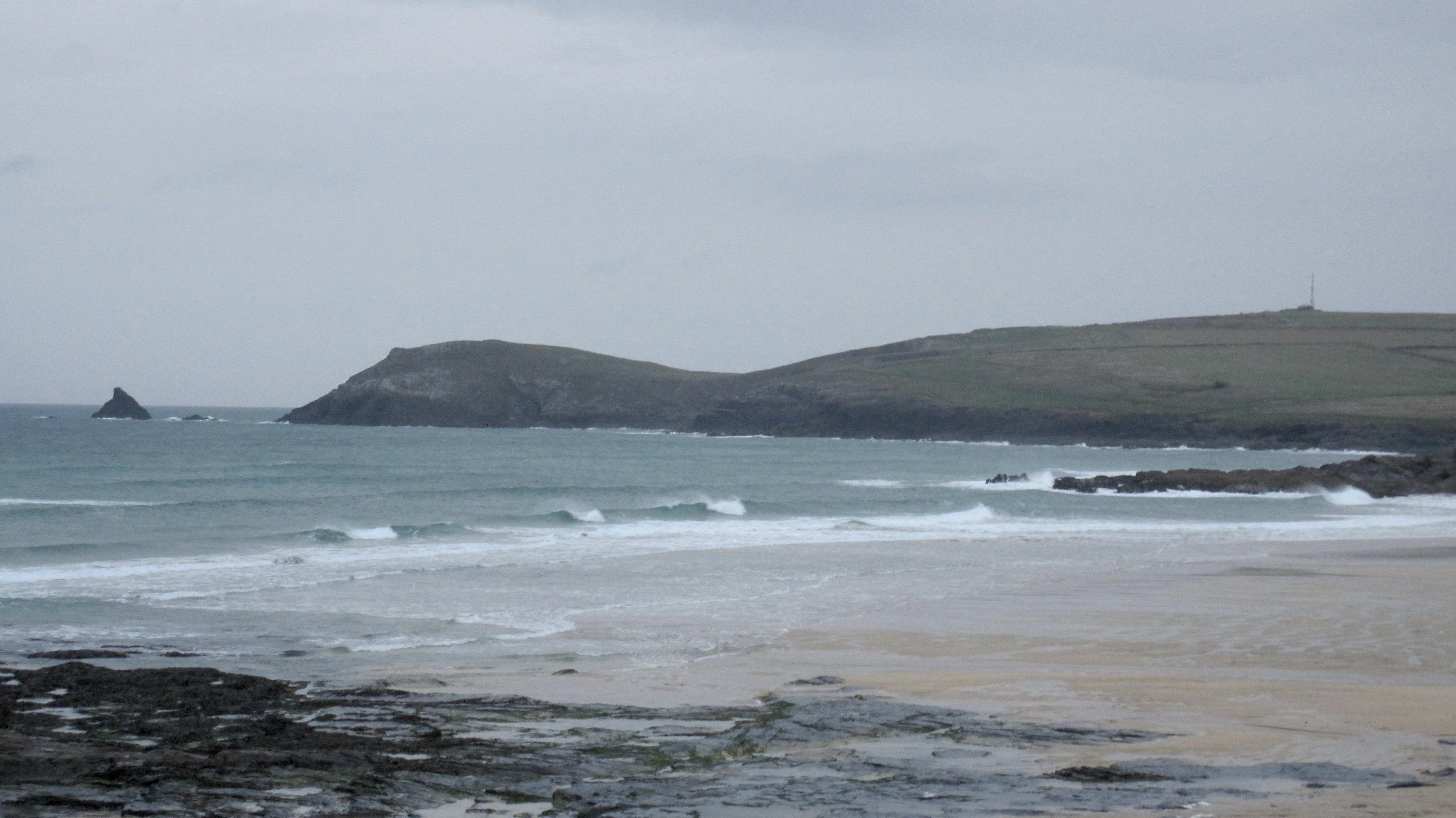
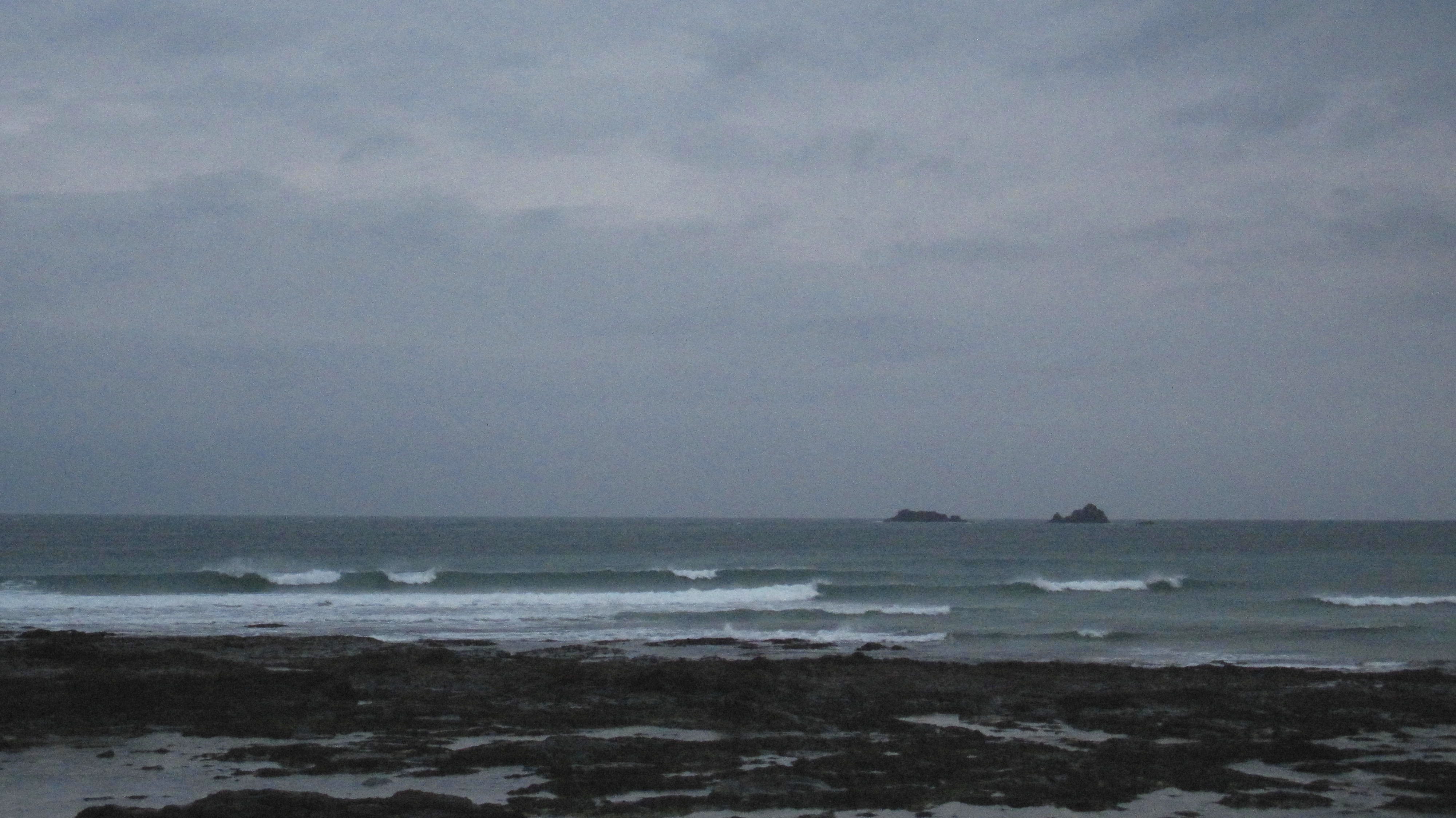
Yes, the wind is gusting offshore, strong enough to rattle the hedgerows and tease those Cornish Palms while blowing straight into the three to maybe just a bit bigger than three foot waves.
Those waves look pretty, all peaky and peeling and curling and snapping. A little dark, reflecting that grey, grey sky but that should brighten up eventually too, if only a little.
So, with the tide dropping to low during mid-morning, watch that swell grow this afternoon as the tide pushes in with a building swell.
It’s going to be bigger this afternoon, a lot bigger by this evening!
And have a look at our surf forecast below for the coming week!
It’s exciting enough to get SJ out of semi-retirement to cast the runes and scour those charts and very thoughtfully provide us with a little blast from the past in the shape of ‘SJ’s forecast for the coming week!’.
Enjoy!
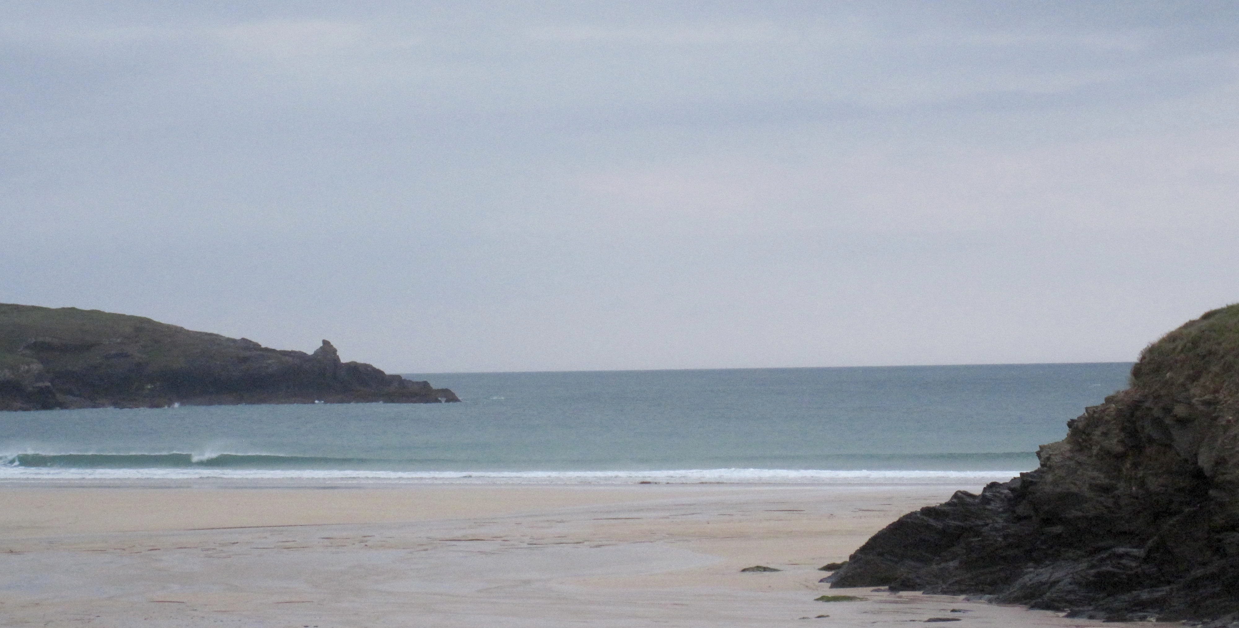
Harlan (2*): 1 to 2 feet.
There are tiny little screamers reeling onto the sand here this morning!
A foot or two of offshore blown, hollow little waves are slapping the sand, those little tubes as wide as they are high, closing out here and there but the occasional one just screaming across the beach.
This is going to be a completely different place in only a few hours! By this evening we should see some roaring waves growling into the bay, powerful and heavy, sand-drenched and hollow!
It could just get good here over the next 48 hours or so!
Today’s Tide Times:
Low Tide: 10:22 (0.9m) High Tide: 16:16 (7.7m)

Surf Forecast for Tuesday 27th October 2015
Five foot groundswells with a midteens wave-period might just be groomed by an offshore south, south easterly wind, lighter than Mondays blow.
Throw in some afternoon autumn sunshine along with an almost 8 metre tide and we might just be anticipating a day of days!
Wax ‘em down – there’s going to be surf today
Surf Conditions for the Start of the Week
It looks as though we could be in for a wave drenched week!
There’s a big old depression marching up to the south west approaches pushing a whole heap of swell ahead of it. Hopefully the low itself should just brush past us but the swell should roar our way.
We are going to see the surf increase a lot through Monday, going from a couple to three feet in the morning to double or treble that by dusk, a strong south easterly wind blowing offshore all the time.
By Tuesday the surf should be well within the ‘big’ range, the first swell of the autumn with that solid ‘winter’ feel to it. Hopefully the wind should have lightened up and should stay just about offshore.
Conditions are likely to have settled a lot by midweek, the wind staying southerly going south westerly, Halyn directly benefiting from that.
Yep, it’s all looking good for some thumping surf to kick this week off.
In fact the surf is looking so good that it seems to have tempted the internet’s original surf forecaster, SJ, out of semi-retirement. Here’s what he has to say (and remember, he doesn’t use capitals LIGHTLY!):
Have a great week, wherever you are and whatever you’re doing!
SJ’s Surf Forecast for the SW
Forecast updated at 00:10 Monday 26th October 2015
[Don’t forget to look at this forecast the day before you go beach for the latest, as things can often change!]
The Last 9 years…:
It’s been 9 years since this forecast stopped being broadcast regularly online, on BBC Radio, and on TV, and for the British Surfing Association. I went on my travels for six months from October 2006 to March 2007. A1Surf.com was put up for sale sold which Friday-Ad bought in the Summer of 2007, and I was officially on ‘gardening leave’ for a ‘while’. The recession hit in September 2007, and the industry changed, the British Surfing Association went, and has now been replaced by surfinggb.com The great guys at magicseaweed.com including Ben Freeston took up the mantle and pushed the boundaries and limits of free surfing information on the web even further and for many they became the one stop place for surfing online – having recently been bought out by an international company. So now is time to bring a little something back to British surfing… As for me, I have grown a little older and wiser, met a great lady in my wife where we work on her social enterprise helping vulnerable adults and we have an amazing young daughter – happy days 🙂
Sunrise and sunset – 07:05 and 17:05
Twilight starts and ends – 06:30 and 17:35
Midday – 12:03
Length of day – 10:00
Offshore Sea Temp approx – 15 C / 59 F
Monday 26th:
Strong off-shores with a jump in size later in the day when the beginnings of a new swell hits. Seek shelter away from these winds, especially those that work at a high tide when you’re likely to get most shelter. Might be a busy day for the life-guards and the RNLI as people may get caught out when sneaker sets start to hit later on.’
Swell direction approx – (i) medium W-WNW going very-strong W-WSW
Wind direction approx – strong SSE-SE going SSE
Weather outlook – mixture of overcast conditions giving way to some rain showers and the odd sunny spell
North Coast approx – 3ft (Waist-high) going 6-10ft (head-high to well-overhead)
South Coast approx – blown-out
Tides – 10:05 Low, 16:01 High
Tuesday 27th:
STONKING! Take care out there.
Swell direction approx – (i) very-strong WSW
Wind direction approx – light to medium S
Weather outlook – overcast with heavy showers, possibly drying out in the afternoon
North Coast approx – 12ft (double over-head) going 6-8ft (over-head)
South Coast approx – 4-6ft (chest to head-high) going 3ft (waist-high)
Tides – 10:51 Low, 16:46 High (spring tides)
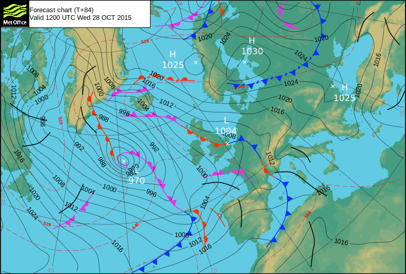
Wednesday 28th:
A drop in size, and the cross-shores on the North will dictate shelter.
Swell direction approx – (i) medium SW
Wind direction approx – medium S going S-SW
Weather outlook – brighter day, mostly dry, with some sunshine and the odd light shower
North Coast approx – 5-6ft (shoulder to head-high)
South Coast approx – 3-4ft (waist to chest-high)
Tides – 11:33 Low, 17:31 High (spring tides)
Thursday 29th:
Too far away to tell accurately, but the swell will still be there, it’ll just weaken during the day.
Swell direction approx – (i) medium SW going weak WSW
Wind direction approx – changeable (!)
Weather outlook – overcast but dry
North Coast approx – 5-6ft (shoulder to head-high)
South Coast approx – 3ft (waist-high)
Tides – 12:18 Low (spring tide)
Friday 30th:
Early days – should be swell but the fine detail on size and wind direction will become clearer a couple of days before.
Swell direction approx – (i) strong going medium W
Wind direction approx – changeable (!)
Weather outlook – overcast and rainy in the morning,with the rain dying our in the afternoon
North Coast approx – 6ft (headhigh) going 3-4ft (waist to chest-high)
South Coast approx – 1-3ft (knee to waist-high) going (1-2 ft / knee-high)
Tides – 06:36 Low, 13:03 High
Weekend Summary:
Too early to tell yet. Initial signs are for plenty of waves but you’d need to wait until mid-week to have an idea what the wind etc will be doing!
Thanks SJ! Any chance of making this a regular thing?
Wooohooooo. Feels like kernow of old. Magic Sw ok but nothing like looking at the charts and knowing it’s gonna pump for sure. Can’t beat knowledge from yrs of surfing here in motherland