At 6.40 a.m:
Constantine (2*): 1 to 2 feet.
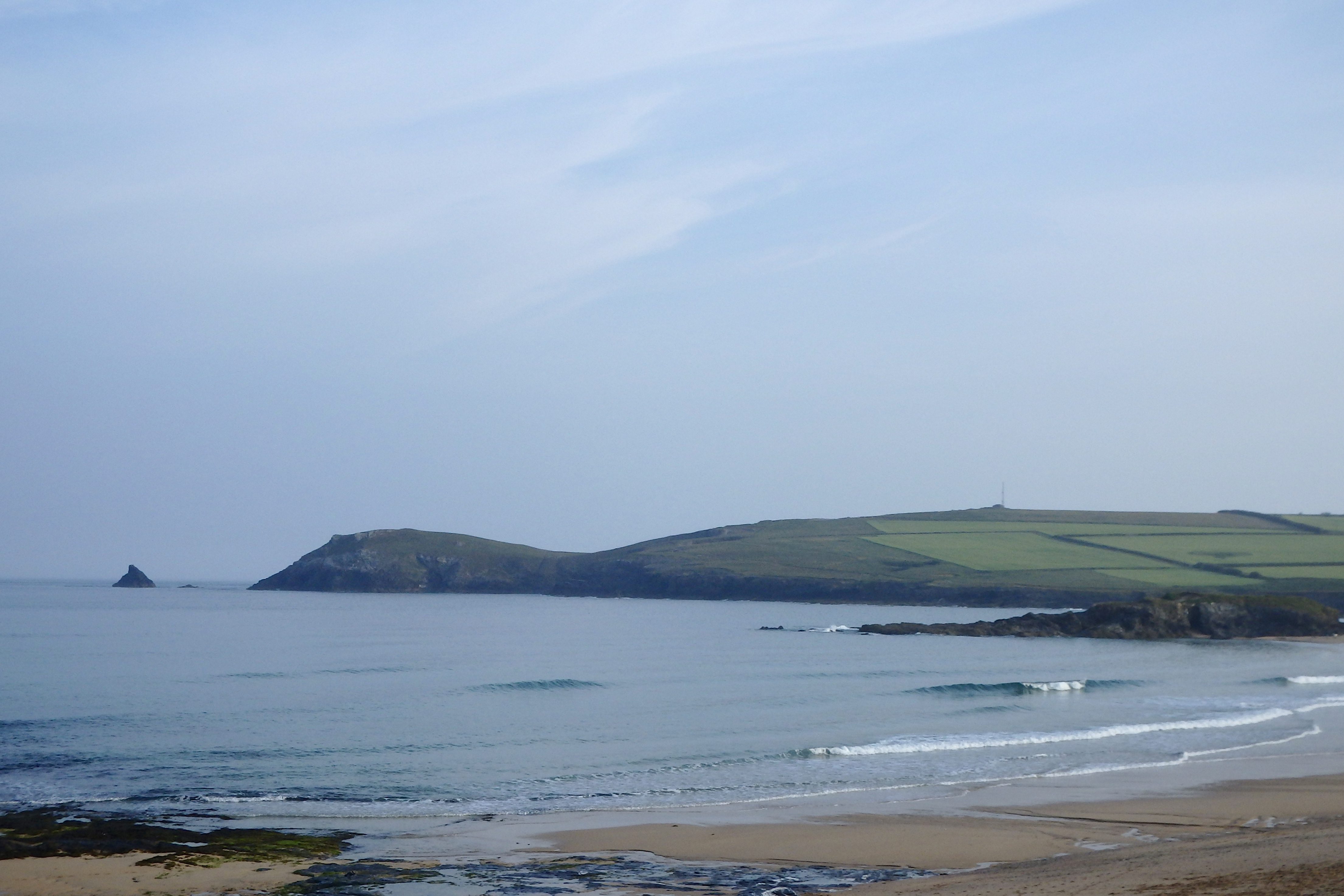
Another calm and brightly hazy morning is quietly warming up this morning, the sound of birdsong and small surf drifting across the fields.
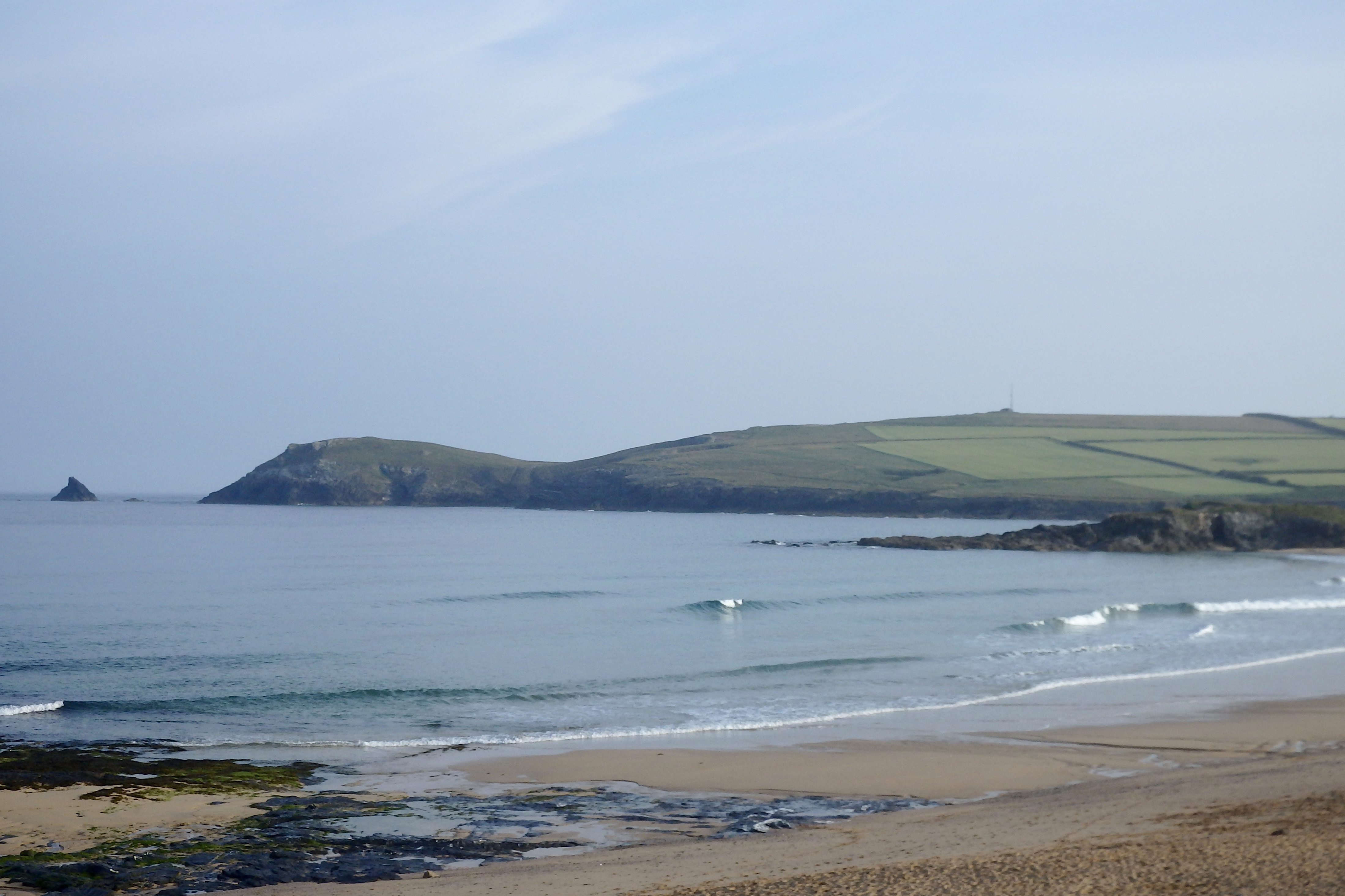
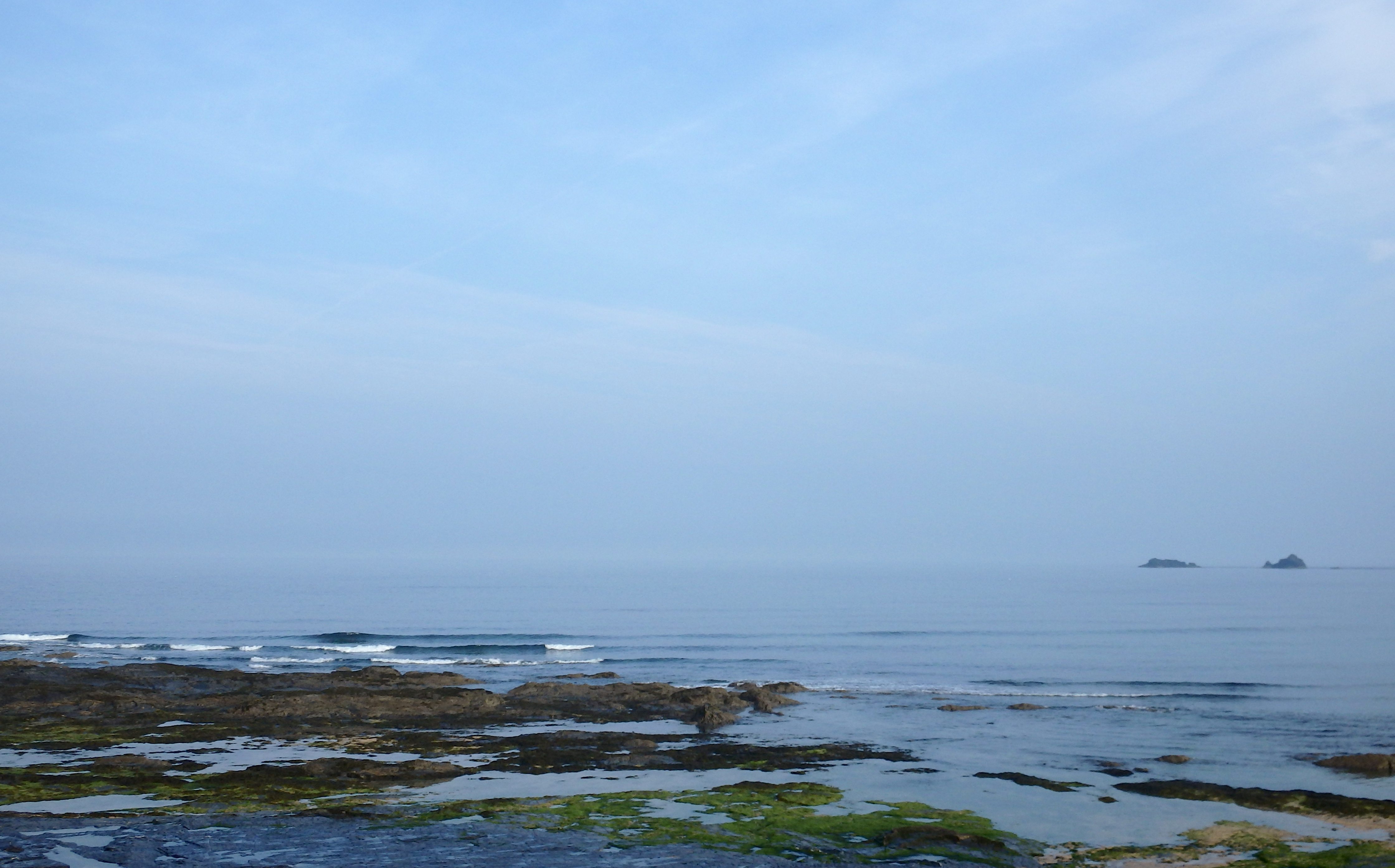
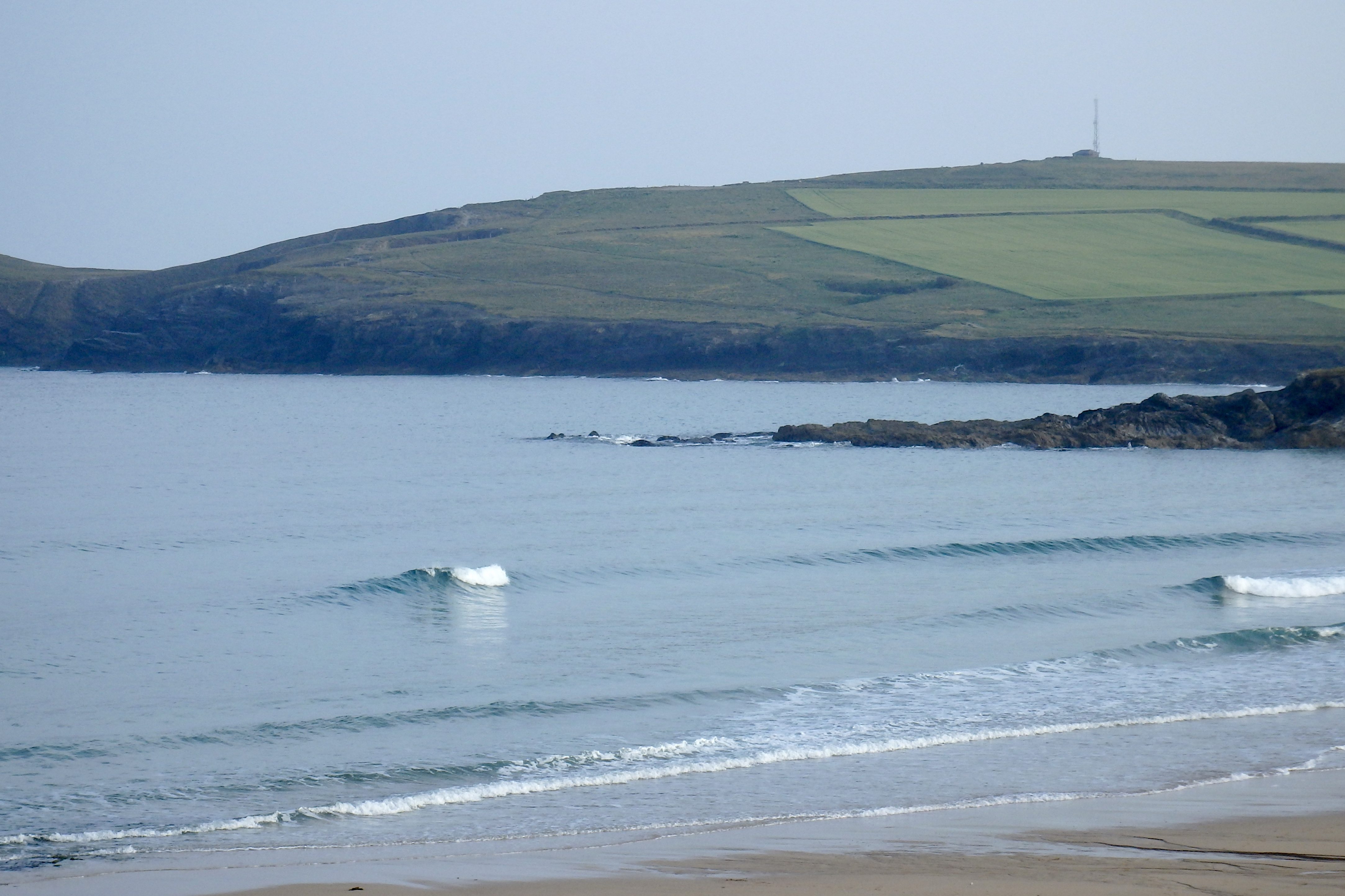
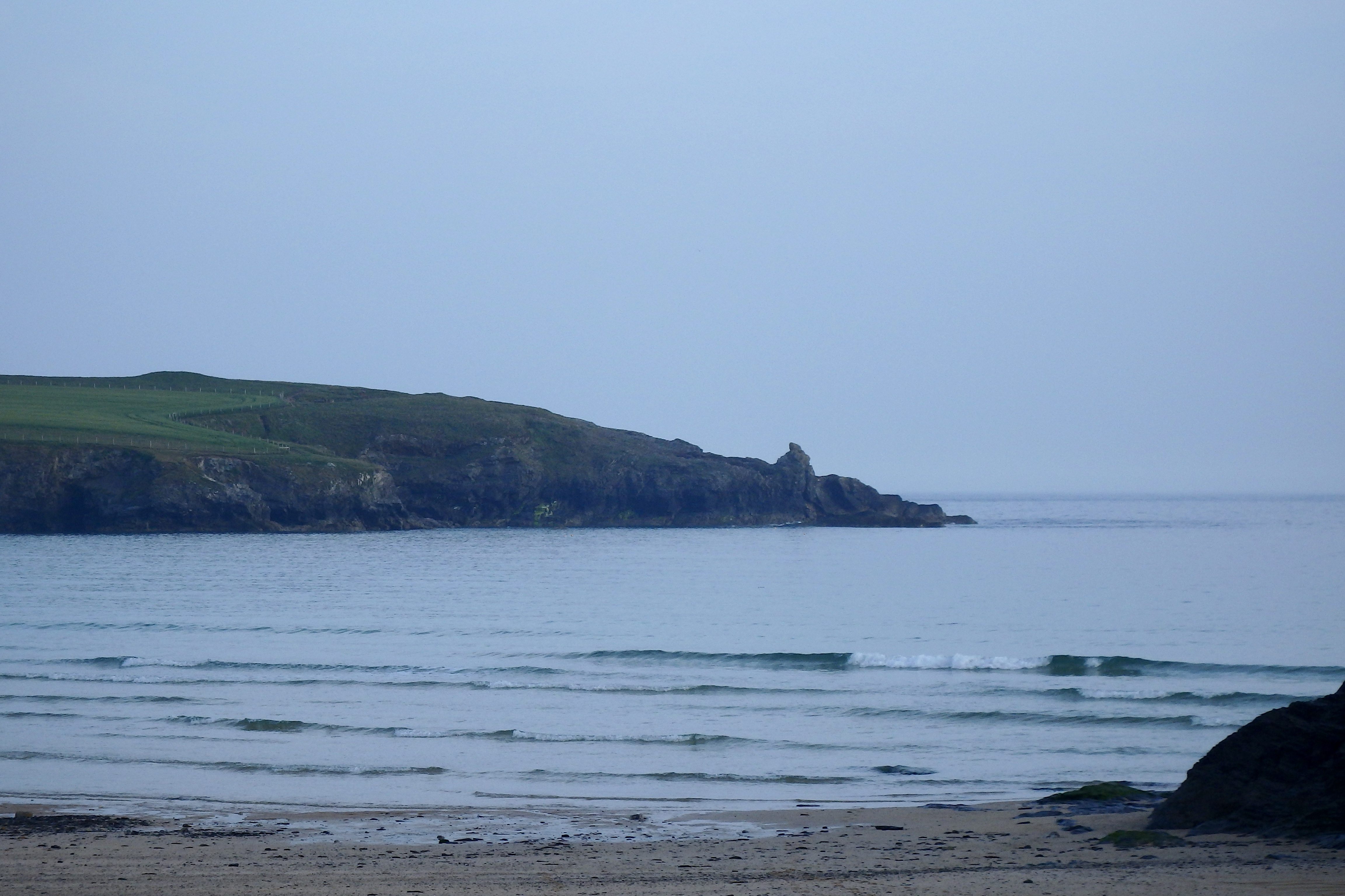
The surf has dropped but there are still some gorgeous one to two foot waves gliding into the bay, gently toppling and spilling their way to shore, mirror like in their smoothness.
This afternoon’s tide should show a little increase in size, a shadowing pulse of swell expected to show itself by this evening.
It could just get very good tonight!
You might already have noticed the addition of the iconic ‘SJ’s Forecast for the South West’ being added on to our daily surf report. If you scroll down to the comments section of our Surf Report page you can find the return of the original UK Web surf forecaster, SJ! At the moment it is a little ad hoc but if things work out there might be the opportunity to expand it all.
Let us know what you think!
Harlyn (0*): 0 to 1 foot
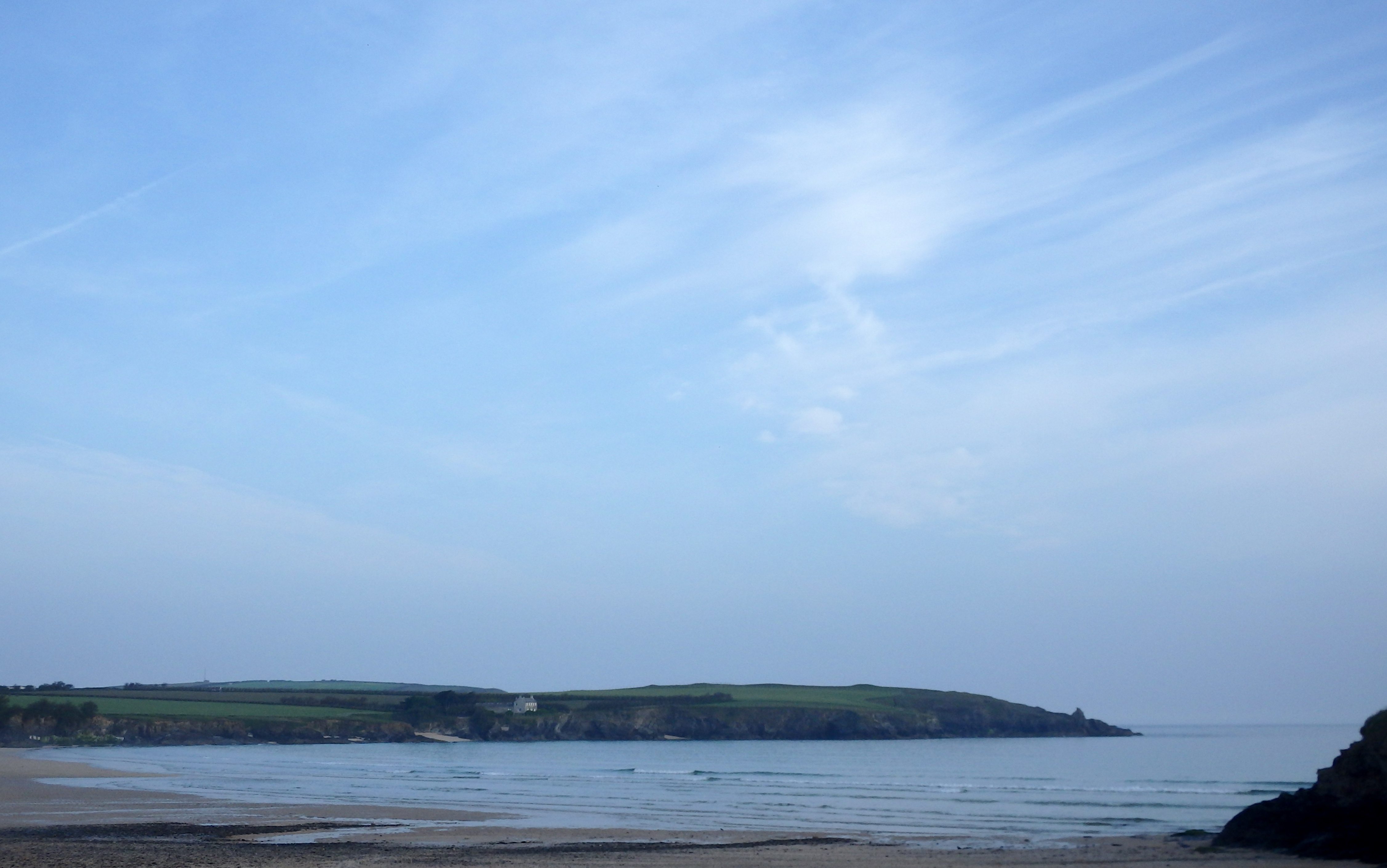
Tiny little wavelets are washing into the bay this morning, oilled glass and curling their way to the sand.
Those waves are tiny but beautiful to watch and probably fun to play in but you won’t be able to surf on them, well, not that easily anyway!
It’s the other side again to surf today, it is still small over there but surfable and fun looking for a longboard.
Today’s Tide Times:
Low Tide: 15:33 (1.3m) High Tide: 09:12 (6.8m)

Surf Forecast for Friday 10th June 2016
A couple to three feet of clean and glassy surf is expected for most of the day, a steady ten second rhythm to those rolling waves.
The winds forecast to be super light and variable, allowing mainly glassy conditions for most of the day, the sea breezes having their effect as the land warms through the afternoon.
Another fine day of fun surf awaits!
Surf Conditions for the Weekend
These small but regular little swells are expected to continue to roll our way all the way through the end of this week and into the weekend.
Those beautifully clean and glassy conditions of the end of the week will gradually be replaced by more onshore conditions as the weekend settles in, the breeze slowly becoming something just a bit stronger.
By Saturday night or Sunday morning we could be seeing a fresher westerly wind starting to push a little more swell our way, resulting in some three to four foot surf by Sunday afternoon.
We might even be surfing Harlyn by Sunday evening!
But generally the weather should be bright enough with the surf getting bigger as the weekend unfolds.
Have a great weekend, wherever you are and whatever you’re doing!
Great surf forecast from SJ – keep it coming.
Thanks Peter – I’m a little rusty being about 8 years out of the game/forecast though!
Reposting yesterdays forecast here – been sunning it up with the family at royal cornwall show all day since 8am, so havent had a chance to read the latest updates on wave data and the charts. Will do a full update again tomorrow morning…
SJ’s Surf Forecast for the SW
Forecast last updated at 09:30 Wednesday 8th June 2016
Hi everyone – these updates are currently made at any time of the day as and when I get the time/chance to update – however from September the intention would be for it to be updated every weekday morning by 10am.
[Don’t forget to look at this forecast the day before you go beach for the latest, as things can often change!]
The Rest Of The Week:
‘Some waves about all week, but it will depend on the winds on when you get in.’
Sunrise and sunset – 05:10 and 21:30
Twilight starts and ends – 04:25 and 22:15
Midday – 13:20
Length of day – 16:20
Offshore Sea Temp approx – 14C / 57F
080616
Monday 6th:
‘Great day for surf – gets bigger and cleaner/glassier as the day goes on.’
Swell – (i) Medium W-WSW going Strong WSW
Wind – Light-Medium E-SE going Light Variable
Weather – Mixture of cloud and sunny spells
North Coast – 3ft (Waisthigh) going 4ft (Chesthigh)
South Coast – 1ft
Tides – 06:38 High, 13:00 Low, 18:59 High (Spring tides)
Tuesday 7th:
‘A good wave but with light onshores by afternoon. Should still be good though, especially in the sun.’
Swell – (i) Medium going Weak WSW
Wind – Light Variable going NW
Weather – Gloriously bright, with some cloud and sunny spells
North Coast – 4-6ft (Chest-Headhigh) going 3-4ft (Waist-Chesthigh)
South Coast – 1ft going Flat
Tides – 07:25 High, 13:47 Low, 19:45 High
Wednesday 8th:
‘Small wave with a light crosshore Northerly wind.’
Swell – (i) Medium going Weak WSW
Wind – Light N
Weather – Cloudy start but with plenty of sunny spells by the afternoon
North Coast – 3ft (Waisthigh) going 2-3ft (Knee-Waisthigh)
South Coast – Flat
Tides – 08:12 High, 14:32 Low, 20:31 High
Thursday 9th:
‘A good clean wave with well defined lulls and sets. Will build further still on the tidal push late afternoon. Royal Cornwall Show starts today!’
Swell – (i) Medium WSW
Wind – Light E-SE going Light-Medium SE
Weather – Cloudy but dry and warm, maybe the odd sunny spell
North Coast – 2-3ft (Knee-Waisthigh) going 3-4ft (Waist-Chesthigh)
South Coast – 1ft
Tides – 08:57 High, 15:17 Low, 21:16 High
Friday 10th:
‘Small good clean/OK waves on the North. Noticeably colder as the change in weather systems kicks in – bye bye tshirts!’
Swell – (i) Medium going Weak WSW
Wind – Changable (Light Variable)
Weather – Overcast with light rain showers
North Coast – 3-4ft (Waist-Chesthigh) going 3ft (Waisthigh)
South Coast – 1ft
Tides – 09:43 High, 16:02 Low, 22:03 High
Weekend Summary:
‘Small on Saturday, and then on Sunday sheltered spots could work. ’
Saturday 11th:
‘Small onshore sloppy mush. Leave it to beginners; go chew some straw at the Royal Cornwall Show instead!’
Swell – (i) Weak W-WSW going WSW
Wind – Light-Medium W going SW
Weather – Cloudy but dry
North Coast – 3ft (Waisthigh) going 2-3ft (Knee-Waisthigh)
South Coast – Flat
Tides – 04:36 Low, 10:32 High, 16:52 Low (Neap tides)
Sunday 12th:
‘A return to more choppy onshore surf for the North that’ll build throughout the day. Not great for surf though with no quality to the swell, and could be a busy one for the lifeguards as people/swimmers get caught out. Sheltered spots should be working a smaller but OK cleanish wave.’
Swell – (i) Weak WSW going W-WSW
Wind – Medium W-SW going W
Weather – Overcast and rainy
North Coast – 3-4ft (Waist-Chesthigh) going 4-6ft (Chest-Headhigh)
South Coast – 1-2ft (Kneehigh) going 2-3ft (Knee-Waisthigh)
Tides – 05:15 Low, 11:15 High, 17:30 Low (Neap tides)
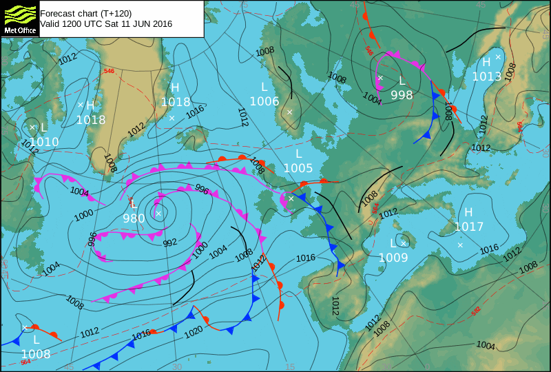
Early Next Week:
‘Wet and windy. A return to slightly cooler weather with a low pressure zone heading in drawing down cooler air, but not much in the way of waves. Rain expected throughout the week.’
The scale for measuring conditions:
0-1ft – Unridable/Flat
1-2ft – Kneehigh
3ft – Waisthigh
4-5ft – Chest/Shoulderhigh
6ft – Headhigh
6-8ft = 1-1.5x Overhead
8-10ft = 1.5x Overhead
10-12ft = 2x Overhead
Please Note!
Wave height predictions are based on the larger breaks on both coasts such as Fistral and Croyde for the North, and Praa Sands and Bantham for the South.
Wave height is measured from the front of the wave, and 6ft would usually mean a ‘head-high’ wave.
Try and use some ‘local’ knowledge about what the wave sizes will be elsewhere. For example the Newquay Bay area is generally 1/3 to 3/4 the size of Fistral, increasing the further up the bay you go from Towan to Lusty Glaze, and that it will be clean on a W wind at ‘harbour left’ at Towan at mid-tide’ for example.
Tide times are based on Newquay.
Stay Stoked!
SJ