At 6.25 a.m:
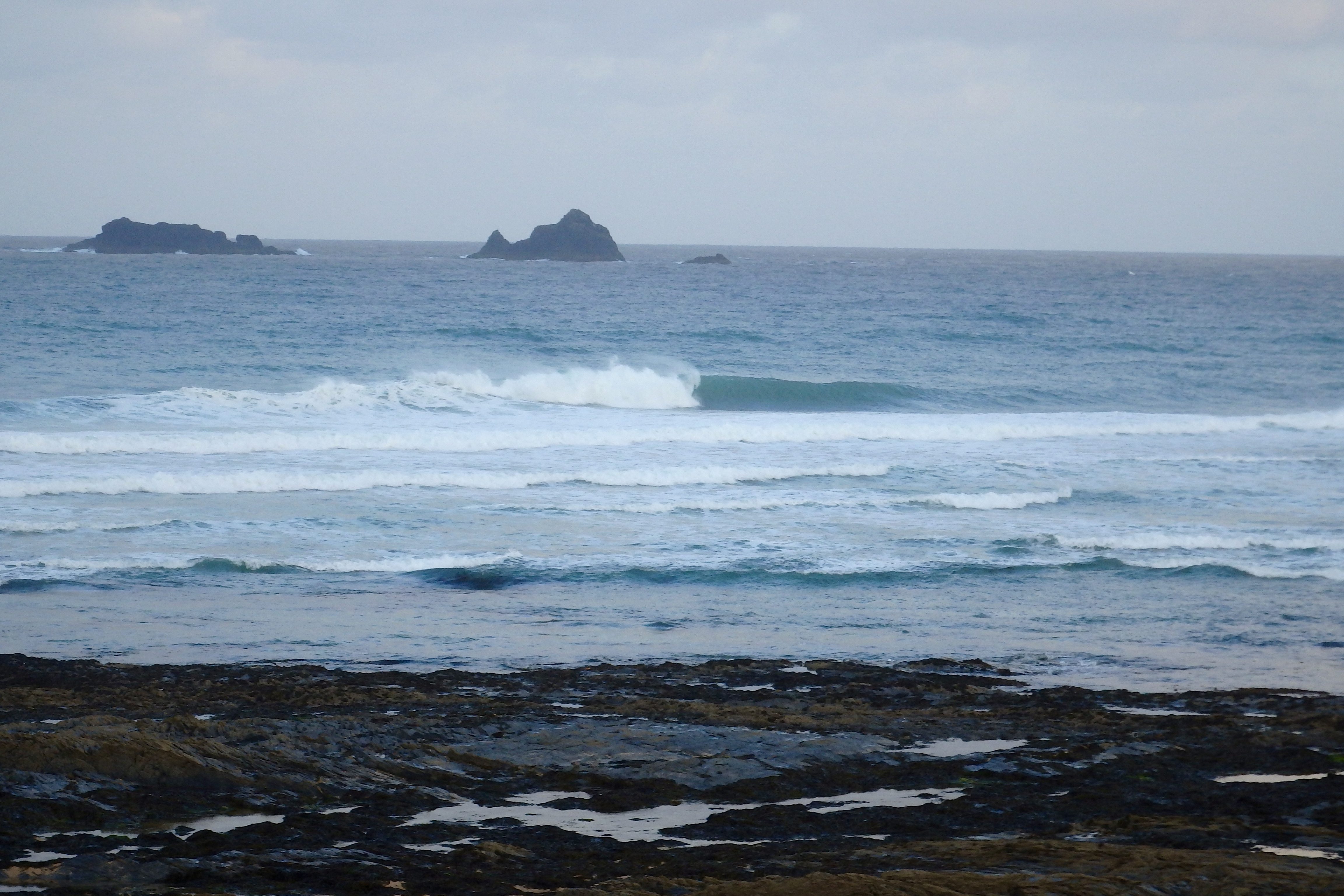
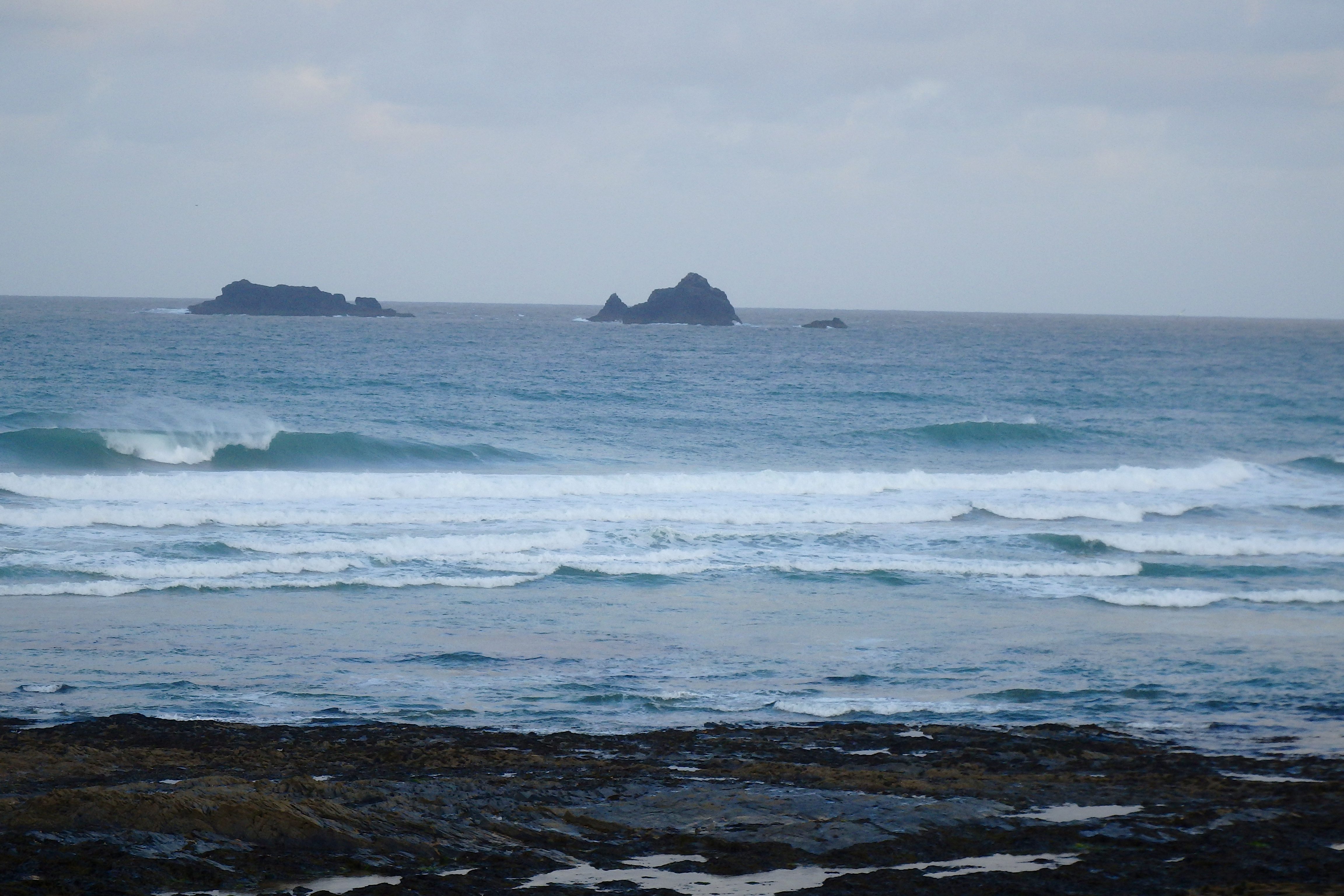
Constantine (3*): 4 feet.
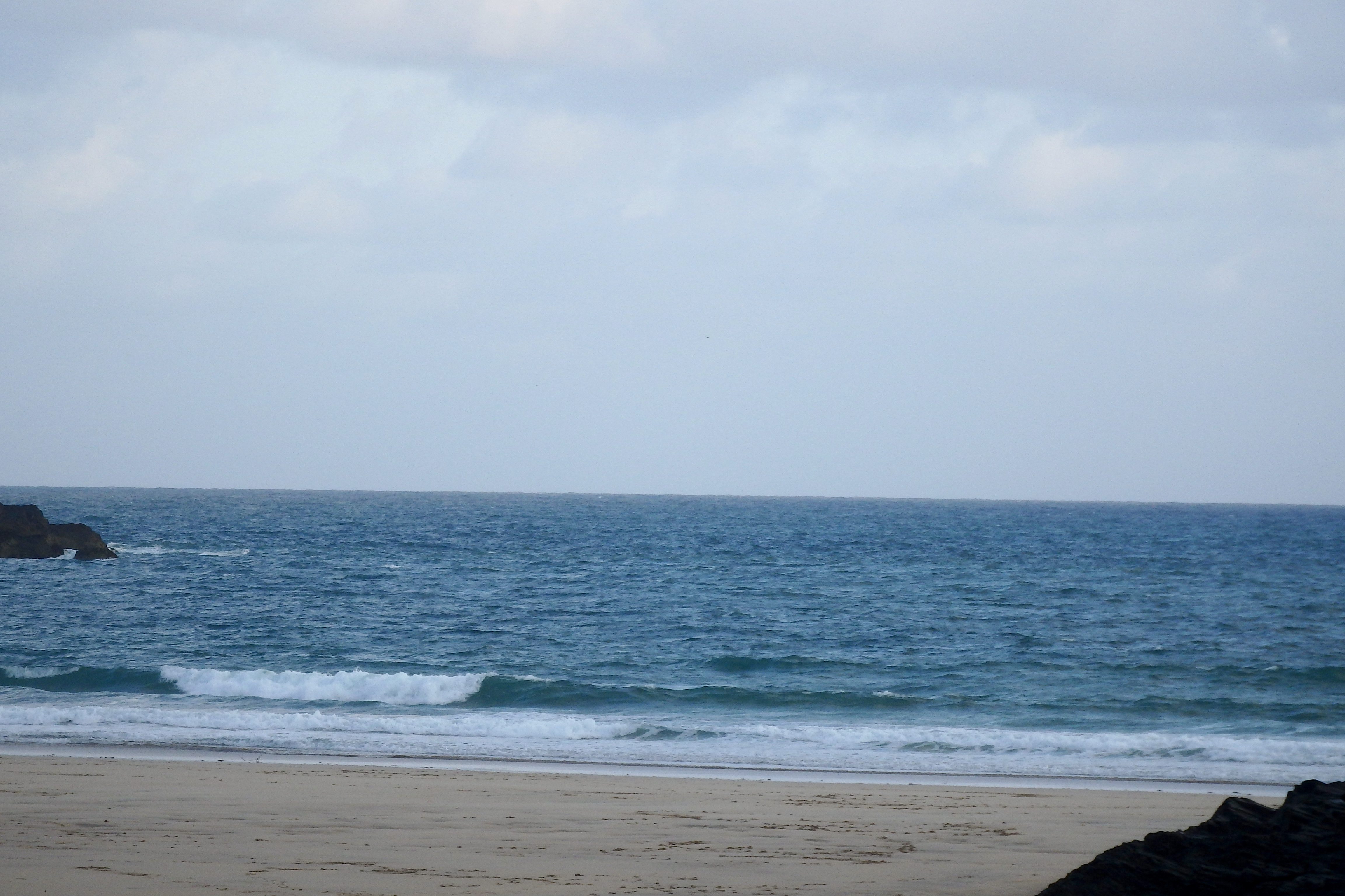
Another chilly one is greeting us again this morning, that same brisk north, north westerly wind rattling into the bay all the way from up there in the cold bits. But the skies are clearing quickly enough and that sun will have enough power to heat things up to at least a pleasant level by the time most people are ready for it.
There’s some more wintery looking surf driving in as well with three to four feet or so of wind-warped but peaking, walling and curling, deep blue waves crashing and splashing into the bay. If only the winds were kinder!
But it is okay and should become more fun as the tide settles in to a neap low high.
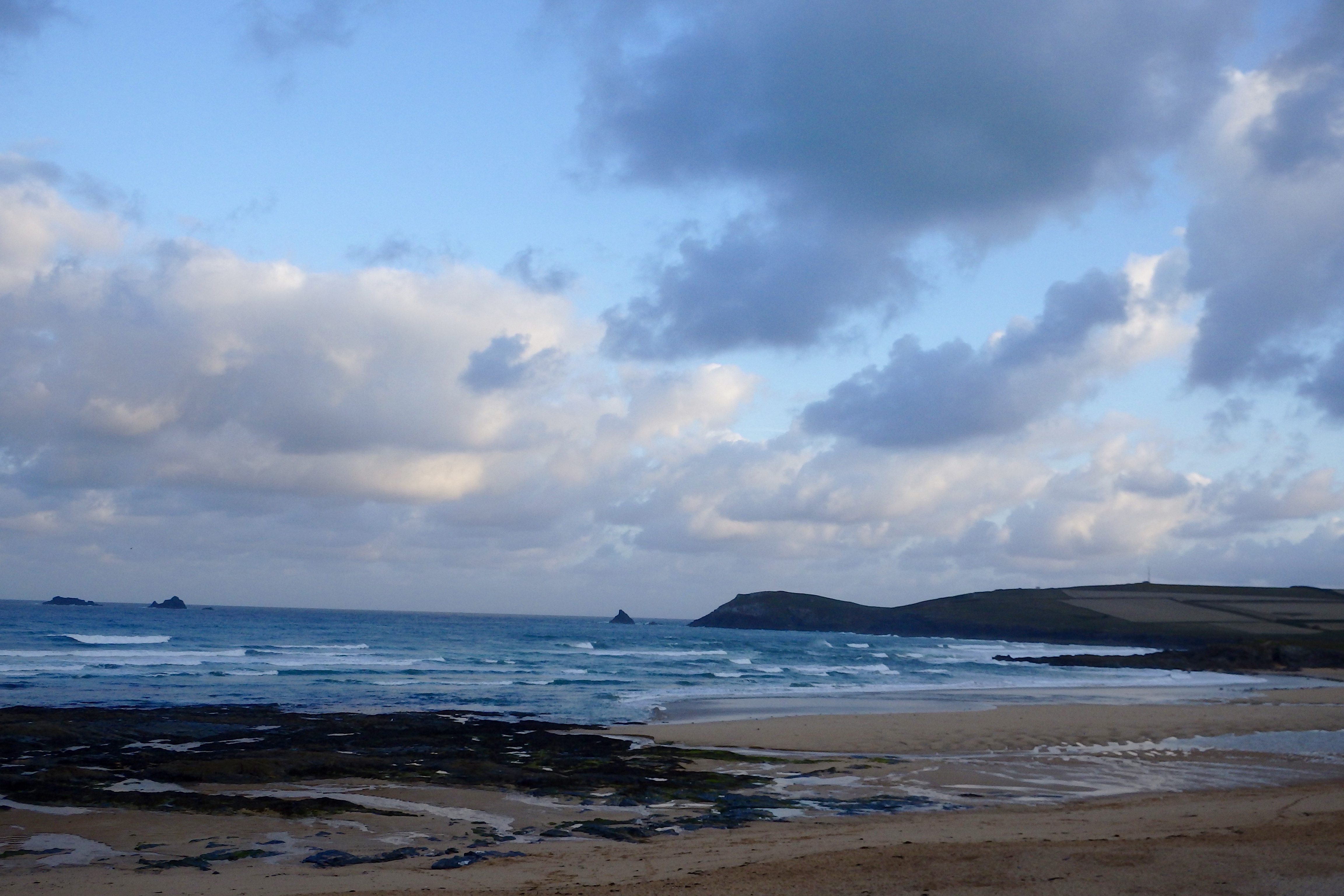
Harlyn (1*): 2 feet.
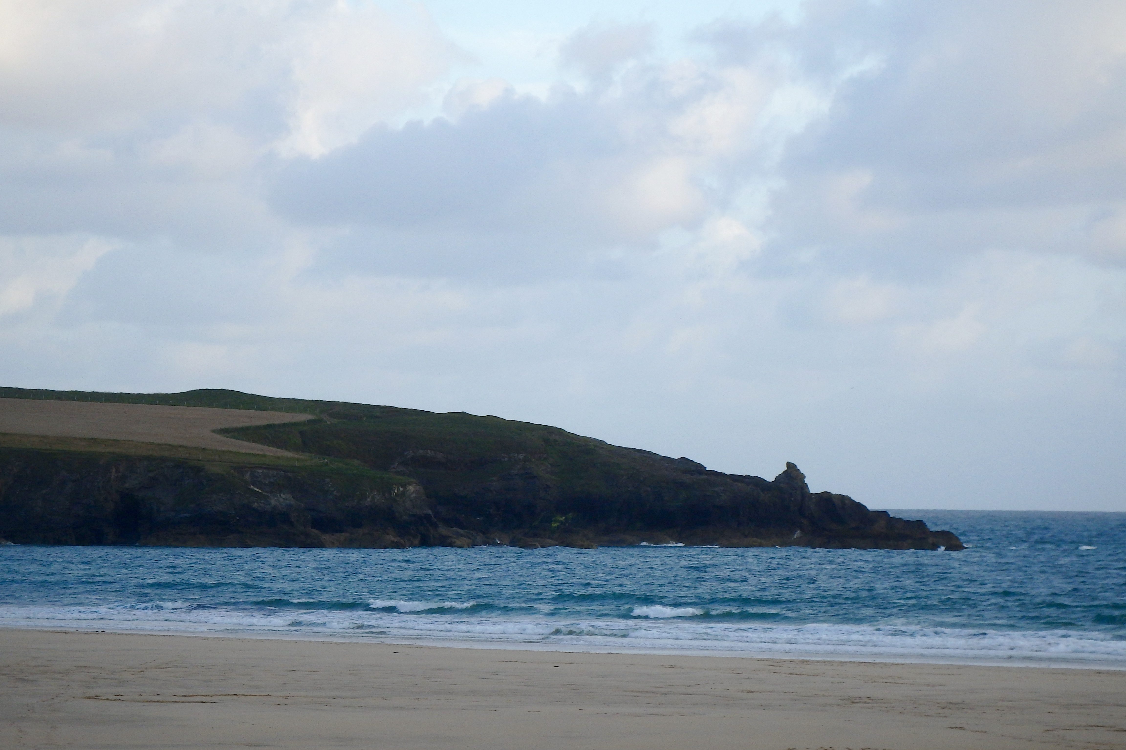
A couple of feet and bigger of wind-slopped and chopped, foaming surf is washing along the sand here this morning, real small and real wind blown.
It should all increase slightly in size with the mid-morning tide but this wind is in for the day.
I’m always saying that Harlyn can be fun in an onshore but the other side is obviously bigger and might just be more fun too today with some screaming peaks marching in!
Today’s Tide Times:
Low Tide: 16:21 (2.0m) High Tide: 10:06 (6.3m)

Surf Forecast for Wednesday 10th August 2016
While that north westerly wind eases in strength again, it is continuing to blow in from the north west and so continuing to mess up the smaller surf.
We’ll be lucky to see much more than a foot or two of slopped out surf today!
It should be bright though!
Surf Conditions for the Start of the Week
Northerly winds are likely to plague us again as a thick and solid summer swell rolls our way to start the week. And those winds, although easing in strength, are likely to stay with us for most, if not all of the week.
But the weather should be just about okay for most of the time and the surf should be fun for most of the time as well, only gradually weakening off as the week rolls by.
These summer weeks are the ones when you hone your fitness levels and sharpen your reflexes by riding those unpredictable, windblown swells that are often twitchy and uncertain with bowling and intense little sections at the same time!
It is definitely worth having an appropriate extra board or two for these summer conditions!
Have a great week, wherever you are and whatever you’re doing!
SJ’s Surf Forecast for the SW
Forecast last updated at 08:30 Tuesday 9th August 2016
Hi everyone – these updates are currently made at any time of the day as and when I get the time/chance to update – however from September the intention would be for it to be updated every weekday morning by 10am.
[Don’t forget to look at this forecast the day before you go beach for the latest, as things can often change!]
The Rest Of The Week:
‘A return to more ‘Summery’ conditions as the swell gets smaller.’
Sunrise and sunset – 06:05 and 20:45
Twilight starts and ends – 05:30 and 21:20
Midday – 13:25
Length of day – 14:40
Offshore Sea Temp approx – 17C / 62.5F
outputmodelrun-090816-0830
Monday 8th:
‘South coast will have a small but clean wave. The North will still be big (decreasing in size throughout the day) but will be onshore.’
Swell – (i) Strong W
Wind – Medium going Light-Medium NW
Weather – Fresher day with mixture of cloud and sunshine. Dry.
North Coast – 6-8ft (Overhead) going 4-6ft (Chest-Headhigh)
South Coast – 3-4ft (Waist-Chesthigh) going 2-3ft (Knee-Waisthigh)
Tides – 09:18 High, 15:34 Low
Tuesday 9th:
‘The swell drops right off today. Onshore on the North, and for the south you best get out for a dawnie before the hightide for a longboardable wave at the main spots.’
Swell – (i) OK W-WNW
Wind – Light-Medium going Medium N-NW
Weather – Cooler Northerly wind to start the day with, but soon warming up with a mixture of cloud and sunshine. Dry.
North Coast – 4-6ft (Chest-Headhigh) going 3ft (Waisthigh)
South Coast – 1-2ft (Kneehigh) going 1ft
Tides – 09:53 High, 16:09 Low
Wednesday 10th:
‘Onshore windslop for the North, and near enough flat for the south.’
Swell – (i) OK going Weak W-WNW
Wind – Medium NW
Weather – Mixture of cloud and sunshine. Chance of some light rain.
North Coast – 2-3ft (Knee-Waisthigh)
South Coast – 1ft
Tides – 10:35 High, 16:52 Low
Thursday 11th:
‘Small onshore slop for the North; flat for the south.’
Swell – (i) Weak W-WNW
Wind – Medium NW going WNW
Weather – Mixture of cloud and sunshine. Dry.
North Coast – 1-3ft (Knee-Waisthigh)
South Coast – 0-1ft
Tides – 11:26 High, 17:50 Low
Friday 12th:
‘Same as Thursday – small onshore slop for the North; flat for the south.’
Swell – (i) Weak WNW
Wind – Light-Medium W
Weather – Mixture of cloud and sunshine. Dry.
North Coast – 1-3ft (Knee-Waisthigh)
South Coast – 0-1ft
Tides – 06:30 Low, 12:37 High, 19:13 Low
Weekend Summary:
‘Too early to tell accurately yet. There is a divergence between the various sources/model runs for Friday onwards – some showing a good swell, and others showing light winds.’
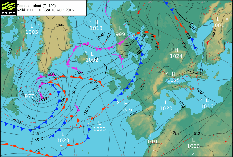
Saturday 13th:
‘Highly changeable at the moment. Small wave with light onshores.’
Swell – (i) OK WNW going W-WNW
Wind – Light-Medium W going Light NW
Weather – Mixture of cloud and sunshine. Dry.
North Coast – 3ft (Waisthigh)
South Coast – 1ft
Tides – 07:56 Low, 14:01 High, 20:34 Low
Sunday 14th:
‘Highly changeable at the moment. Wind could go light leaving a small but clean wave – best on a longboard to catch those small peelers!’
Swell – (i) Weak W
Wind – Light Variable (possibly E-NE)
Weather – Mixture of cloud and sunshine. Dry.
North Coast – 2-3ft (Knee-Waisthigh) going 1-2ft (Kneehigh)
South Coast – Flat
Tides – 09:08 Low, 15:10 High
Early Next Week:
‘Way too early to tell yet!’
The scale for measuring conditions:
0-1ft – Unridable/Flat
1-2ft – Kneehigh
3ft – Waisthigh
4-5ft – Chest/Shoulderhigh
6ft – Headhigh
6-8ft = 1-1.5x Overhead
8-10ft = 1.5x Overhead
10-12ft = 2x Overhead
Please Note!
Wave height predictions are based on the larger breaks on both coasts such as Fistral and Croyde for the North, and Praa Sands and Bantham for the South.
Wave height is measured from the front of the wave, and 6ft would usually mean a ‘head-high’ wave.
Try and use some ‘local’ knowledge about what the wave sizes will be elsewhere. For example the Newquay Bay area is generally 1/3 to 3/4 the size of Fistral, increasing the further up the bay you go from Towan to Lusty Glaze, and that it will be clean on a W wind at ‘harbour left’ at Towan at mid-tide’ for example.
Tide times are based on Newquay.
Stay Stoked!
SJ