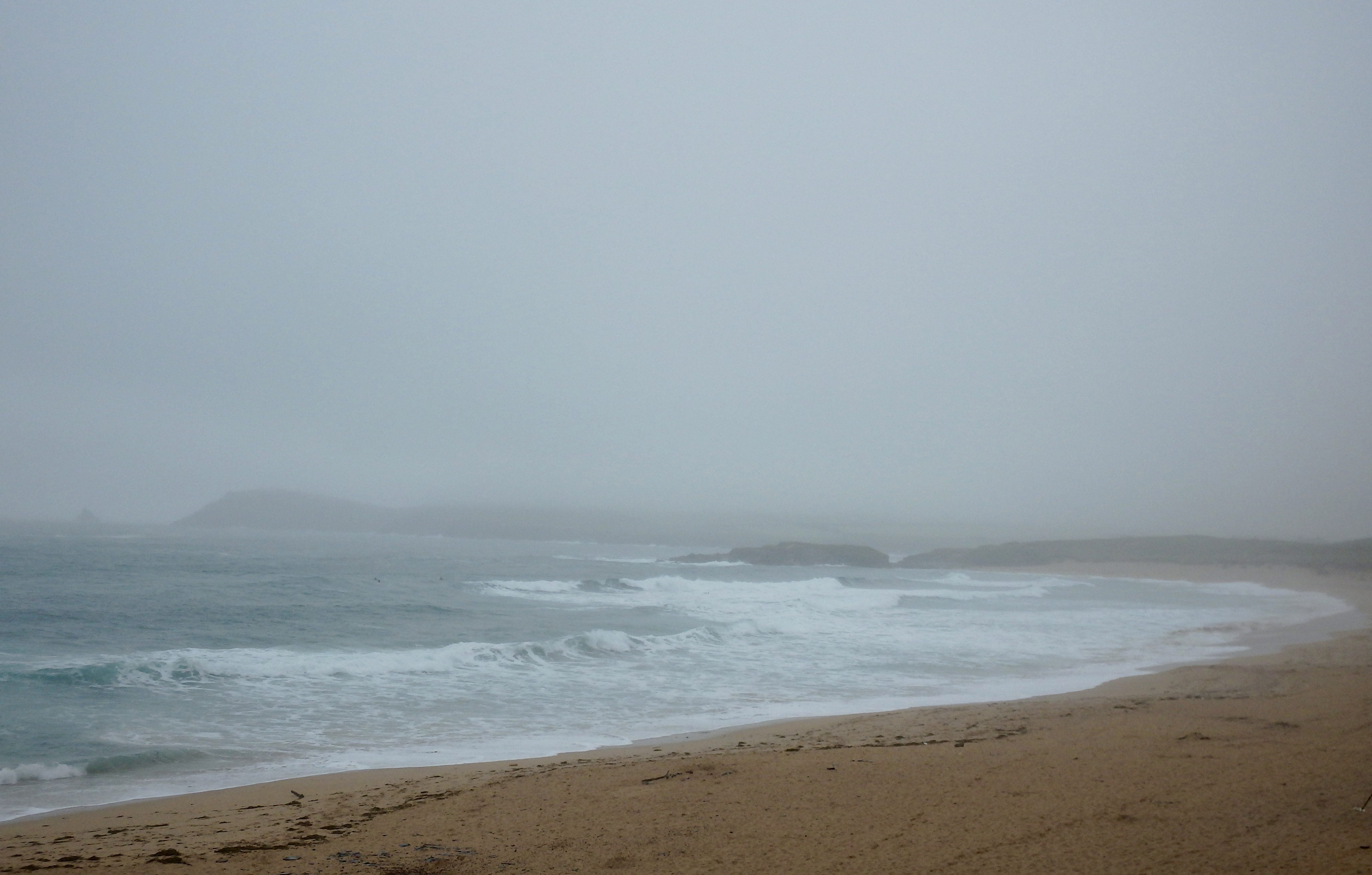
At 6.35 a.m:
Constantine (2*): 3 feet.
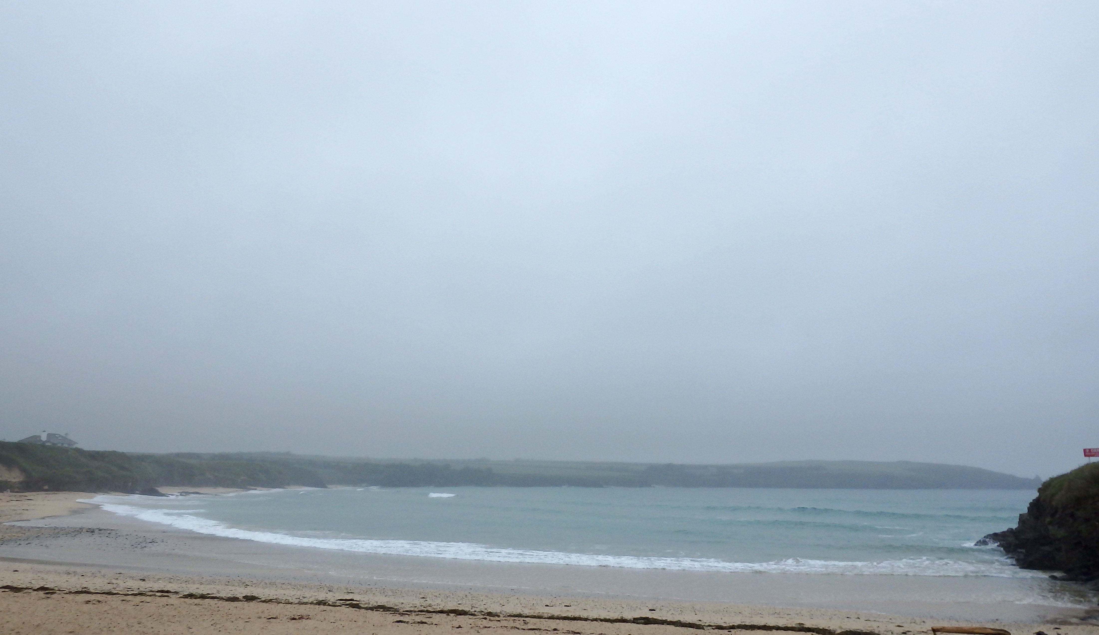
It’s another dull and dreary start to the day, that damp blanket of mizzle and murk pulled tight about us, the breeze light, the saturated air heavy.
Three feet of sloppy surf is entertaining a handful of enthusiastic early starters, the pre HTC peak bouncing some fun looking backwash peaks their way.
The forecast is showing a weakening in wind strength as the day goes on, with the promise of some clean and glassy conditions for later. It might even brighten up too!
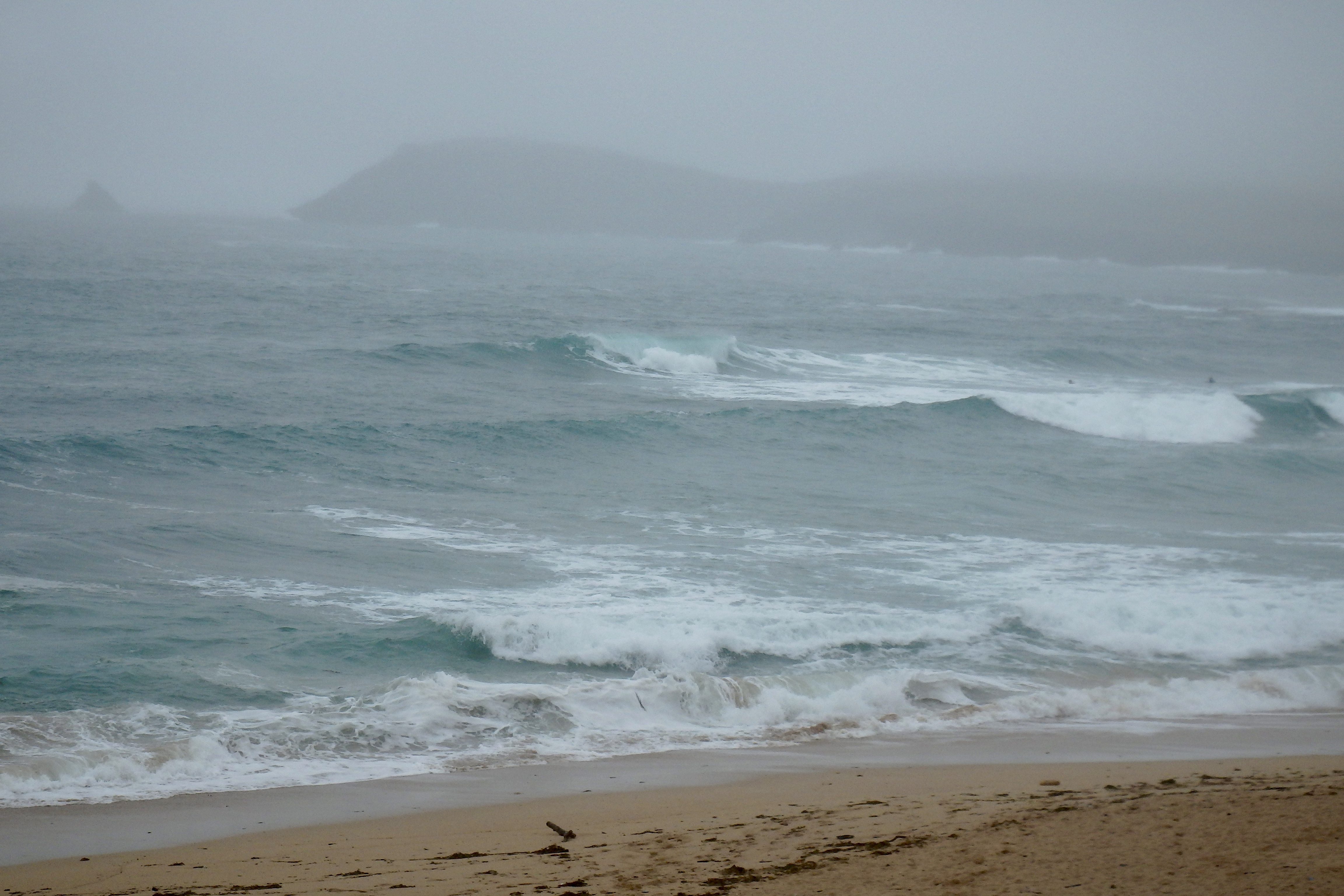
Harlyn (2*): 1 to 2 feet.
A couple of feet or so of weak looking surf is dribbling onto the high tide bank this morning, a bumpy and sloppy little surf but promising better for later. The wind is forecast to ease to a standstill as the day goes on, allowing this afternoon’s tide to push through some more powerful and maybe slightly bigger but still very small little waves here.
But of course the other side will be better then too!
Today’s Tide Times:
Low Tide: 13:47 (1.3m) High Tide: 19:41 (7.1m)

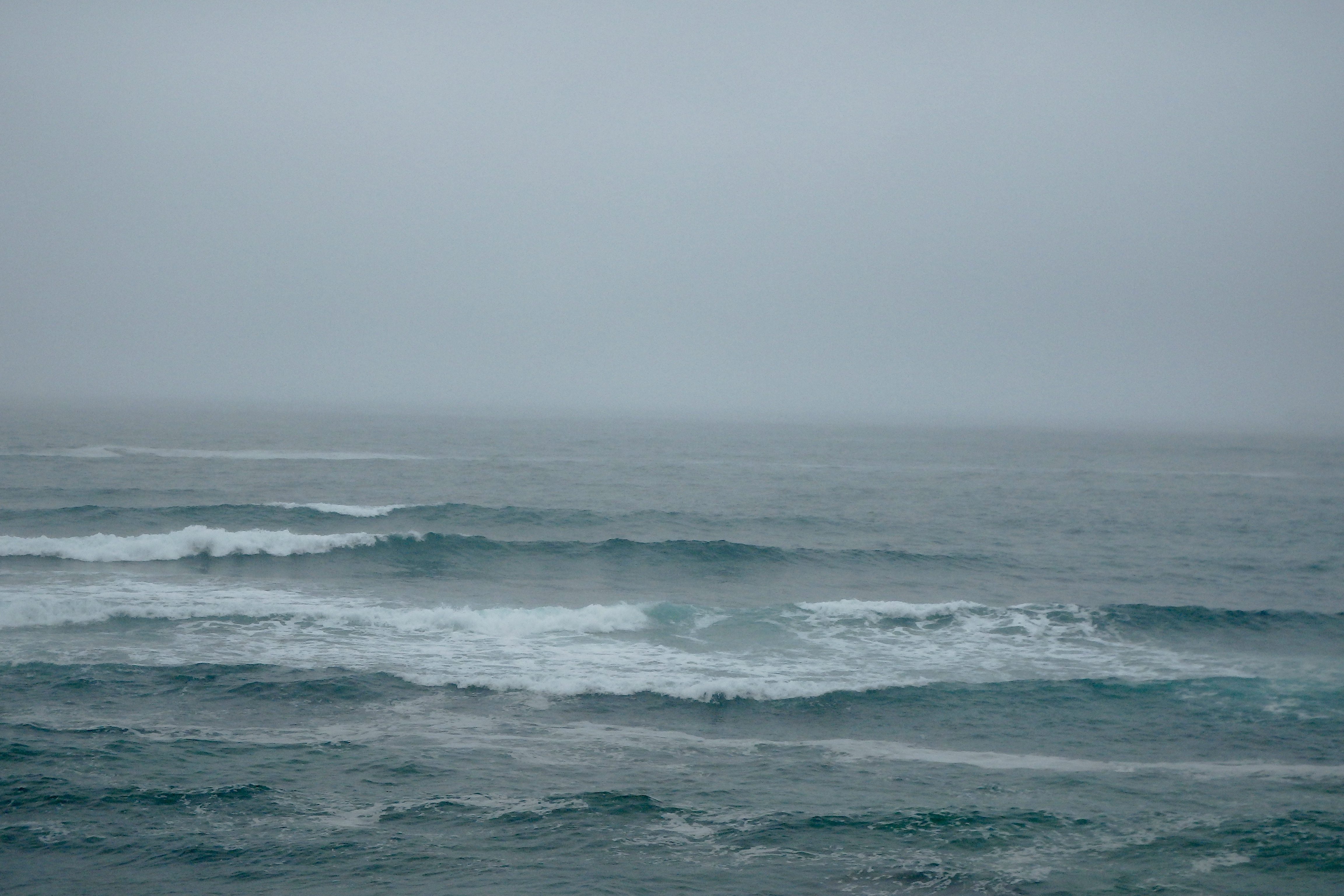
Surf Forecast for Thursday 23rd June 2016
That same three foot swell will continue to roll on through but the wind is probably going to be onshore all day and fresher than it has been.
So we are looking at enjoying some more sloppy surf conditions especially through mid-afternoon. Early morning and late evening are going to be the times to enjoy the cleanest conditions.
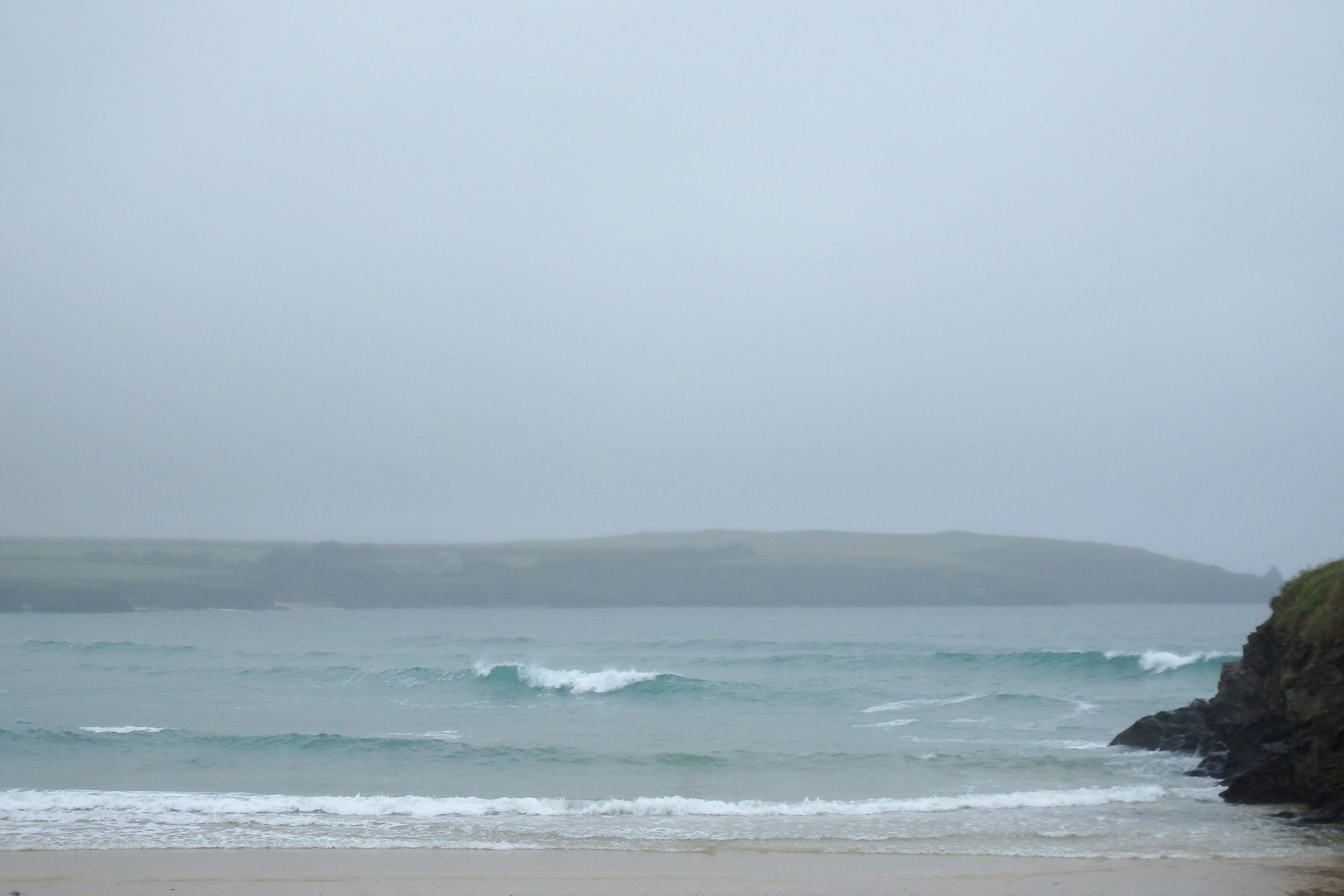
Surf Conditions for the Rest of the Week
A new three foot, teen sized wave-period swell has pushed through to start this week, the wind staying onshore and while remaining relatively light.
And those light winds will continue to drift in onshore as the week unfolds, the swell keeping up its steady three foot rhythm as it pours our way.
The weather is likely to continue to be mixed but should settle as the breeze eases more to the south through midweek.
The end of the week is starting to look bright and cheerful with the promise of more smallish surf along with those continuing onshore winds.
In the meantime it looks like we have a few days of fairly typical British summer surf to play in!
Have a great week, wherever you are and whatever you’re doing!
SJ’s Surf Forecast for the SW
Forecast last updated at 09:00 Wednesday 22nd June 2016
Hi everyone – these updates are currently made at any time of the day as and when I get the time/chance to update – however from September the intention would be for it to be updated every weekday morning by 10am.
[Don’t forget to look at this forecast the day before you go beach for the latest, as things can often change!]
The Rest Of The Week:
‘The weather will improve as the week goes on, but unless you catch your timing just right with the winds, the rest of the week looks poor for surf.’
Sunrise and sunset – 05:10 and 21:35
Twilight starts and ends – 04:25 and 22:20
Midday – 13:20
Length of day – 16:25
Offshore Sea Temp approx – 14.5C / 58F
outputmodelrun-220616-0900
Monday 20th:
‘Dark, grey, missly day.’
Swell – (i) Medium W
Wind – Medium W
Weather – Overcast and raining
North Coast – 5-6ft (Shoulder-Headhigh) going 4-6ft (Chest-Headhigh)
South Coast – 1-3ft (Knee-Waisthigh)
Tides – 06:00 High, 12:00 Low, 18:00 High
Tuesday 21st:
‘Semi-sheltered spots on the North should have a small but clean wave.’
Swell – (i) Medium W going W-WSW
Wind – Overcast or cloudy, but dry.
Weather – Light-Medium W-SW going S
North Coast – 4-6ft (Chest-Headhigh) going 4ft (Chesthigh)
South Coast – 1-2ft (Kneehigh)
Tides – 06:26 High, 12:46 Low, 18:44 High
Wednesday 22nd:
‘Surf on! There’ll be a window of light/no winds later on, so mid-late afternoon on the tidal push should see the waves clean up nicely!’
Swell – (i) Medium W
Wind – Light SW going Variable going N-NW
Weather – Cloudy with some rain showers, turning slightly brighter later on
North Coast – 3-4ft (Waist-Chesthigh)
South Coast – 0-1ft (Flat-Kneehigh)
Tides – 07:03 High, 13:24 Low, 19:22 High
Thursday 23rd:
‘Small wave with onshore winds – not great, but there’s a wave there if you want to get wet behind your ears.’
Swell – (i) Medium W
Wind – Light-Medium N-NW going W
Weather – Cloudy and dry, with the odd sunny spell
North Coast – 3ft (Waisthigh)
South Coast – 0ft (Flat)
Tides – 07:42 High, 14:03 Low, 20:02 High
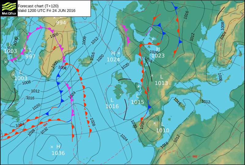
Friday 24th:
‘Blown out onshore messy slop on the North and messy dribble on the south.’
Swell – (i) Medium going Weak W
Wind – Medium W-SW going W
Weather – Cloudy with plenty of sunny spells, but also the chance of a heavy shower
North Coast – 3ft (Waisthigh)
South Coast – 1ft (Flat-Kneehigh)
Tides – 08:22 High, 14:44 Low, 20:45 High
Weekend Summary:
‘No good surf this weekend! We should have a return to good weather, however with no quality to the weak swell and onshore winds, there’ll be a bit of messy slop for beginners, but nothing in the way of real waves.’
Saturday 25th:
‘Small onshore messy slop for the North, flat for the south. Leave it to beginners – there’s no quality to the waves as it’s a weak wave period anyway.’
Swell – (i) Weak W-WNW going WNW
Wind – Light-Medium N-NW
Weather – Cloudy with plenty of sunny spells
North Coast – 3ft (Waisthigh) going 2-3ft (Knee-Waisthigh)
South Coast – 0ft (Flat)
Tides – 09:06 High, 15:29 Low, 21:31 High
Sunday 26th:
‘Same as yesterday – leave it to beginners!’
Swell – (i) Weak WNW going VeryWeak W-NW
Wind – Light-Medium NW going W-NW
Weather – Cloudy but dry
North Coast – 2-3ft (Knee-Waisthigh) going 1-2ft (Kneehigh)
South Coast – 0ft (Flat)
Tides – 09:55 High, 16:17 Low
Early Next Week:
‘There’s a battle on between a blocking high in the Western approaches, and a low over Iceland. At the moment the charts show a general trend for the low to push down/win bringing onshore predominantly Westerly winds. Unfortunately this will mean poor onshore surf for the North coast which is the only place where the swell will get to. So mostly waist-shoulderhigh onshore choppy conditions for the week.’
The scale for measuring conditions:
0-1ft – Unridable/Flat
1-2ft – Kneehigh
3ft – Waisthigh
4-5ft – Chest/Shoulderhigh
6ft – Headhigh
6-8ft = 1-1.5x Overhead
8-10ft = 1.5x Overhead
10-12ft = 2x Overhead
Please Note!
Wave height predictions are based on the larger breaks on both coasts such as Fistral and Croyde for the North, and Praa Sands and Bantham for the South.
Wave height is measured from the front of the wave, and 6ft would usually mean a ‘head-high’ wave.
Try and use some ‘local’ knowledge about what the wave sizes will be elsewhere. For example the Newquay Bay area is generally 1/3 to 3/4 the size of Fistral, increasing the further up the bay you go from Towan to Lusty Glaze, and that it will be clean on a W wind at ‘harbour left’ at Towan at mid-tide’ for example.
Tide times are based on Newquay.
Stay Stoked!
SJ