At 6.45 a.m:
Constantine (1*): 2 to 3 feet
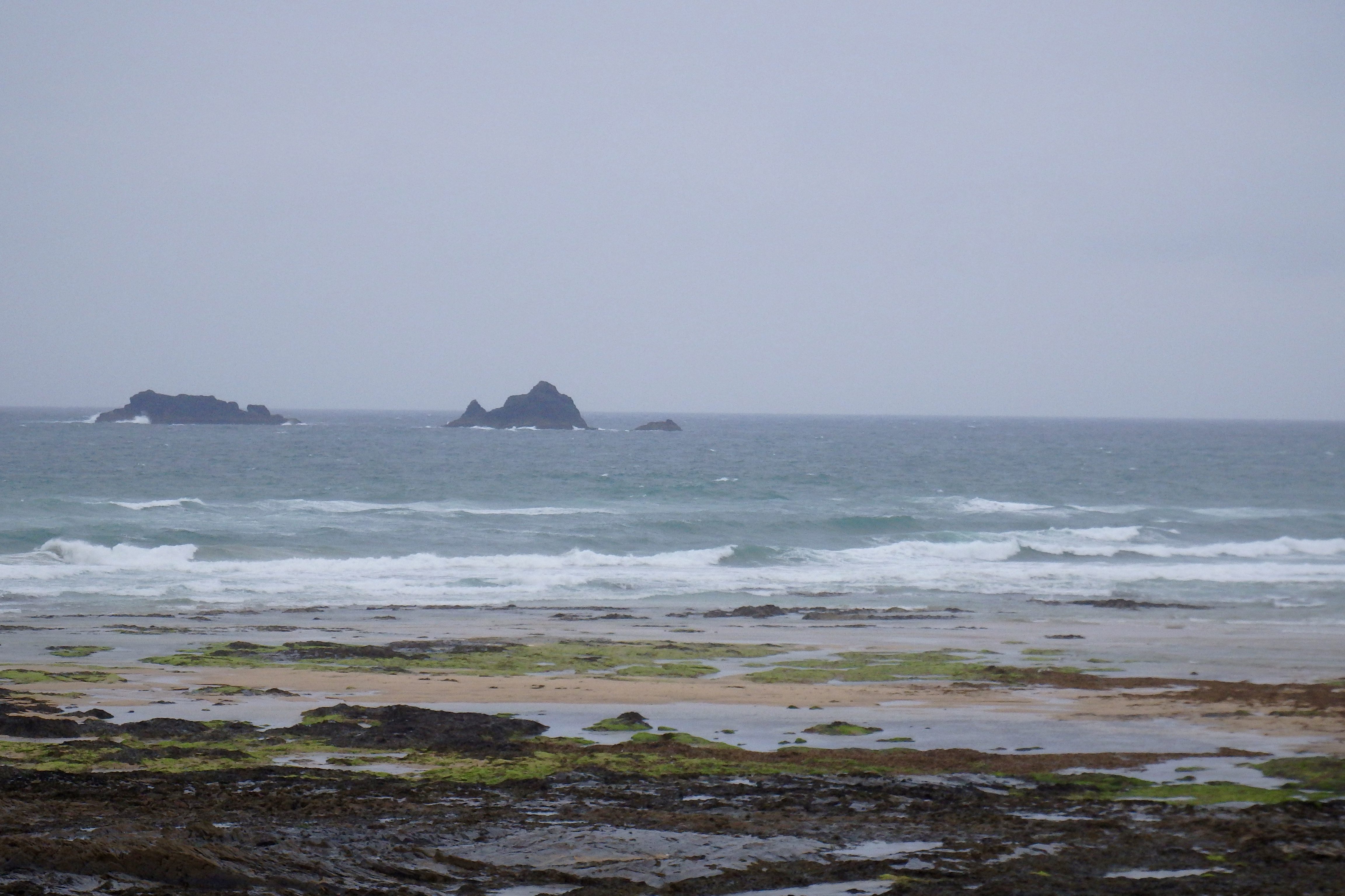
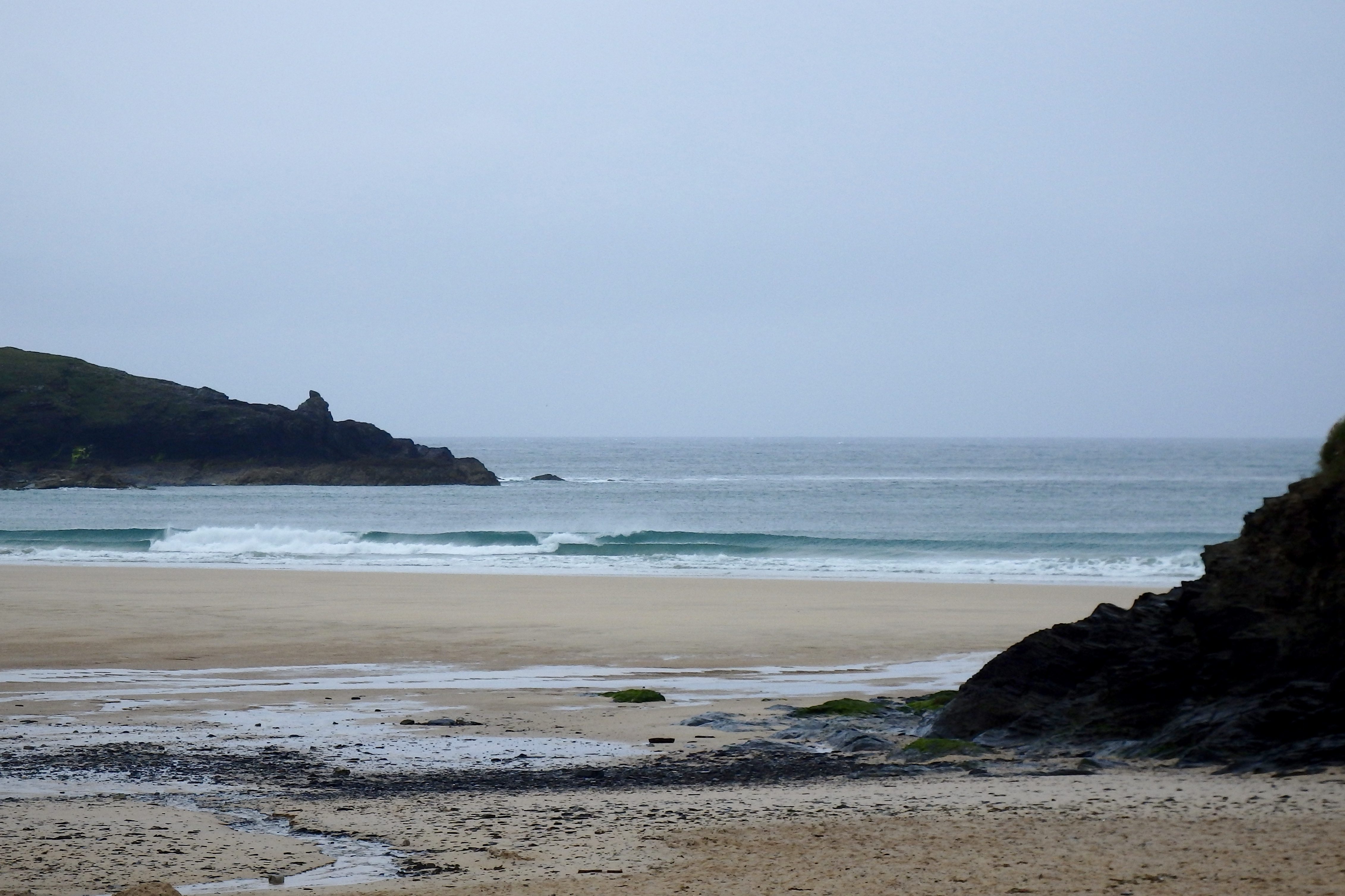
Summer was nice while it lasted wasn’t it? But now it seems as though we are plunged back into winter!
There’s a forceful wind blasting into the bay this morning, all blustery and noisy and in a hurry and, of course, trashing the surf!
The two to three feet of weak looking and windblown surf is being dragged up the beach by that rain sodden and blustering blow.
There ain’t no surf worth riding here this morning, so let’s have a little look at Harlyn…….
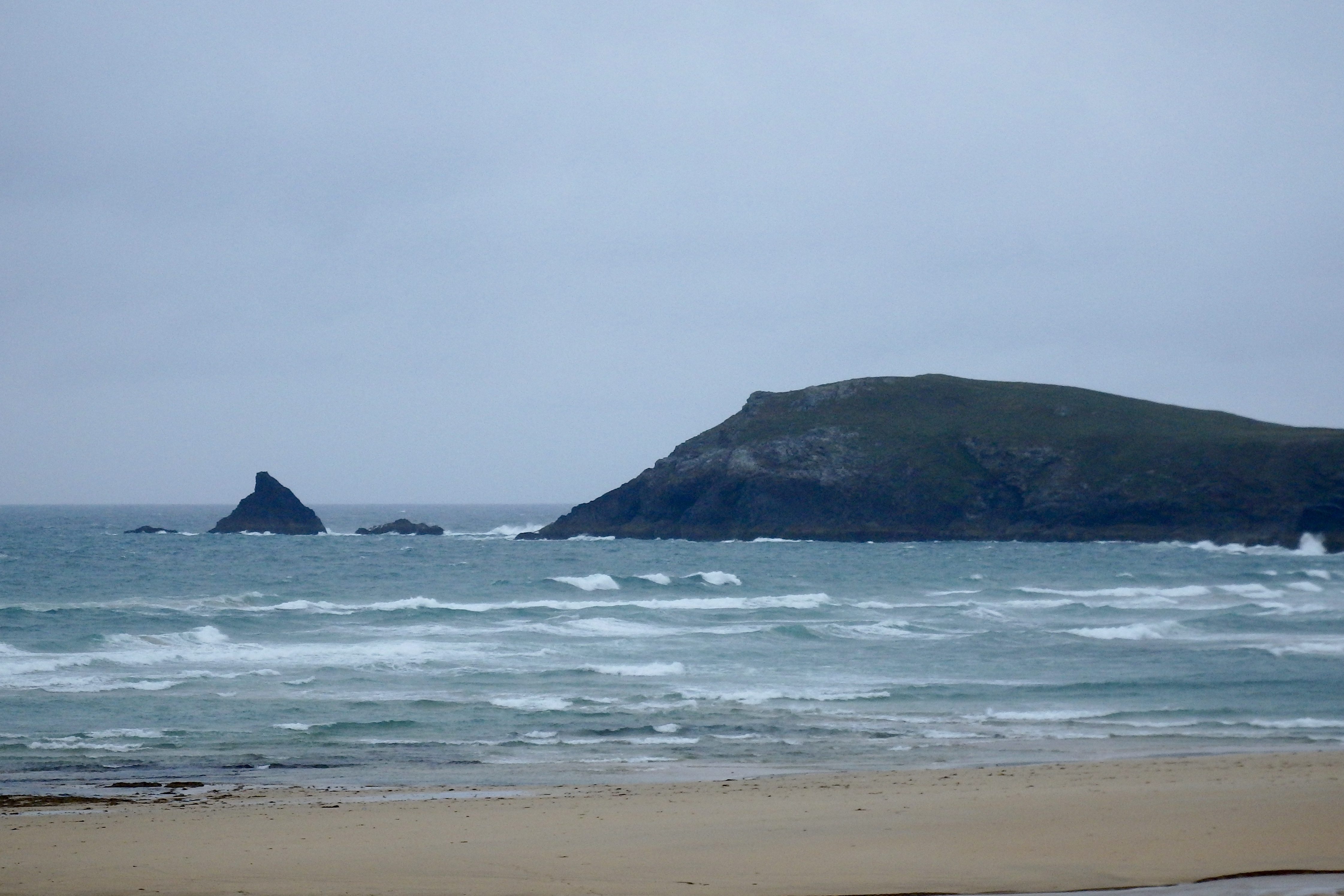
Harlyn (2*): 1 foot.
Small but sweetly shaped little waves are washing ashore here this morning, the wind gusting strongly offshore and so holding up those little waves until the last moment before they topple and spill to shore.
It’s a bit of a dismal view across the rain lashed sand to those tiny little waves but there are some rideable and glideable little one to two foot snappers that should turn into something better by later out there.
Give it an hour or two and it could just be well worth a wet, especially if this wind eases up a little!
Today’s Tide Times:
Low Tide: 19:40 (2.1m) High Tide: 13:10 (6.2m)

Surf Forecast for Thursday 30th June 2016
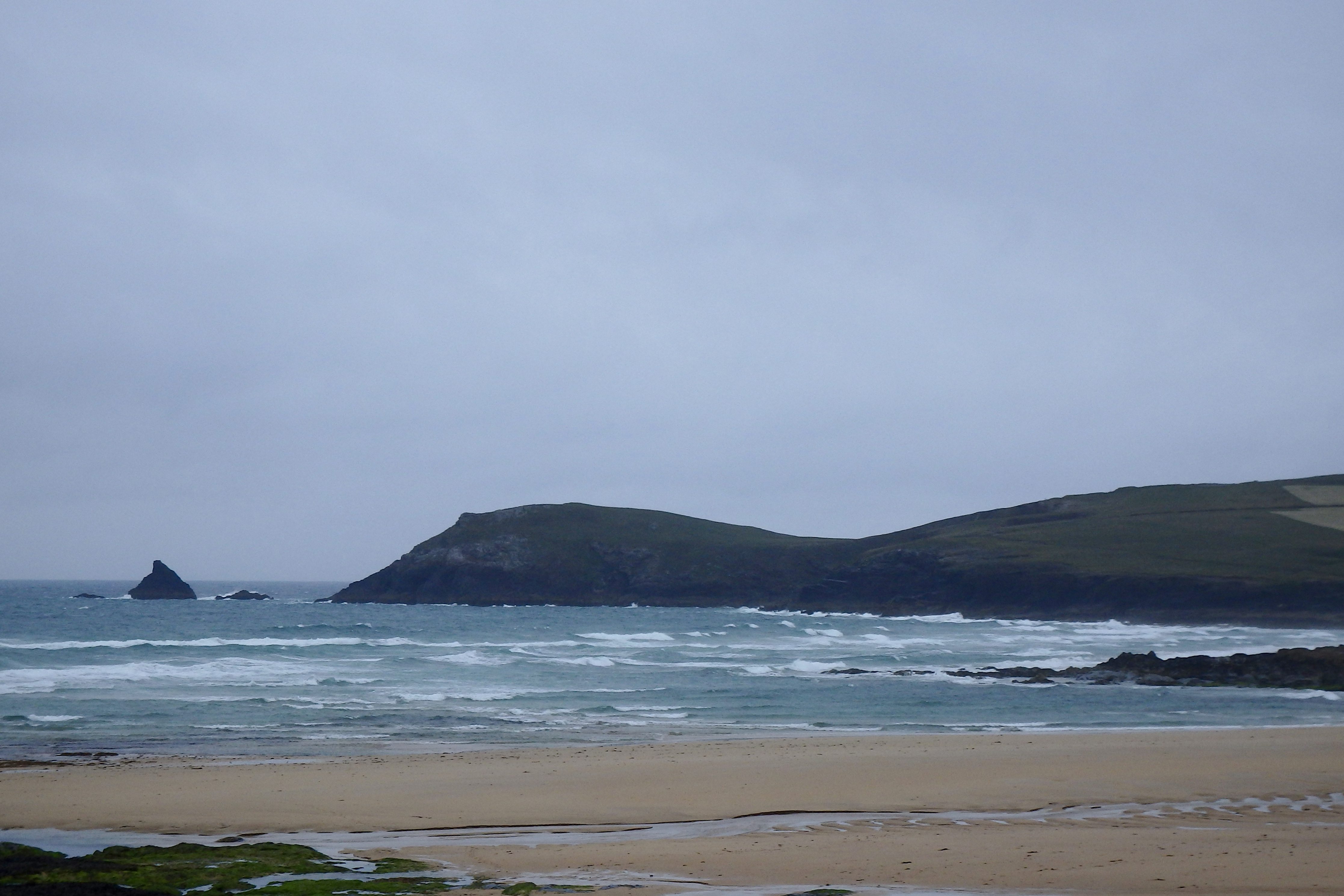
A three to four foot swell should be bolstered by a still fresh westerly wind. So the main surf breaks are going to be sloppy and junky again but Harlyn and other sheltered spots should be clean enough if still quite small.
A couple to three feet of maybe a little wishy washy Harlyn awaits!
Surf Conditions for the Rest of the Week
This week looks like it’s going to be another windy and damp one with a lot of mixed up and chopped out surf rolling our way.
Monday’s north westerly wind soon shifted to the south west by Tuesday, strengthening through Wednesday to quite a stormy blow. At least that will improve the size of those windblown waves while allowing Harlyn a chance to show itself through midweek.
So that three foot swell is likely to double in size as we go through the week, the south westerly wind making for choppy conditions at the exposed breaks but keeping things clean at Harlyn.
Have a great week, wherever you are and whatever you’re doing!
SJ’s Surf Forecast for the SW
Forecast last updated at 09:00 Wednesday 29th June 2016
Hi everyone – these updates are currently made at any time of the day as and when I get the time/chance to update – however from September the intention would be for it to be updated every weekday morning by 10am.
[Don’t forget to look at this forecast the day before you go beach for the latest, as things can often change!]
The Rest Of The Week:
‘A bleak weak with no real quality to the swell, and therefore it’s looking likely there’ll only be one ‘window’ of good winds this week to allow a decent clean wave – see/read below.’
Sunrise and sunset – 05:15 and 21:35
Twilight starts and ends – 04:30 and 22:20
Midday – 13:20
Length of day – 16:20
Offshore Sea Temp approx – 14.5C / 58F
outputmodelrun-290616-0830
Monday 27th:
‘Small onshore mush for the North, flat for the south.’
Swell – (i) Weak going OK W-WNW
Wind – Medium NW going Light-Medium W-NW
Weather – Overcast and dull, turning cloudy with sunny spells
North Coast – 3ft (Waisthigh)
South Coast – 0-1ft
Tides – 04:51 Low, 10:50 High, 17:14 Low
Tuesday 28th:
‘The winds should get enough southerly in them to make a dawn patrol or at least a session by mid morning worthwhile, before the winds turn onshore Westerly and pick up in strength.’
Swell – (i) OK going Weak W-WNW
Wind – Light-Medium S-SW going Strong W-NW
Weather – Bright start, but with cloud and rain pushing through later on
North Coast – 3-4ft (Waist-Chesthigh) going 4-6ft (Chest-Headhigh)
South Coast – 1-2ft (Kneehigh) going 3ft (Waisthigh)
Tides – 05:52 Low, 11:54 High, 18:22 Low
Wednesday 29th:
‘Strong winds and awful weather! Stormy surf like conditions with only a small raggedy wave at sheltered spots on the North.’
Swell – (i) Weak W-WSW
Wind – Strong SW going Medium-Strong W-SW
Weather – Overcast with heavy rain sweeping across the region
North Coast – 3-5ft (Waist-Shoulderhigh) going 5-6ft (Shoulder-Headhigh)
South Coast – 3-4ft (Waist-Chesthigh)
Tides – 07:05 Low, 13:04 High, 19:38 Low
Thursday 30th:
‘Small clean wave at sheltered spots on the North – similar in size to Wednesday but slightly cleaner.’
Swell – (i) OK W going Weak W-WSW
Wind – Light-Medium going Medium-Strong W-SW
Weather – Cloudy but dry, with the odd sunny spell and light shower
North Coast – 4-5ft (Chest-Shoulderhigh)
South Coast – 2-3ft (Knee-Waisthigh)
Tides – 08:16 Low, 14:13 High, 20:49 Low
Friday 1st:
‘Swell will start to pick up throughout the day, but with a brisk Westerly wind not many places will escape the crosshore conditions.’
Swell – (i) Weak W going W-WNW
Wind – Medium-Strong W
Weather – Mixture of cloud, sunshine, and light rain
North Coast – 3-5ft (Waist-Shoulderhigh) going 5-6ft (Shoulder-Headhigh)
South Coast – 3-4ft (Waist-Chesthigh)
Tides – 09:21 Low, 15:19 High, 21:53 Low
Weekend Summary:
‘Not much (good) surf about this weekend.’
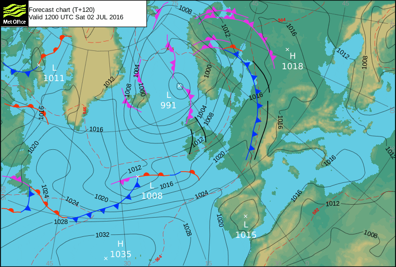
Saturday 2nd:
‘Onshore messy surf.’
Swell – (i) OK W-WNW
Wind – Medium-Strong going Medium W
Weather – Mixture of cloud, sunshine, and light rain
North Coast – 5-6ft (Shoulder-Headhigh)
South Coast – 1-3ft (Knee-Waisthigh)
Tides – 10:20 Low, 16:17 High
Sunday 3rd:
‘Winds pick up again but it’ll be blown out choppy onshore conditions.’
Swell – (i) OK going Weak W
Wind – Medium-Strong SW going W-SW
Weather – Cloudy with light rain
North Coast – 4-5ft (Chest-Shoulderhigh)
South Coast – 2-4ft (Waisthigh)
Tides – 04:45 High, 11:13 Low, 17:10 High
Early Next Week:
‘Signs are for high pressure to increasingly dominate, so that’ll mean a declining swell and small surf, accompanied by light winds predominantly Westerly winds.’
The scale for measuring conditions:
0-1ft – Unridable/Flat
1-2ft – Kneehigh
3ft – Waisthigh
4-5ft – Chest/Shoulderhigh
6ft – Headhigh
6-8ft = 1-1.5x Overhead
8-10ft = 1.5x Overhead
10-12ft = 2x Overhead
Please Note!
Wave height predictions are based on the larger breaks on both coasts such as Fistral and Croyde for the North, and Praa Sands and Bantham for the South.
Wave height is measured from the front of the wave, and 6ft would usually mean a ‘head-high’ wave.
Try and use some ‘local’ knowledge about what the wave sizes will be elsewhere. For example the Newquay Bay area is generally 1/3 to 3/4 the size of Fistral, increasing the further up the bay you go from Towan to Lusty Glaze, and that it will be clean on a W wind at ‘harbour left’ at Towan at mid-tide’ for example.
Tide times are based on Newquay.
Stay Stoked!
SJ