At 6.15 a.m:
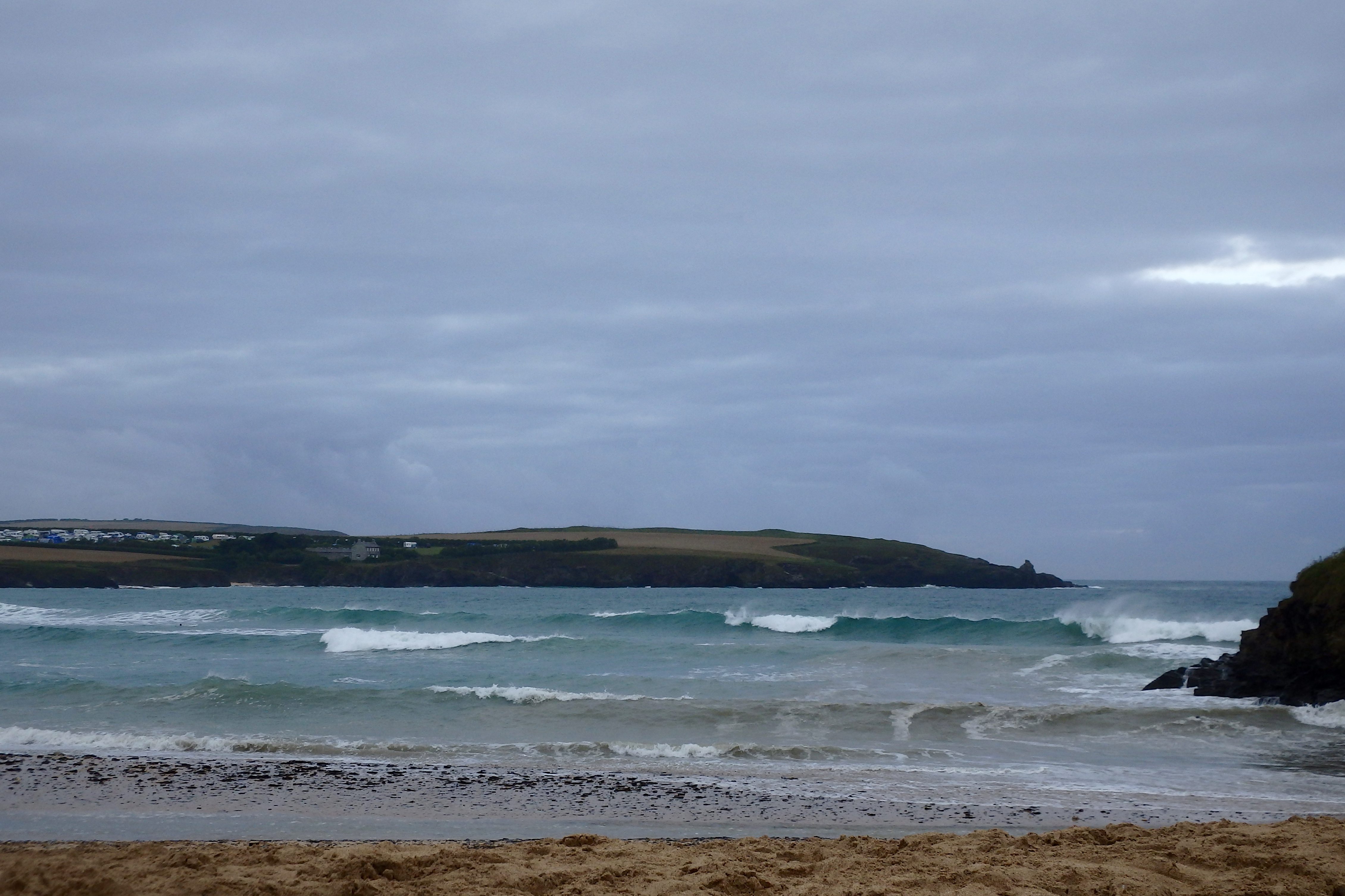
Constantine (1*): 4 to 5 feet.
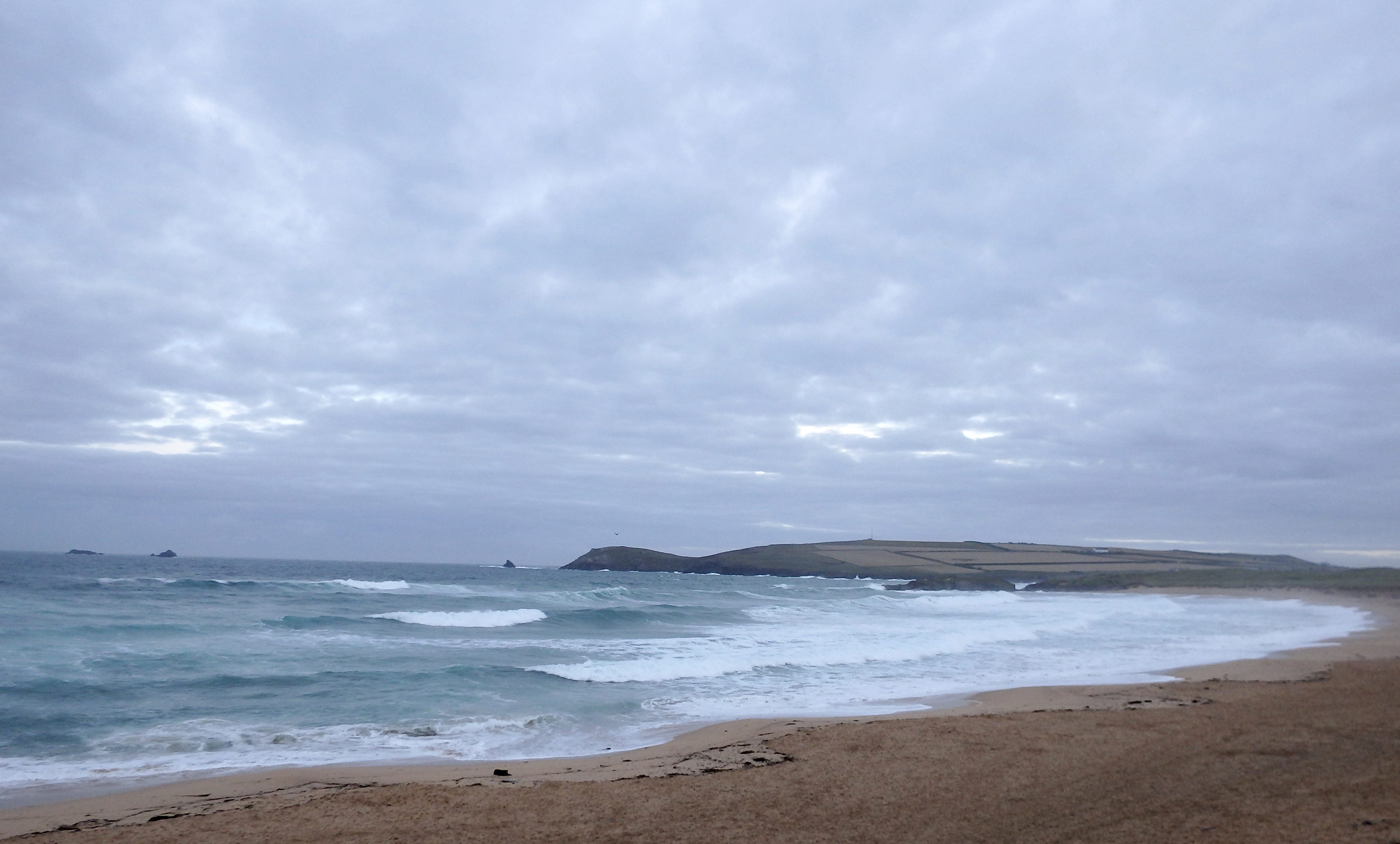
The wind is still rattling into the bay this morning with a brisk west sou’ wester galloping across the headland. The sky is still threatening too, with large expanses of grey taking up most of the horizon although laced by smaller but promising streaks of pale blue.
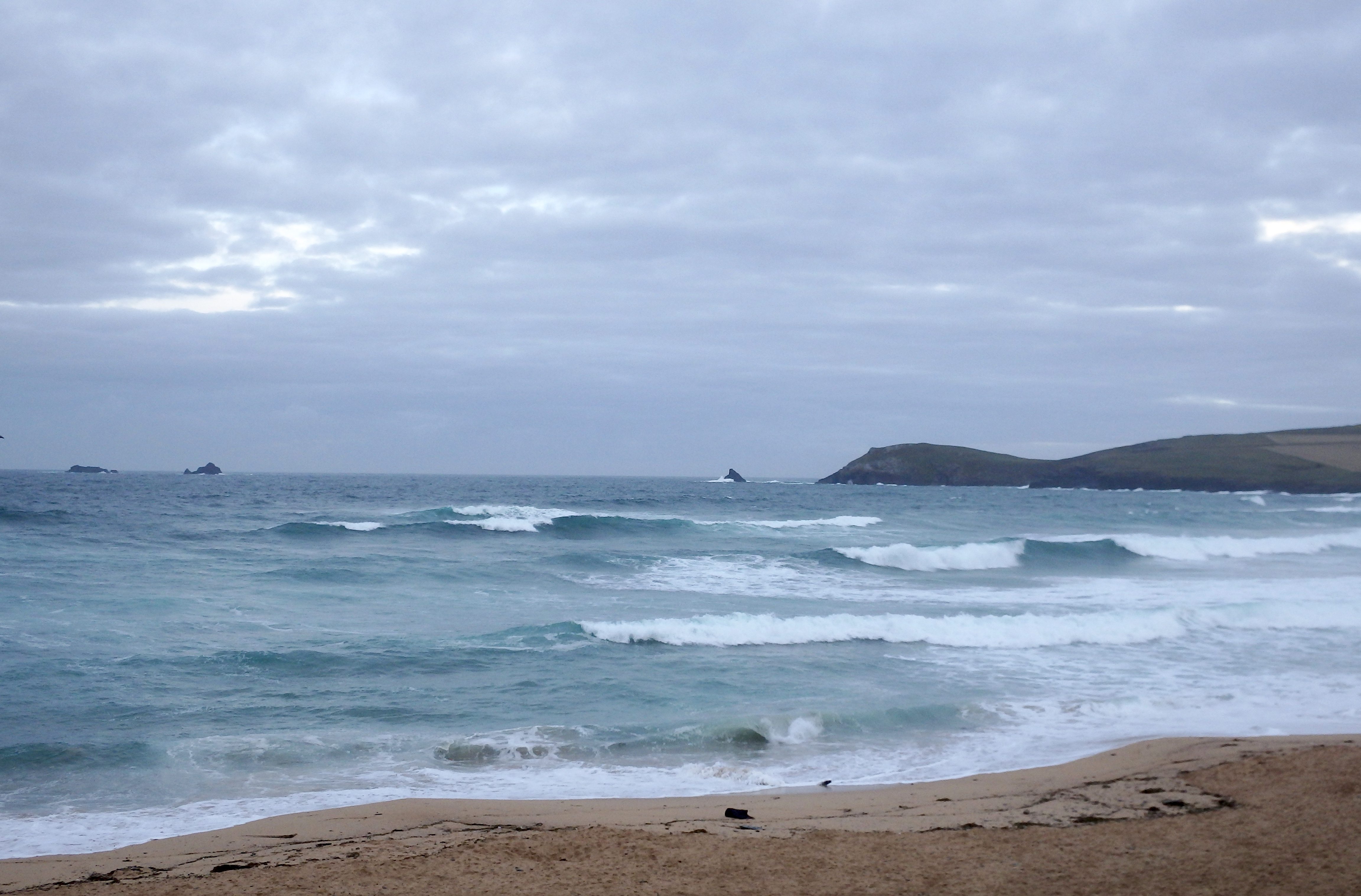
And so the surf is junked out again. It is bigger but is still a mess of mixed up and windblown chop with four to five feet of windblown and raggedy surf washing ashore.
It’s not pretty and it’s not inviting but there are waves and you might just find a few screaming inside peaks as the tide drops back later.
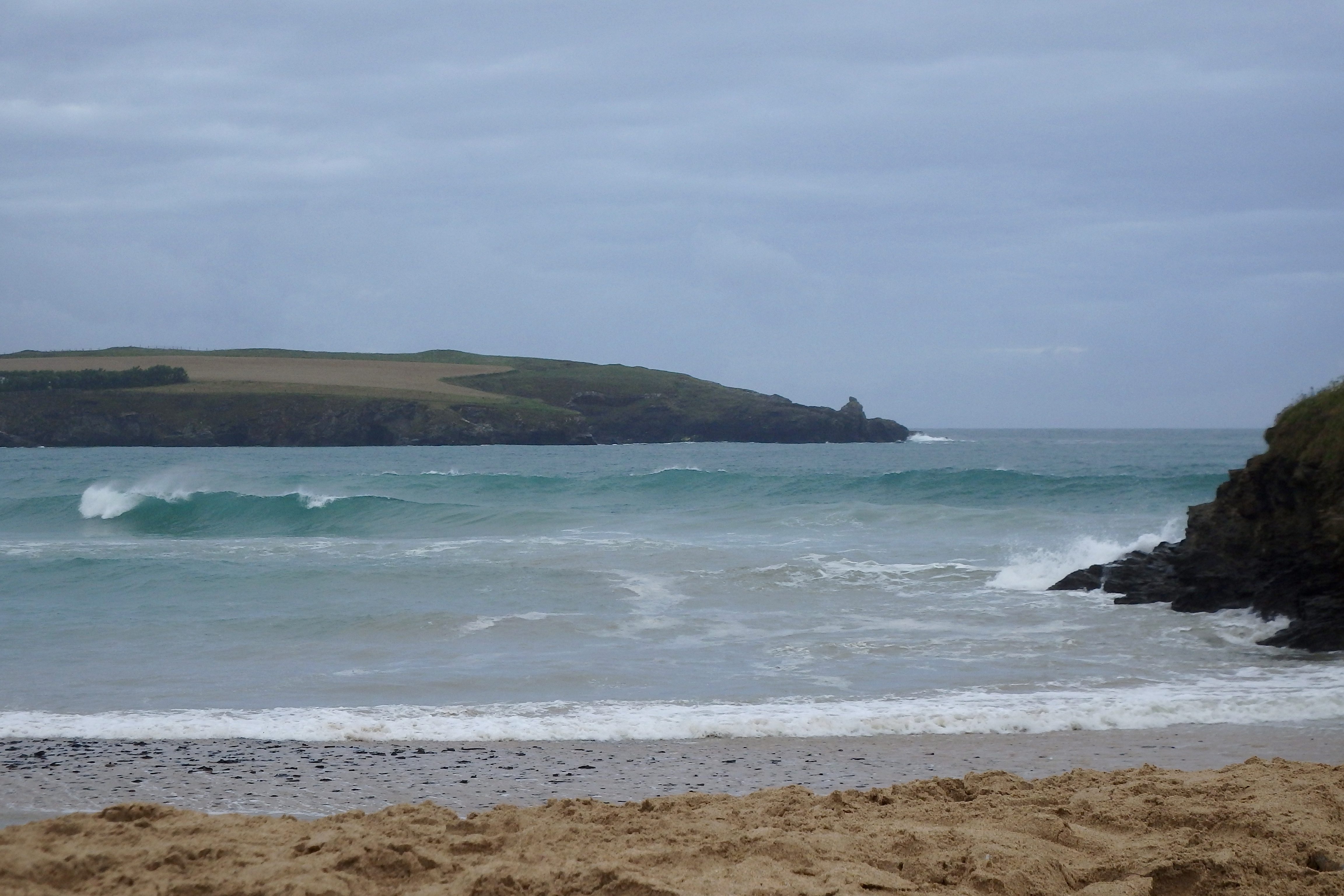
But it is really another Harlyn day today!
Harlyn (3*): 3 feet.
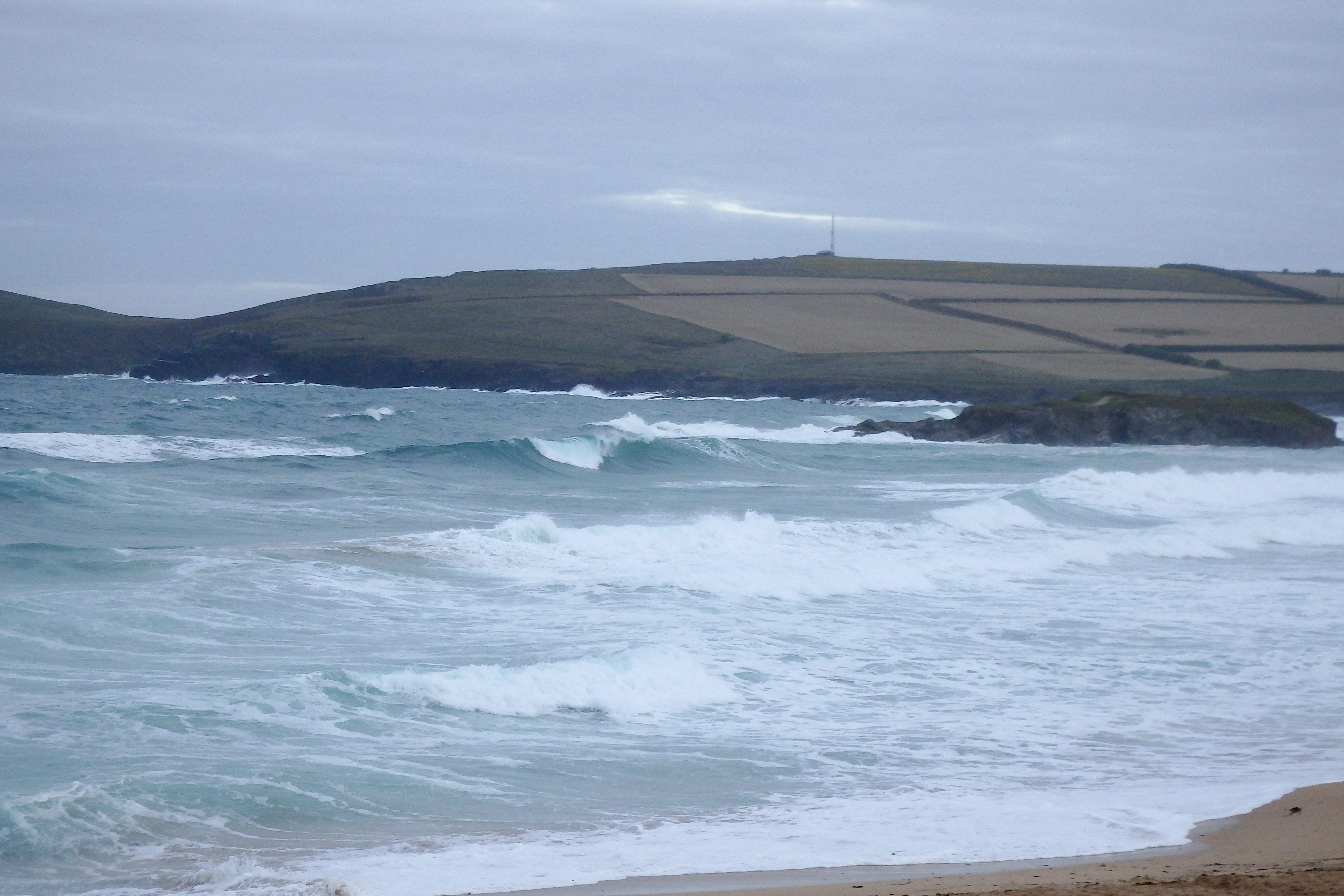
The wind must be a little more westerly than it has been, creating a bit more of a messier surf than we would hope for.
The three feet of rumbling surf is ruffled and tousled again at high tide this morning, bigger than it looks at first sight and full of promise for the dropping tide.
It is likely to be the best place locally for some half decent surf today, especially on this afternoon’s tide. We can expect a decent three to four feet of fun surf to be barrelling onto the beach through this afternoon!
And the sun might even put in an appearance by this evening too!
Today’s Tide Times:
Low Tide: 12:54 (1.0m) High Tide: 18:50 (7.4m)

Surf Forecast for Thursday 4th August 2016
A brighter day should cheer us all up today but that wind is still going to blow onshore, brisk and fresh and from the north west. And so it is going to feel chilly in the wind but pleasant in the sunshine.
The surf is likely to be continue in the three to four feet range, staying choppy and messy but at least with a little bit of size to it.

Surf Conditions for the Rest of the Week
A little depression is set to glide in and over us at the start of this week, bringing freshening south westerly winds, as well as some ‘mixed’ summer weather!
Those winds should push up some waves and blow them onto our local surf breaks, making for really choppy conditions at our favourite spots but maybe getting enough waves rolling around and into the sheltered spots like Harlyn.
Those waves are going to more of the locally produced and weaker kind than we would prefer from those long range swells but at this time of year, we’ll take what comes our way!
So we should have a choice between surfing bigger but very choppy main break locations or really small but crisp and clean Harlyn as the week starts out.
By the end of the week though, just as the weather settles, that wind is likely to back round to the north west again and that is onshore everywhere.
Still, theres plenty of time for that to change yet!
Have a great week, wherever you are and whatever you do!
SJ’s Surf Forecast for the SW
Forecast last updated at 08:30 Wednesday 3rd August 2016
Hi everyone – these updates are currently made at any time of the day as and when I get the time/chance to update – however from September the intention would be for it to be updated every weekday morning by 10am.
[Don’t forget to look at this forecast the day before you go beach for the latest, as things can often change!]
The Rest Of The Week:
‘Autumnal feel to this week with strong winds and plenty of rain.’
Sunrise and sunset – 05:55 and 20:55
Twilight starts and ends – 05:15 and 21:35
Midday – 13:25
Length of day – 15:00
Offshore Sea Temp approx – 16.5C / 62F
outputmodelrun-030816-0930
Monday 1st:
‘Small onshore waves.’
Swell – (i) Weak WSW-SW
Wind – Light-Medium going Medium SW
Weather – Overcast with heavy heavy rain
North Coast – 3ft (Waisthigh)
South Coast – 1-2ft (Kneehigh)
Tides – 11:09 Low, 17:09 High
Tuesday 2nd:
‘Sheltered spots on the North should be working with a clean wave.’
Swell – (i) Weak going OK W-WSW
Wind – Medium-Strong going Medium SW
Weather – Overcast and rainy start, with the rain stopping by lunchtime
North Coast – 6ft (Headhigh)
South Coast – 2-4ft (Waisthigh)
Tides – 05:28 Low, 11:49 Low, 17:49 High
Wednesday 3rd:
‘Strong wind! Sheltered spots should be holding a good wave on both coasts. Be careful out there.’
Swell – (i) OK W-WSW going W
Wind – Medium going Medium-Strong WSW
Weather – Mixture of cloud and sunshine
North Coast – 6-8ft (Overhead) going 8-10ft (1.5 x Overhead)
South Coast – 3ft (Waisthigh) going 3-4ft (Waist-Chesthigh)
Tides – 06:13 High, 12:31 Low, 18:31 High
Thursday 4th:
‘Nothing on the North with large even dangerous conditions.’
Swell – (i) OK W
Wind – Medium W going WNW
Weather – Mixture of cloud and sunshine, with the odd light shower
North Coast – 6-8ft (Overhead) going 4-5ft (Chest-Shoulderhigh)
South Coast – 3ft (Waisthigh) going 1-3ft (Knee-Waisthigh)
Tides – 06:53 High, 13:10 Low, 19:11 High (Spring tides)
Friday 5th:
‘Poor quality junky/mushy waves.’
Swell – (i) OK W-WNW going Weak W
Wind – Light-Medium WNW going W-WSW
Weather – Mixture of cloud and sunshine
North Coast – 3-4ft (Waist-Chesthigh) going 2-3ft (Knee-Waisthigh)
South Coast – 1-2t (Kneehigh)
Tides – 07:32 High, 13:50 Low, 19:49 High
Weekend Summary:
‘Sunday should be a stonker of a day for surf as a new long-range swell is looking likely to hit!!’
Saturday 6th:
‘Small weak on/crosshore surf.’
Swell – (i) Weak W-WSW
Wind – Light-Medium SW
Weather –Mixture of cloud and sunshine
North Coast – 2-3ft (Knee-Waisthigh)
South Coast – 1f
Tides – 08:09 High, 14:26 Low, 20:24 High
Sunday 7th:
‘New long-range swell kicking in – the first proper long-range swell of the season!! Depending on how the wind forecast changes – the exact/precise detail will become clear by Friday, as to exactly what will be happening on Sunday. There will be a JUMP in surf size from first thing in the morning.’
Swell – (i) Weak W-WSW going Strong W
Wind – Light W going WNW
Weather – Mixture of cloud and sunshine
North Coast – 3ft (Waisthigh) going 8-10ft (1.5 x overhead)
South Coast – 1ft going 3-4ft (Waist-Chesthigh)
Tides – 08:44 High, 15:01 Low, 20:59 High
Early Next Week:
‘Monday should see plenty of good swell – too early to tell what the winds will do yet!’
The scale for measuring conditions:
0-1ft – Unridable/Flat
1-2ft – Kneehigh
3ft – Waisthigh
4-5ft – Chest/Shoulderhigh
6ft – Headhigh
6-8ft = 1-1.5x Overhead
8-10ft = 1.5x Overhead
10-12ft = 2x Overhead
Please Note!
Wave height predictions are based on the larger breaks on both coasts such as Fistral and Croyde for the North, and Praa Sands and Bantham for the South.
Wave height is measured from the front of the wave, and 6ft would usually mean a ‘head-high’ wave.
Try and use some ‘local’ knowledge about what the wave sizes will be elsewhere. For example the Newquay Bay area is generally 1/3 to 3/4 the size of Fistral, increasing the further up the bay you go from Towan to Lusty Glaze, and that it will be clean on a W wind at ‘harbour left’ at Towan at mid-tide’ for example.
Tide times are based on Newquay.
Stay Stoked!
SJ