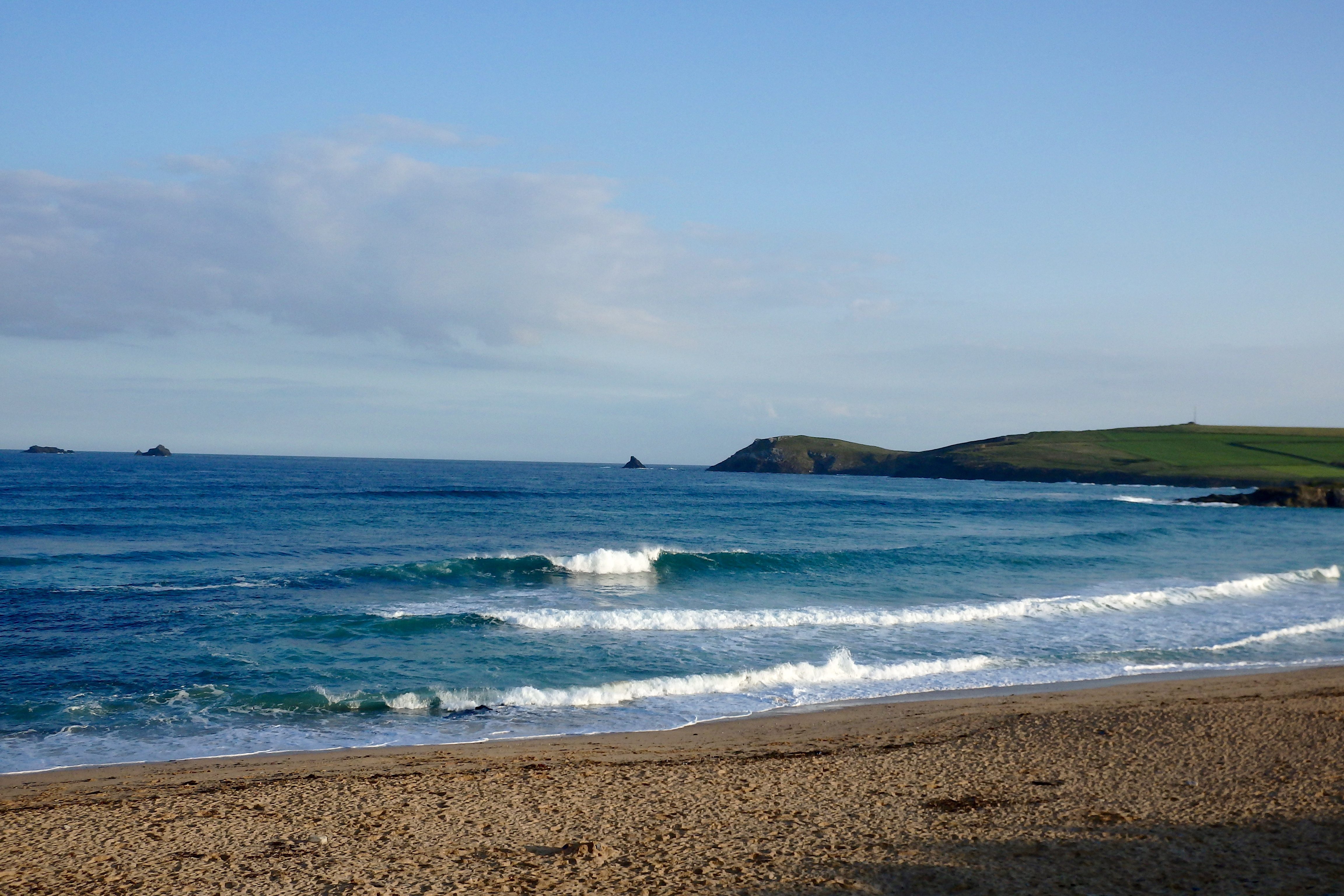
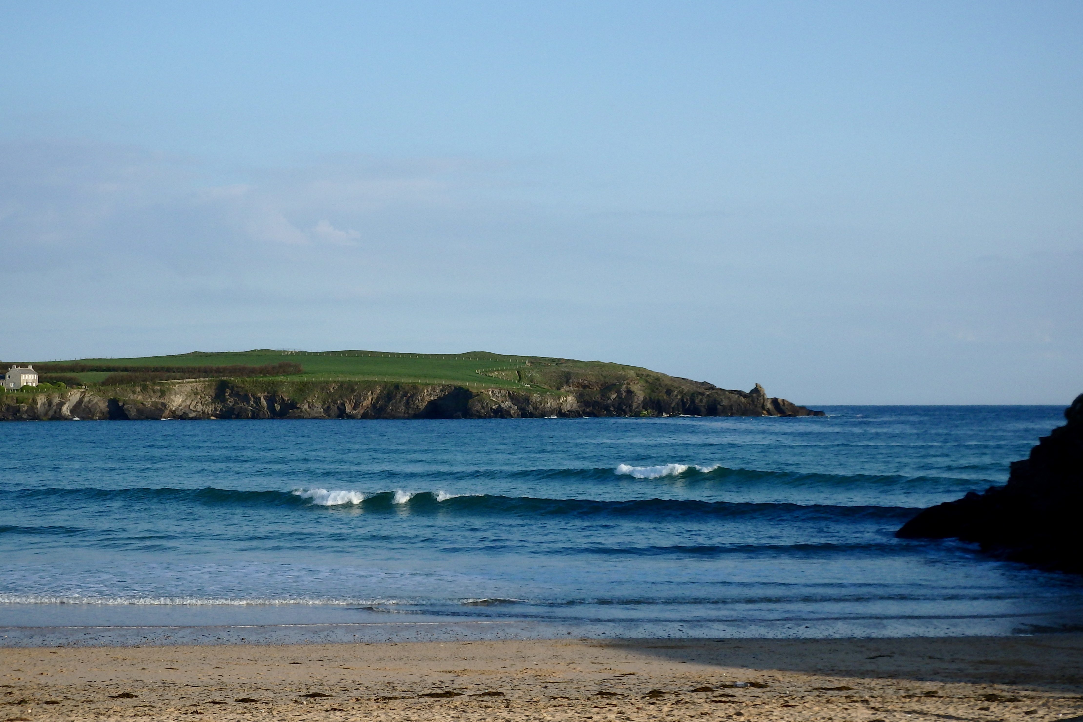
At 6.30 a.m:
Constantine (3*): 3 feet.
A beautiful day is spreading its warmth and brightness along the entire coast of Cornwall this morning, the breeze light and offshore, the sky a clear and deep, deep blue, the air filled with birdsong.
And the surf is pumping!
Three feet of curling glass waves are peeling into the bay an hour or so ahead of high water, those crashing little tunnels glistening and glinting in the early morning dew-crystalled sunshine.
With a new swell expected to start showing itself through this afternoon, you have to think that today could just be one of ‘those’ days!
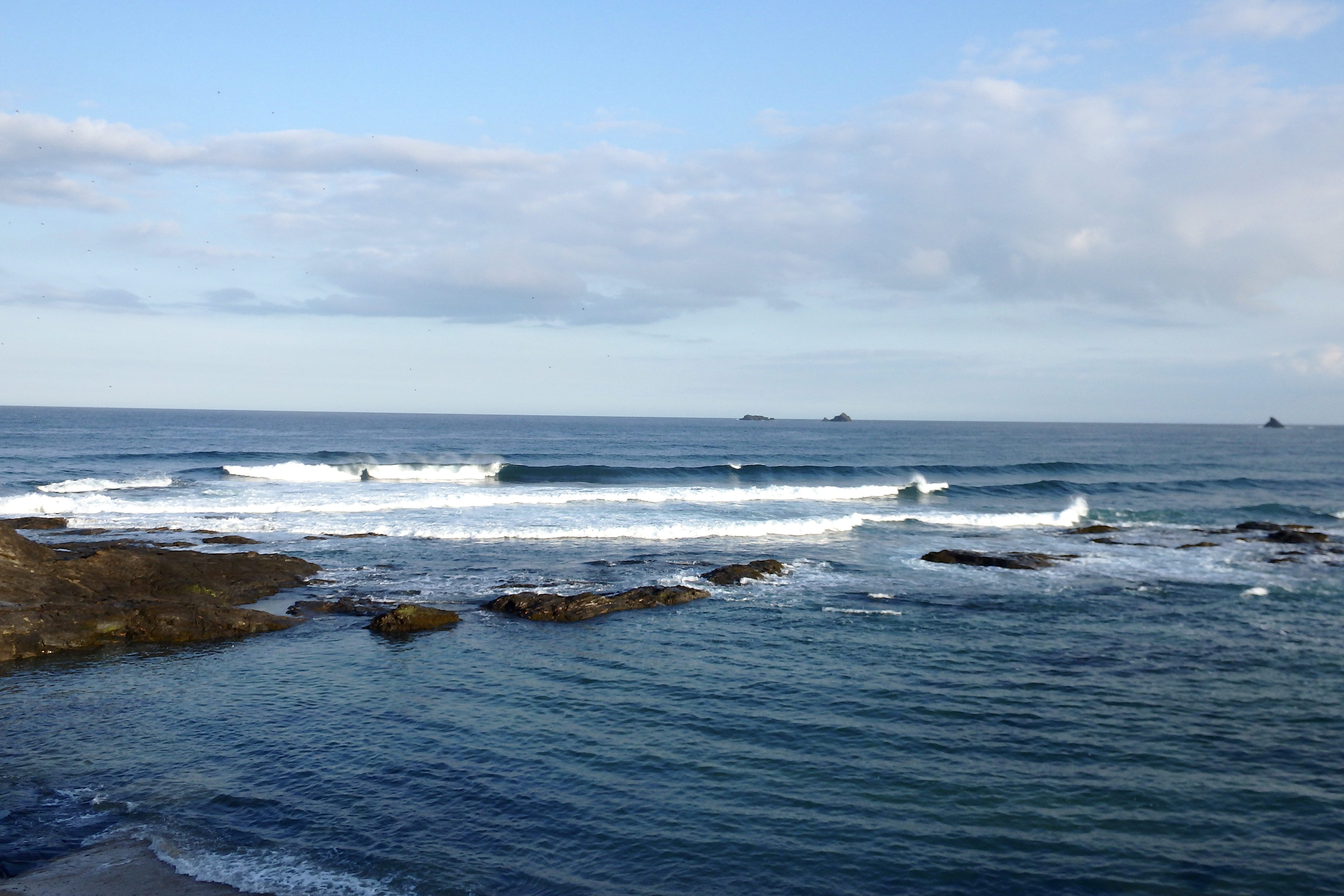
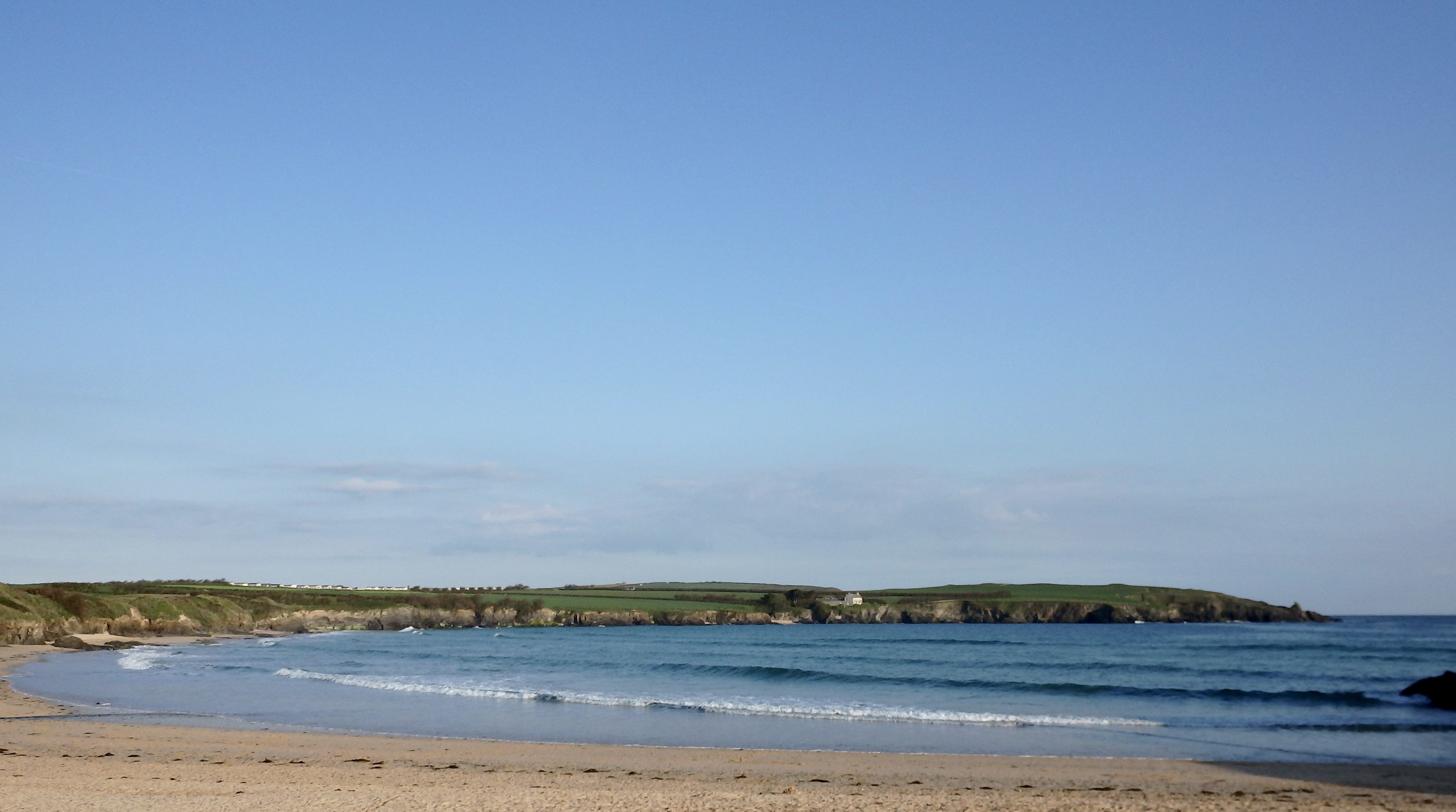
Harlyn (1*): 1 foot.
The waves are small here this morning with only a foot or two of glassy little lines wandering into the high water zone. It does all look a bit weak and wishy washy as this existing swell, mainly leftover windswell from the last few days’ onshores, slowly starts to be replaced by a brand new, shiny and more solid swell, a proper, well travelled atlantic swell.
That should happen through this afternoon’s tide resulting in some smooth and lined up waves all along the coast and lasting for a good few days if we’re lucky!
Today’s Tide Times:
Low Tide: 14:02 (1.2m) High Tide: 19:56 (6.9m)

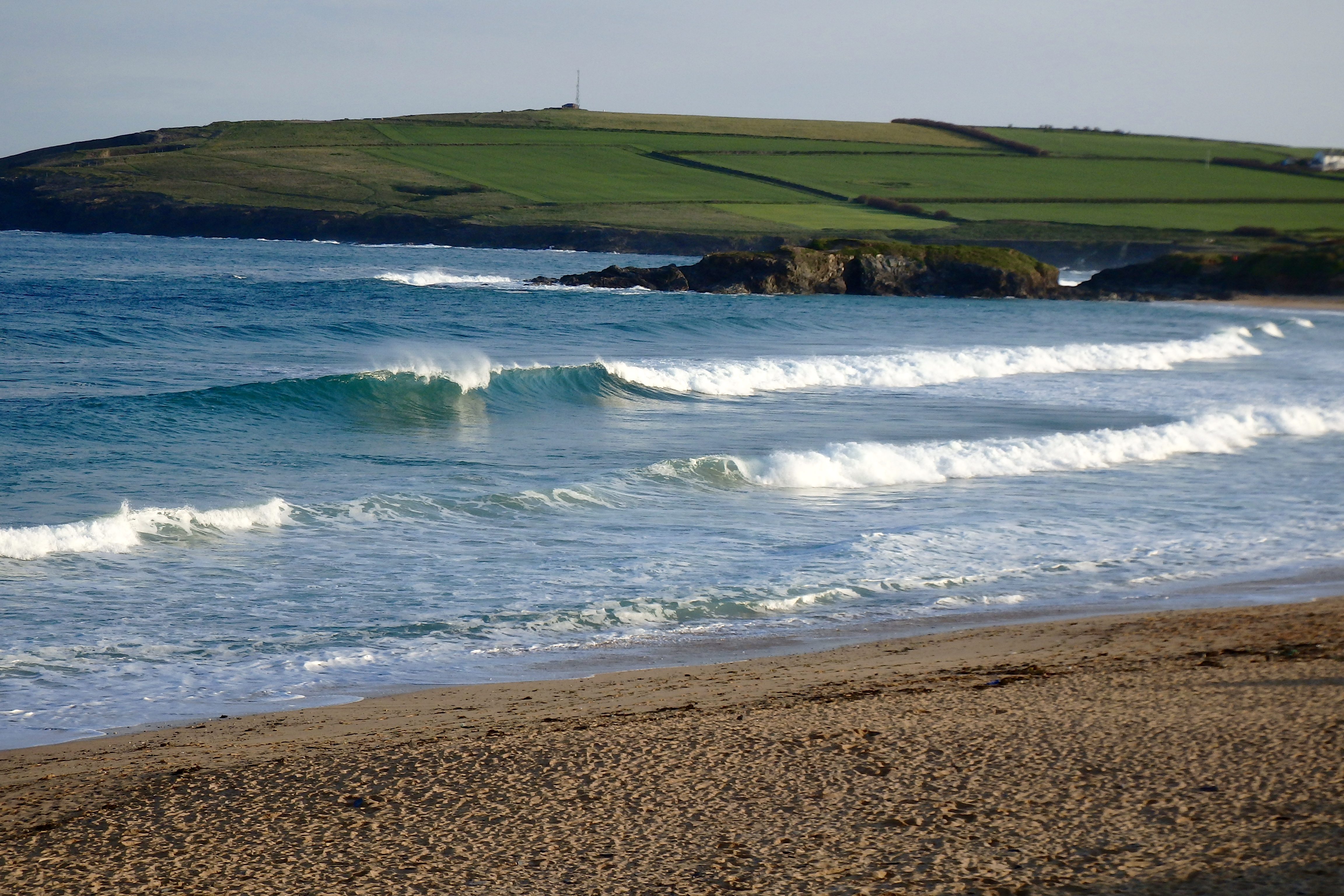
Surf Forecast for Wednesday 25th May 2016
We are all expecting great things today with a solid, well travelled four feet and bigger of smooth and driving swell meeting some light offshore breezes as they explode into our bays and coves all day long.
And don’t forget that fabulous spring sunshine either, we could just enjoying wall-to-wall sunshine while surfing those offshore shaped and reeling tubes!
Surf Conditions for the Start of the Week
After a bit of a lazy and slow start, this week could just turn out to be a delight of clean and sunny conditions with small but sparkling surf to ride.
The wind frustrated us on Monday, a brisk northerly that slopped the rolling swell as it eventually reached shore.
But by Tuesday the wind should have backed to the east, eventually slipping more to the south east. And as the wind strength eases into the evening that small and fairly close-fetch little surf will be replaced by the start of a new three foot swell with a long wave period.
Wednesday is looking really promising with a thick and solid three to four feet of rolling groundswell pumping in against a light and smooth offshore breeze.
The swell will eventually weaken as the week winds down but the wind is set to remain light and offshore and the sun is set to shine.
It promises to be a good one!
Have great week, wherever you are and whatever you’re doing!
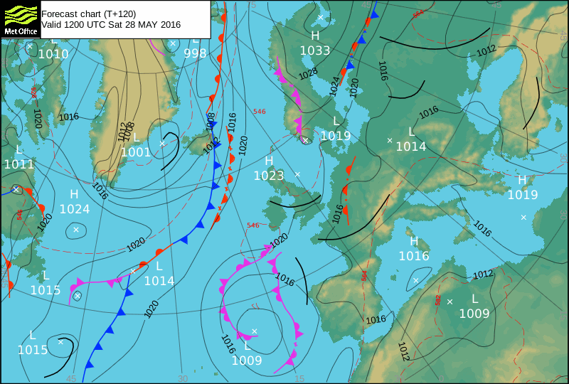
SJ’s Surf Forecast for the SW
Forecast last updated at 14:45 Tuesday 24th May 2016
[Don’t forget to look at this forecast the day before you go beach for the latest, as things can often change!]
The Rest Of The Week:
‘Good run of surf Tuesday to Thursday.’
Sunrise and sunset – 05:20 and 21:15
Twilight starts and ends – 04:35 and 22:00
Midday – 13:15
Length of day – 15:55
Offshore Sea Temp approx – 12.2 C / 54.0 F
Monday 23:
‘A bit too bindblown and sloppy on the North, with the south being too small.’
Swell – (i) Medium W
Wind – Light-Medium NNW going N
Weather – Cloudy but with plenty of sunny spells
North Coast – 4-5ft (chest-shoulderhigh) going 3ft (waisthigh)
South Coast – 1-2ft (kneehigh) going 0-1ft (ankle snappers)
Tides – 06:46 High, 13:06 Low, 19:03 High
Tuesday 24:
‘Great day for surf. The first of the ‘pulses’ of the long range swell will start to show late morning with occasional bigger sets despite the falling tide. Then around low tide and on the tidal push in the afternoon, surf size will really start to build. Perfect off-shores, and sunshine to boot!! Lazy halcyonic days of Summer…’
Swell – (i) Weak W (ii) Faint going Very strong WSW
Wind – Medium E going Light-Medium E-ESE
Weather – Bright and sunny blue sky day with some cloud
North Coast – 1-2ft (kneehigh) going 3-5ft (waist-shoulderhigh)
South Coast – Flat going 1-2ft (kneehigh)
Tides – 07:19 High, 13:40 Low, 19:38 High
Wednesday 25:
‘Good surf throughout the day with offshore Easterly winds. Expected to be in the waist to shoulderhigh region in size depending on where you are along the North coast of Devon and Cornwall.’
Swell – (i) Very Strong going Strong WSW
Wind – Medium E going Light-Medium E-NE
Weather – Cloudy but dry with the odd sunny spell
North Coast – 3-5ft (waist-shoulderhigh)
South Coast – 1-2ft (kneehigh)
Tides – 07:55 High, 14:17 Low, 20:14 High
Thursday 26:
‘Decreasing swell – make the most of what’s left in the mornig before it goes flat/crosshore.’
Swell – (i) Faint W-WNW (ii) Faint WSW-SW
Wind – Light E-NE going Light-Medium N-NE
Weather – Mixture of cloud and sunshine
North Coast – 3ft (waisthigh) going 1-3ft (knee-waisthigh)
South Coast – 0-1ft (ankle snappers)
Tides – 08:33 High, 14:55 Low, 20:54 High
Friday 27:
‘ALMOST flat! You might be lucky to get the occasional ridable wave on say a longboard.’
Swell – (i) Faint WNW (ii) Faint SW
Wind – Light E going NE
Weather – Mixture of cloud and sunshine and showers
North Coast – 1-2ft (kneehigh)
South Coast – 0-1ft (ankle snappers)
Tides – 09:15 High, 15:38 Low, 21:41 High
Bank Holiday Weekend Summary:
‘Almost flat – well it is a bank holiday weekend!’
Saturday 28:
‘Flat for surf – might just get the odd ripple but too small to ride.’
Swell – (i) Faint W-WNW (ii) Faint SSW-SW
Wind – Light-Medium E-SE going Light Variable
Weather – Mixture of cloud and sunshine and showers
North Coast – 1ft (Flat to kneehigh) going 1-2ft (kneehigh)
South Coast – 1ft (Flat to kneehigh)
Tides – 10:07 High, 16:30 Low
Sunday 29:
‘Flat for surf – might just get the odd ripple but too small to ride.’
Swell – (i) Faint WNW (ii) Faint SW
Wind – Light Variable
Weather – Mixture of cloud and sunshine and showers
North Coast – 1ft (Flat to kneehigh)
South Coast – 1ft (Flat to kneehigh)
Tides – 05:09 High, 11:09 Low, 17:35 High (Neap tides)
Early Next Week:
‘x’
The scale for measuring conditions:
0-1ft – Unridable/Flat
1-2ft – Kneehigh
3ft – Waisthigh
4-5ft – Chest/Shoulderhigh
6ft – Headhigh
6-8ft = 1-1.5x Overhead
8-10ft = 1.5x Overhead
10-12ft = 2x Overhead
Please Note!
Wave height predictions are based on the larger breaks on both coasts such as Fistral and Croyde for the North, and Praa Sands and Bantham for the South.
Wave height is measured from the front of the wave, and 6ft would usually mean a ‘head-high’ wave.
Try and use some ‘local’ knowledge about what the wave sizes will be elsewhere. For example the Newquay Bay area is generally 1/3 to 3/4 the size of Fistral, increasing the further up the bay you go from Towan to Lusty Glaze, and that it will be clean on a W wind at ‘harbour left’ at Towan at mid-tide’ for example.
Tide times are based on Newquay.
Stay Stoked!
SJ