At 6.35 a.m:
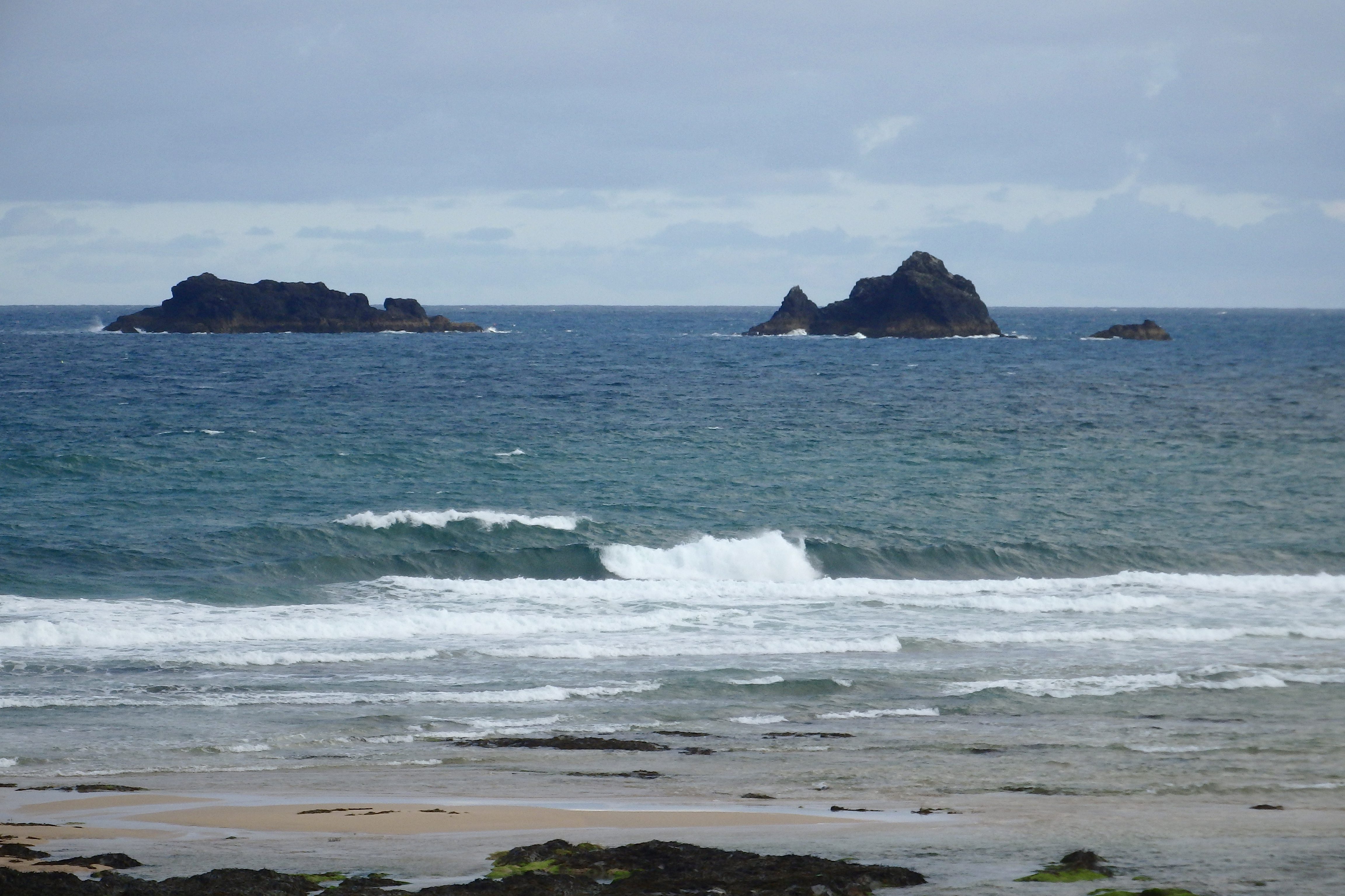
Constantine (1*): 2 to 3 feet.
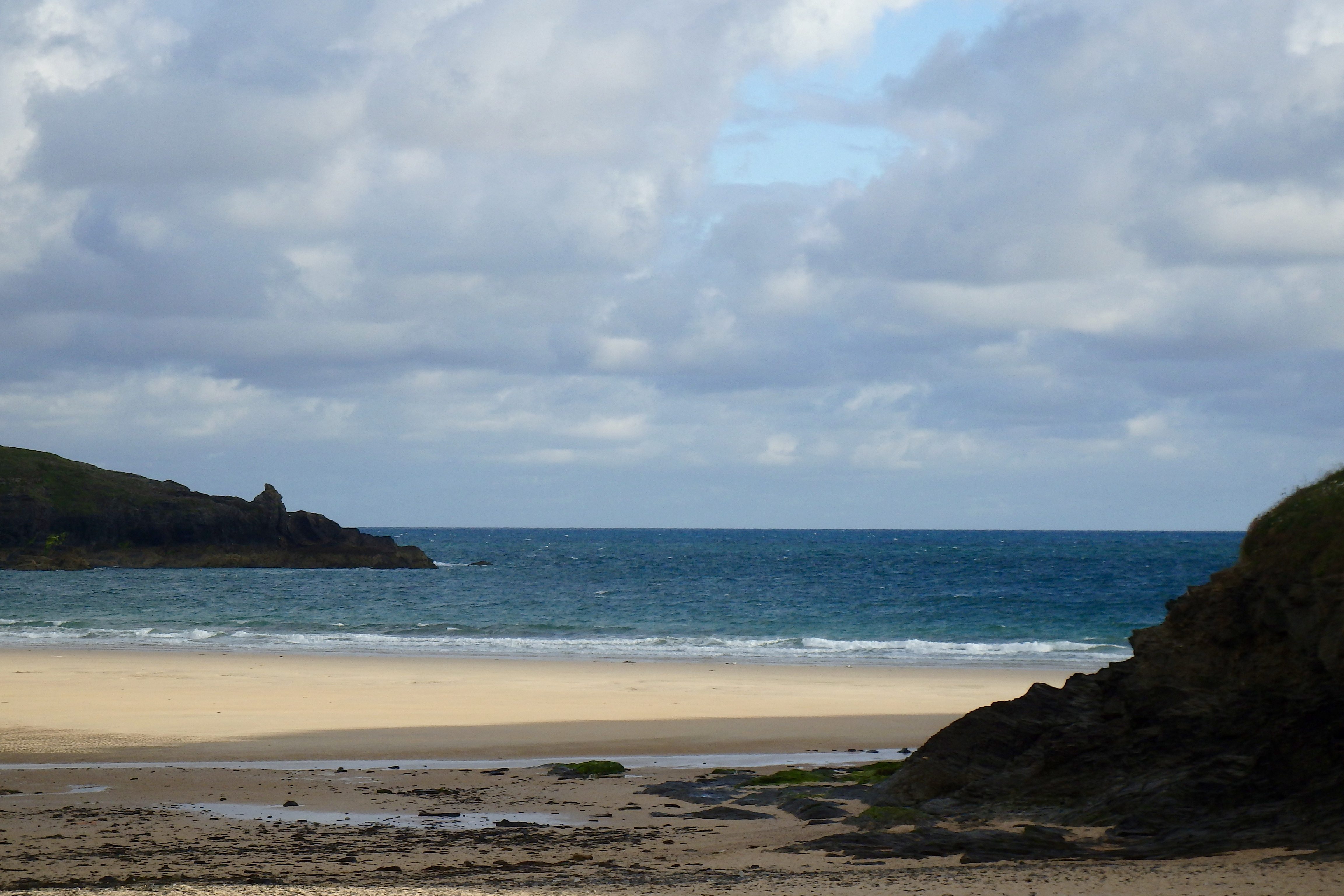
There’s that chill north westerly wind still blowing this morning, scattering lumps of cloud across the horizon, freshening the air while all the time continuing to trash the surf.
Three feet or so of mixed up and messy surf is being blown ashore, my favourite left of this year still managing to entice, standing tall before turning itself inside out, even in these onshore conditions.
Other than that though, it is a bit of a mess of surf right now.
But the tide is an hour or so off low and so those waves are fully exposed to the wind. It could all improve, if only a little, as the tide gently fills through this morning, especially as that wind weakens to a breeze as we go along.
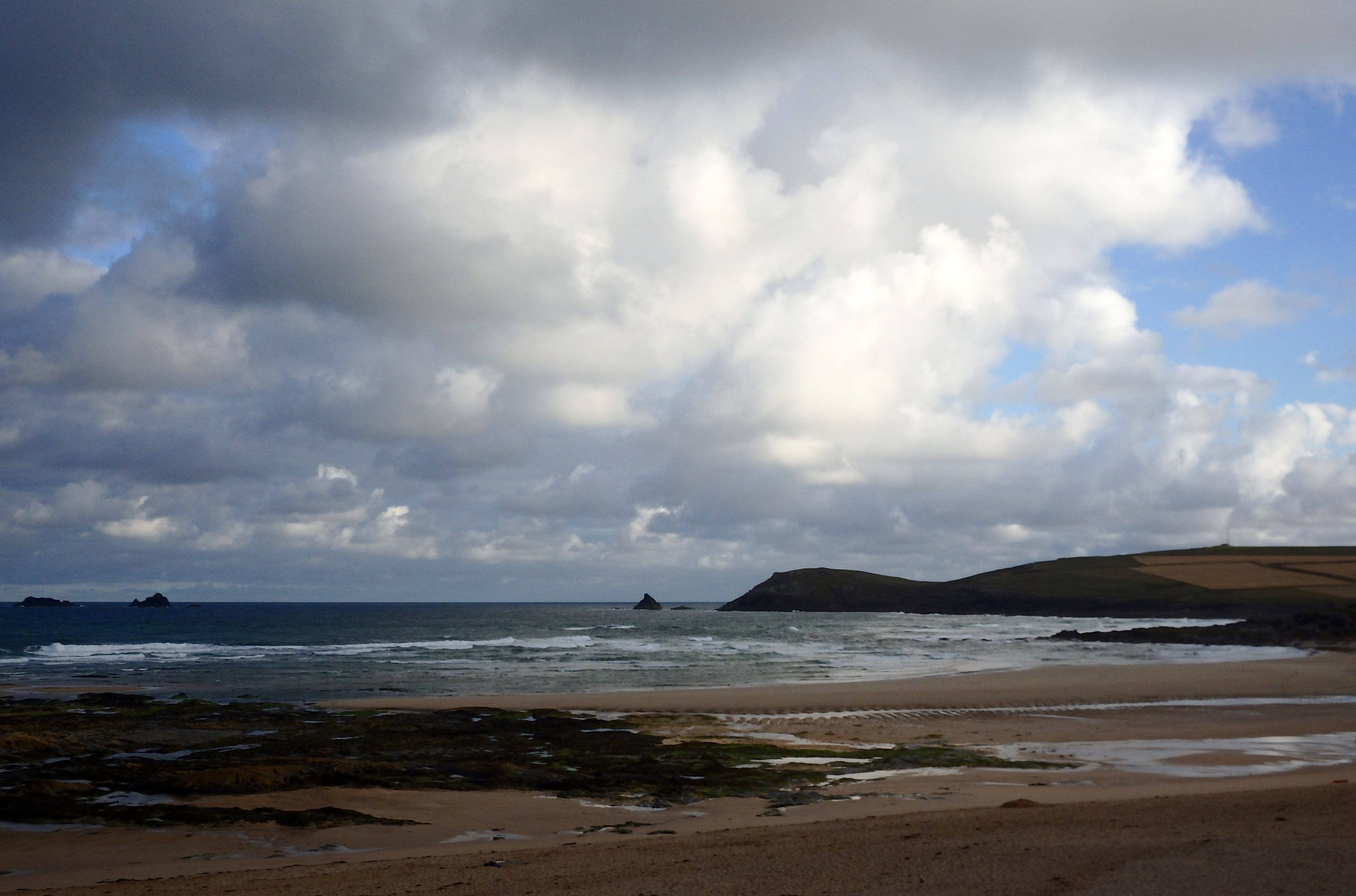
Harlyn (0*): 0 to 1 foot
It is pretty much flat here this morning, a foot or less of wind chopped and bumpy slop just washing onto the beach.
It could build just a little as the tide fills in but it is still likely to be small (tiny) and choppy at best!
Today’s Tide Times:
Low Tide: 10:14 (2.7m) High Tide: 13:50 (5.7m)

Surf Forecast for Friday 15th July 2016
The onshore winds continue but now from the south west, so bringing milder air temperatures as well as being more wave supporting. And it is also offshore at Harlyn, although we are unlikely to see anything bigger than ankle high for a little while at least over there.
No, we are most likely to be ‘enjoying’ one foot and choppy Constantine side surf today! It should be bright and sunny and pleasant all day though!
Surf Conditions for the Weekend
The wind is likely to ease up as the weekend brings lighter and brighter, milder conditions than those of last week when that north westerly wind was blowing.
The surf is likely to be small at best, a couple of feet but maybe with a three foot push through Saturday evening and into Sunday morning. And Sunday should see some some cleaner conditions with that wind easing to no more than a breeze.
Get the sun block out, it could be a burny weekend with that combination of sun and breeze and don’t stress about the surf, it’s unlikely to be great but there should be enough and it should still be fun!
Have a great weekend, wherever you are and whatever you’re doing!
SJ’s Surf Forecast for the SW
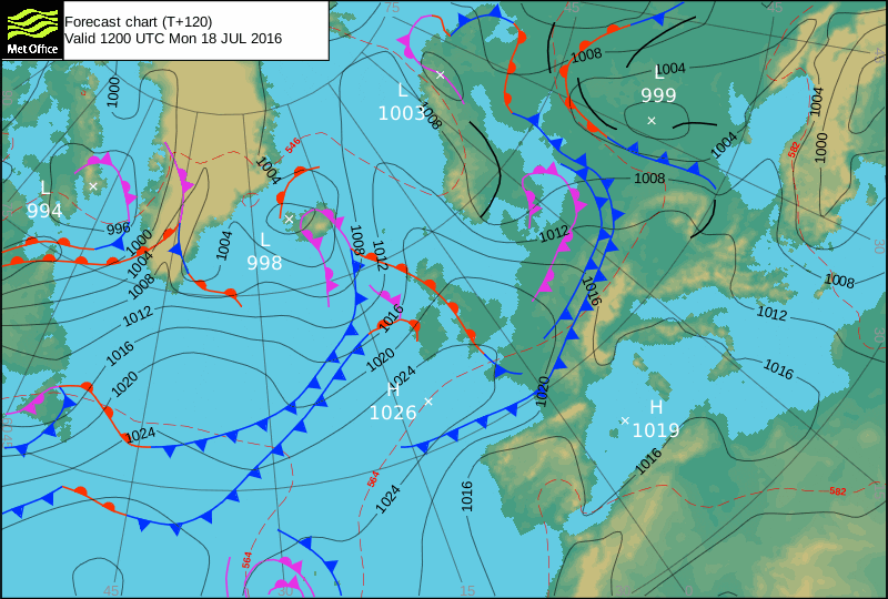
Forecast last updated at 09:30 Thursday 14th July 2016
Hi everyone – these updates are currently made at any time of the day as and when I get the time/chance to update – however from September the intention would be for it to be updated every weekday morning by 10am.
[Don’t forget to look at this forecast the day before you go beach for the latest, as things can often change!]
The Rest Of The Week:
‘Apologies for the lack of surf forecasts over the last 10 days. Family and I went on a last minute sojourn over to France for a bit of a break/holiday, where I took my three year old daughter surfing for the first time:) Not a particularly great week for surf, but at least it’s not flat. Charts are highly changeable for the end of the week.’
Sunrise and sunset – 05:25 and 21:25
Twilight starts and ends – 04:45 and 22:05
Midday – 13:25
Length of day – 16:00
Offshore Sea Temp approx – 15.5C / 60F
outputmodelrun-130716-0930
Monday 11th:
‘More like an Autumnal day with a big swell and W-SW winds. Get on it quick at sheltered spots on the North before the winds veer around too far to the West.’
Swell – (i) Medium W-WSW
Wind – Medium-Strong WSW going Medium W
Weather – Unsettled and windy with frequent showers.Cloudy start, but the odd sunny spell later on.
North Coast – 6-10ft (Overhead-WellOverhead)
South Coast – 3-4ft (Waist-Chesthigh)
Tides – 10:39 High, 16:57 Low
Tuesday 12th:
‘Onshore messy windslop for the North, and too small for the south.’
Swell – (i) Weak-Medium W
Wind – Light-Medium WNW-NW
Weather – Mixture of cloud and showers and sunny spells, becoming brighter in the afternoon.
North Coast – 4ft (Chesthigh) going 3ft (Waisthigh)
South Coast – 1-2ft (Kneehigh) going 1ft
Tides – 05:30 Low, 11:29 High, 17:51 Low
Wednesday 13th:
‘A smaller version of Tuesday – onshore slop for the North, and too small for the south.’
Swell – (i) Weak WNW
Wind – Medium WNW-NW
Weather – Mixture of cloud sunny spells, turning very ‘Summery’ for the afternoon.
North Coast – 3ft (Waisthigh)
South Coast – 1ft
Tides – 06:30 Low, 12:32 High, 18:59 Low (Neap tides)
Thursday 14th:
‘Onshore dribbly windlsop for the North (just enough for surf schools and learners), and flat for the south.’
Swell – (i) Weak WNW going Faint
Wind – Light-Medium NW going W-NW
Weather – Mixture of cloud and sunny spells, dry.
North Coast – 3ft (Waisthigh) going 1-3ft (Knee-Waisthigh)
South Coast – 1ft going Flat
Tides – 07:40 Low, 13:42 High, 20:10 Low (Neap tides)
Friday 15th:
‘Enough for surf schools and beginners – however with a weak swell and SW winds, it’s going to have no real quality to the knee/waisthigh waves.’
Swell – (i) Weak W-WSW going WSW
Wind – Light-Medium SW
Weather – Cloudy/overcast but much warmer.
North Coast – 1-2ft (Kneehigh) going 2-3ft (Knee-Waisthigh)
South Coast – Flat going 1ft
Tides – 08:47 Low, 14:48 High, 21:15 Low (Neap tides)
Weekend Summary:
‘VERY changeable for Friday onwards – take this forecast update for the weekend with a good pinch of salt! Not great by any means, however there should be a wave for those wanting to get wet behind the ears – hey, it’s Summer – could be flat!’
Saturday 16th:
‘More of the same, the swell should build throughout the day. However it’s looking like cross/onshore W-SW winds.’
Swell – (i) Weak going OK W
Wind – Light-Medium SW going W-SW
Weather – Cloudy.
North Coast – 2-3ft (Knee-Waisthigh) going 3-4ft (Waist-Chesthigh)
South Coast – 1-2ft (Kneehigh)
Tides – 09:44 Low, 15:43 High
Sunday 17th:
‘Small but rideable waves. Winds are still looking uncertain, so check back on Thursday/Friday for the latest updates.’
Swell – (i) OK W-WNW
Wind – Light W-NW going Light-Medium NW
Weather – Mixture of cloud and sunshine, dry.
North Coast – 3-4ft (Waist-Chesthigh) going 3ft (Waisthigh)
South Coast – 1ft
Tides – 10:32 Low, 16:29 High
Early Next Week:
‘Looking like a ‘Summery’ week with good warm weather and light winds, but close to flat conditions.’
The scale for measuring conditions:
0-1ft – Unridable/Flat
1-2ft – Kneehigh
3ft – Waisthigh
4-5ft – Chest/Shoulderhigh
6ft – Headhigh
6-8ft = 1-1.5x Overhead
8-10ft = 1.5x Overhead
10-12ft = 2x Overhead
Please Note!
Wave height predictions are based on the larger breaks on both coasts such as Fistral and Croyde for the North, and Praa Sands and Bantham for the South.
Wave height is measured from the front of the wave, and 6ft would usually mean a ‘head-high’ wave.
Try and use some ‘local’ knowledge about what the wave sizes will be elsewhere. For example the Newquay Bay area is generally 1/3 to 3/4 the size of Fistral, increasing the further up the bay you go from Towan to Lusty Glaze, and that it will be clean on a W wind at ‘harbour left’ at Towan at mid-tide’ for example.
Tide times are based on Newquay.
Stay Stoked!
SJ